Scotland 2019
Edinburgh
We came into the country in Edinburgh, Scotland’s second largest city, after Glasgow. There are only seven cities in the nation, which itself about the size of the state of Maine. There are requirements to city-hood, not the least of which is official approval from the queen.
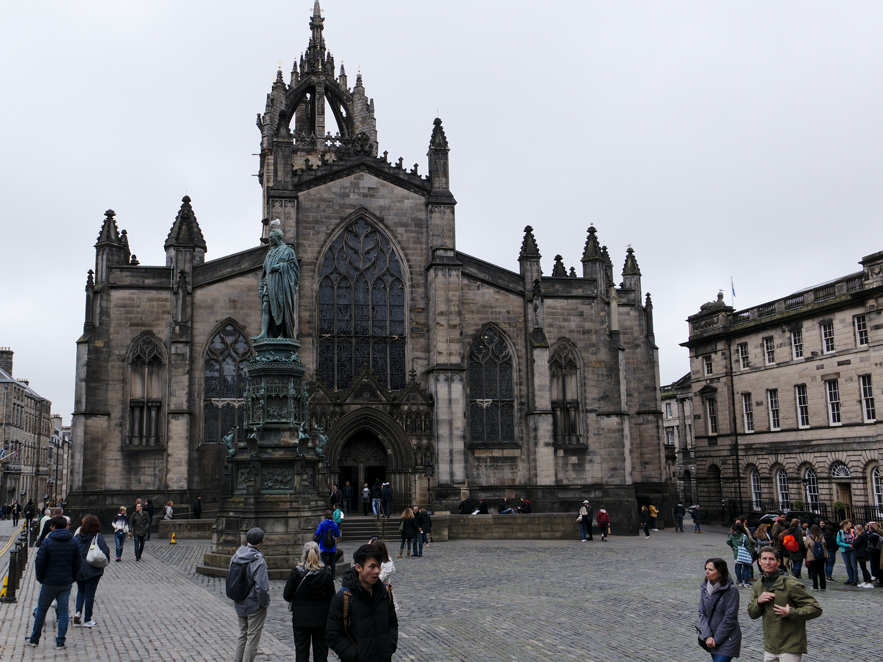
Our flight landed in the rain. Not a driving rain, but a steady one, and it continued through our first day, leaving us to walk the Royal Mile of Edinburgh’s Old Town with our jacket collars pulled up against it.
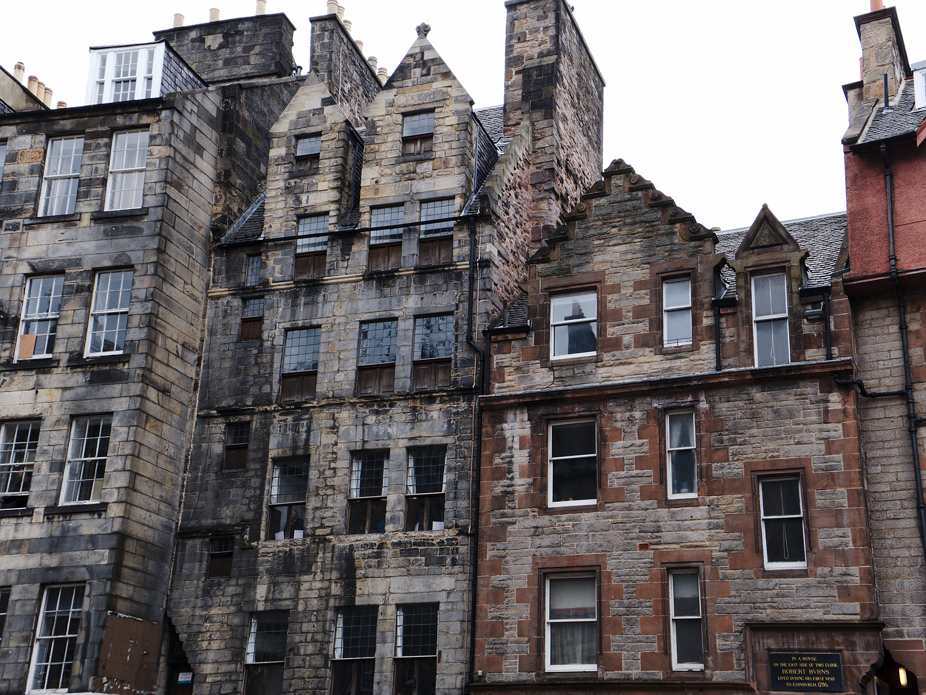
Edinburgh is dominated by its castle, which sits on a craggy hilltop – one of several in the city – and dominates everything around it. The seat of power moved around Scotland many times before settling in Edinburgh, but the castle is one of the most impressive. The Royal Mile is a shop-lined street, still in cobblestone, that leads down the back of the hillside from the castle gates, and still contains a handful of buildings pre-1700, although most are now Victorian in age.
St Giles’ Cathedral sat close to our hotel, and was one of our first stops. The curve of Victoria Street leads down the hill towards Grassmarket, one of the old market squares, and is said to be the street that inspired Diagon Alley in the Harry Potter novels. It’s easy to see why.
From near the castle gates you can look out across the rooftops, past New Town, to the monuments atop Calton Hill. The tall tower rising above the Grecian columns is the Nelson Monument, in honor of Admiral Horatio Nelson.
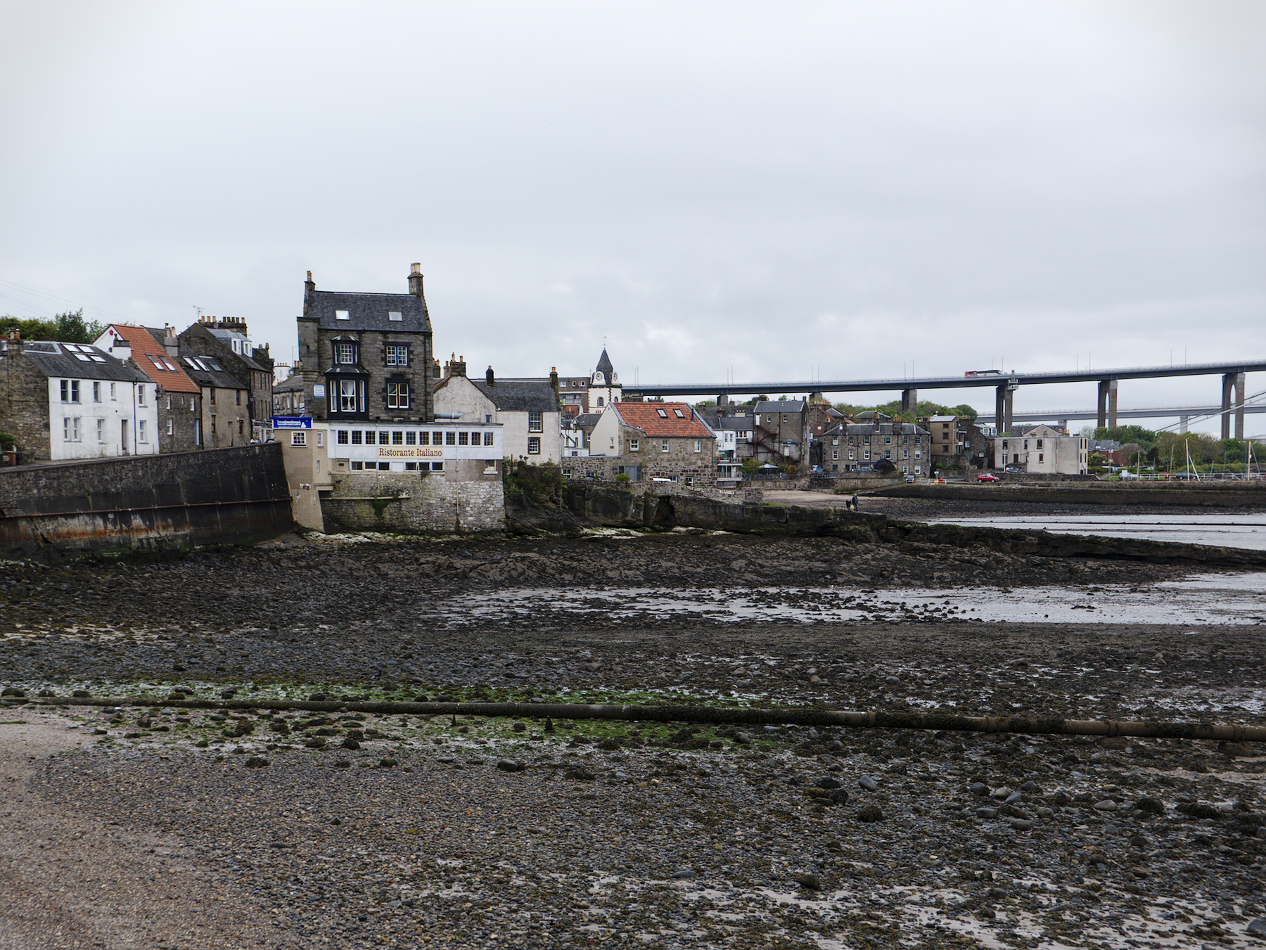
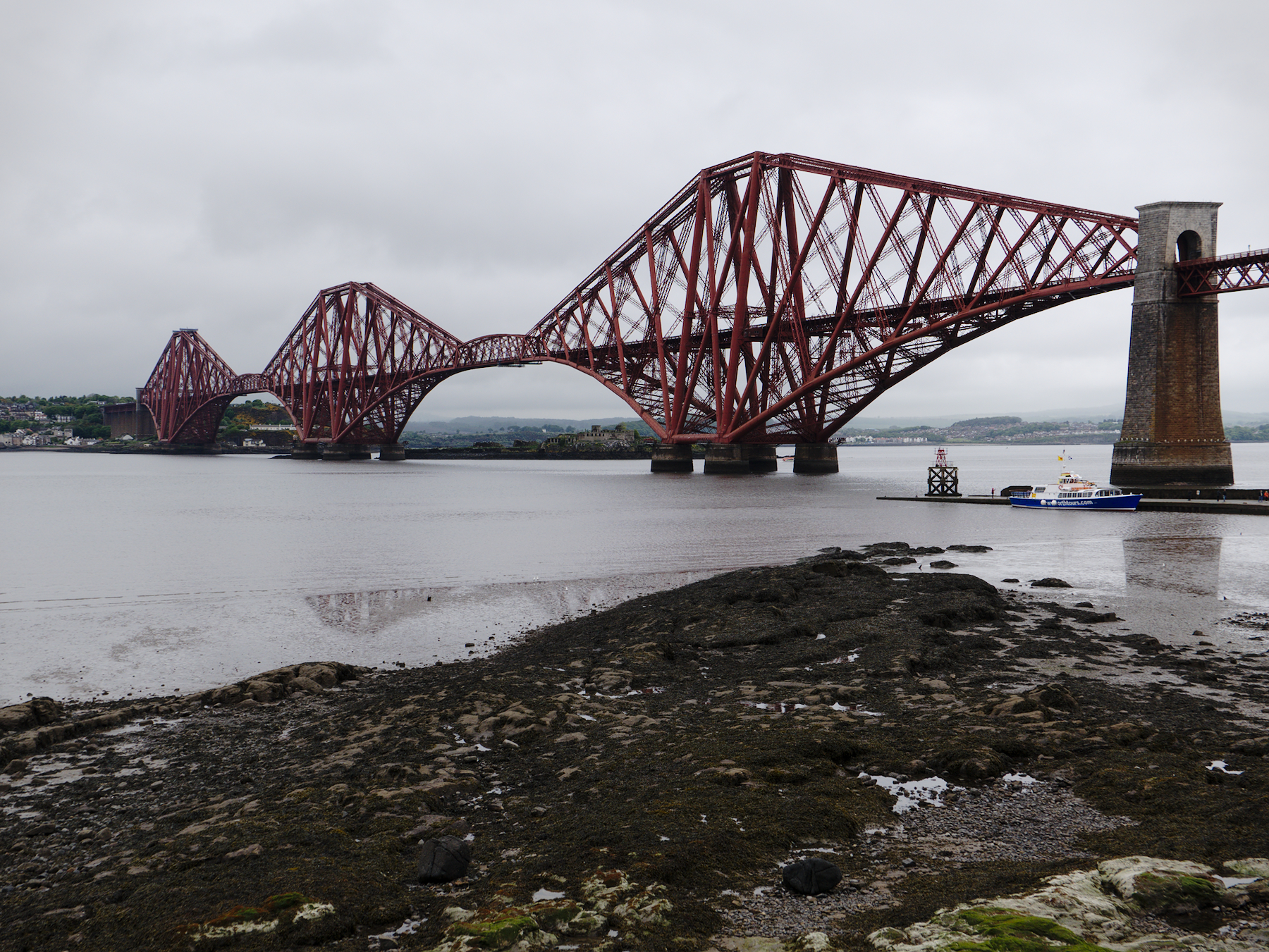
Our tour began with a quick stop at the Firth of Forth, where several Scottish rivers meet before flowing east to the sea. The bridges that span the Firth are a study in engineering across more than a century, and include a pair of modern suspension bridges and the glorious, over-engineered Forth Bridge, a cantilevered railroad bridge from the late Victorian era.
Aside from the visuals, this was a get-to-know you stop with Rob, our guide, who had arrived complete with dreadlocks, a waxed mustache, and full Scottish garb, including a kilt and gartered knee socks. We shared a dram of (very fine) scotch and then crossed the Firth and headed north, to the Highlands.
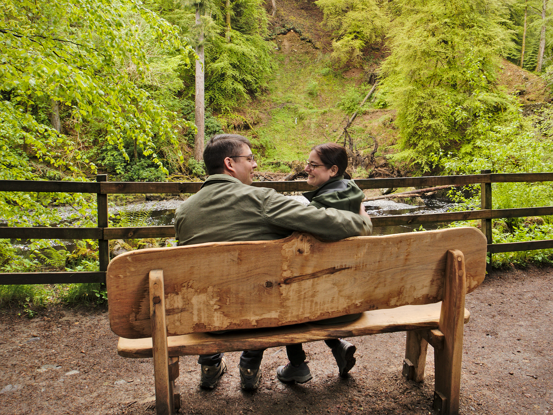
The Hermitage
Once you leave the cities, Scotland opens up quickly – there is a lot of empty land, especially in the Highlands, which have managed to retain a bit of a wild, untamed feeling. The landscape becomes dominated by hills and mountains, which range in size from lonely rounded hillocks to steep, craggy peaks. Most of them are barren, covered only by bracken (large, coarse ferns) and heather. The bracken were ever-present, as Rob told us, so that “Scottish heroes could come crashing through it.”
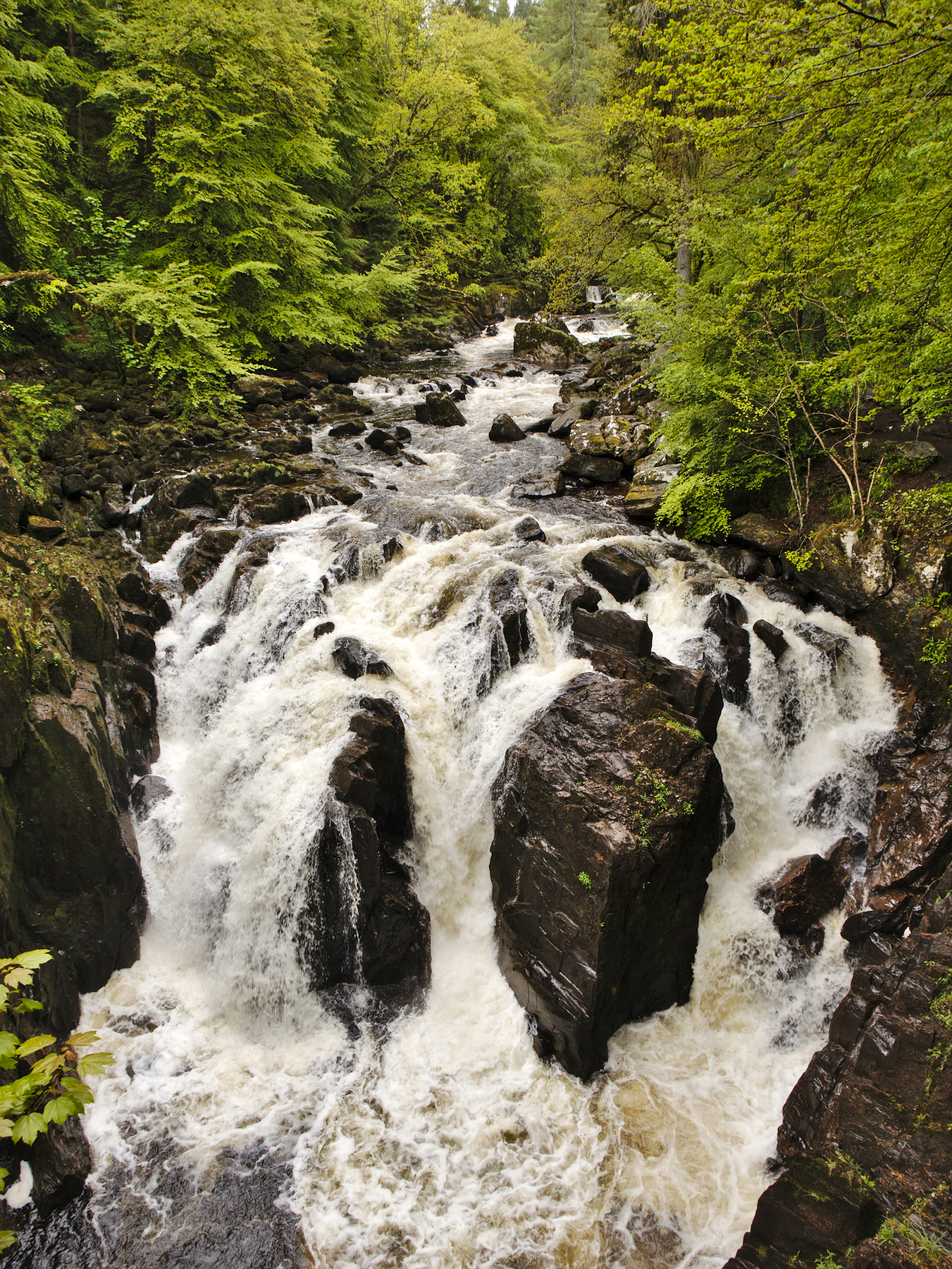
But there are forests as well, timber being one of Scotland’s leading industries. The become predominately coniferous as you move north, becoming dense, dark, and foreboding by the time you reach Shakespeare’s Birnam Wood.
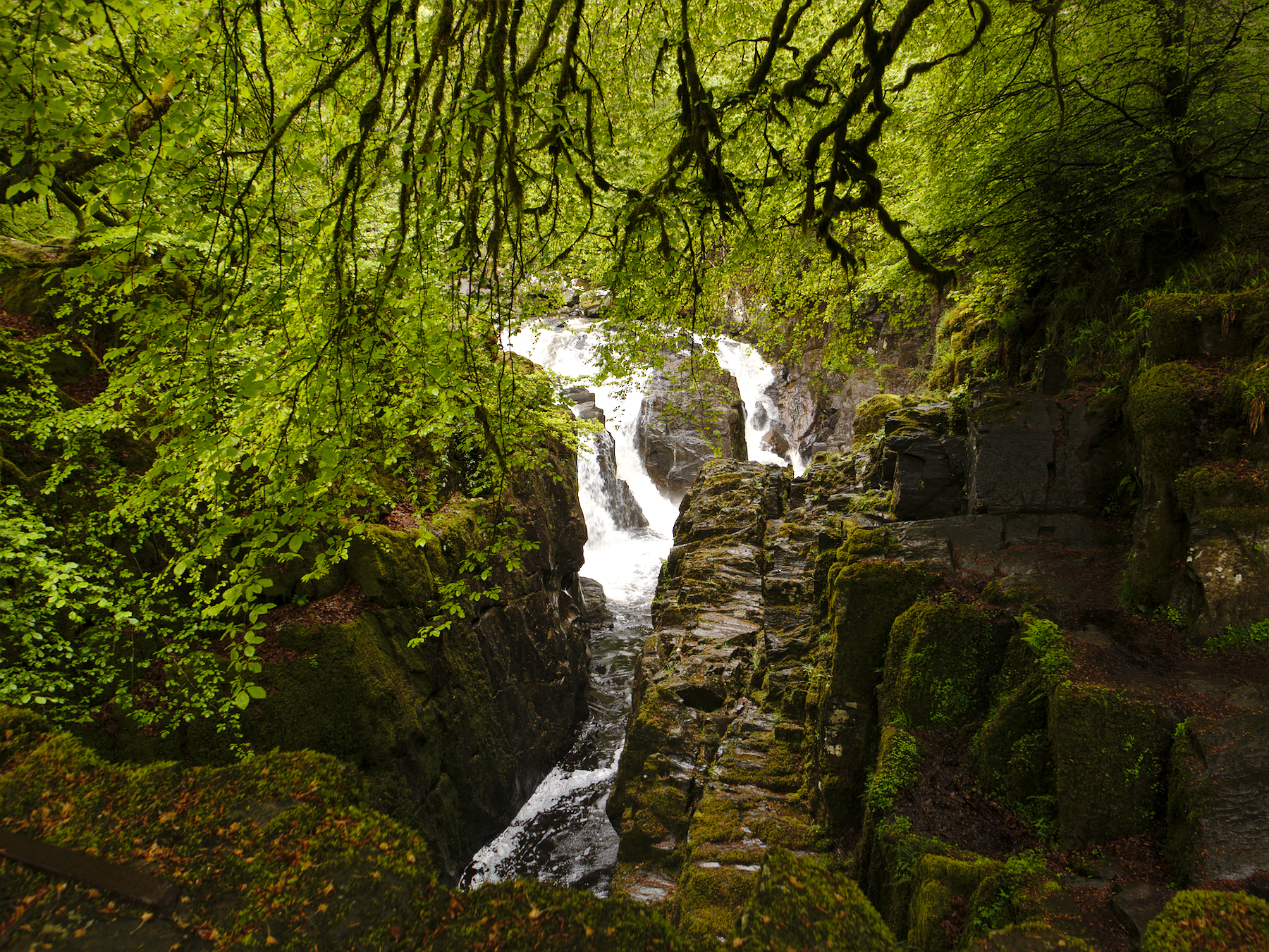
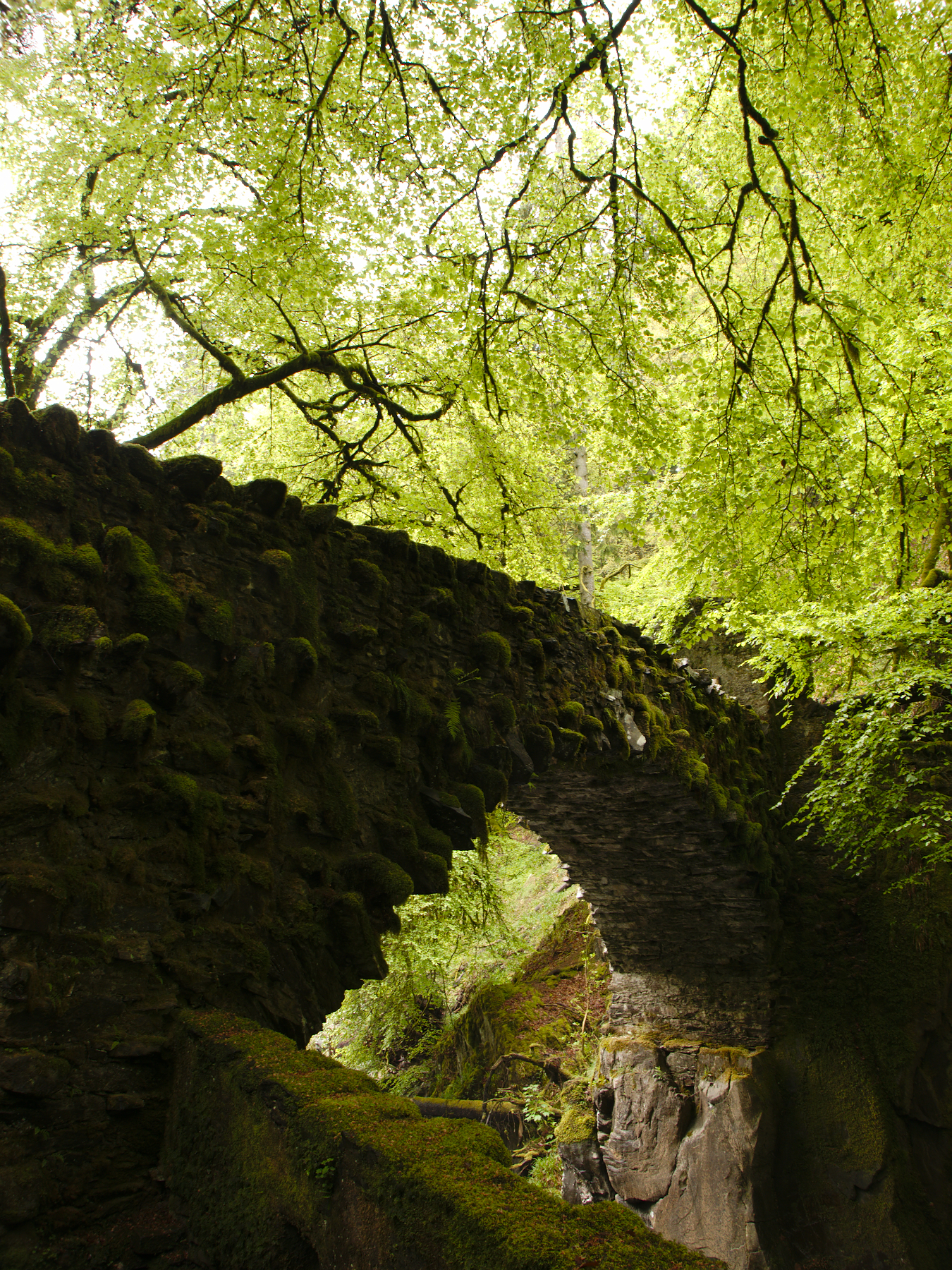
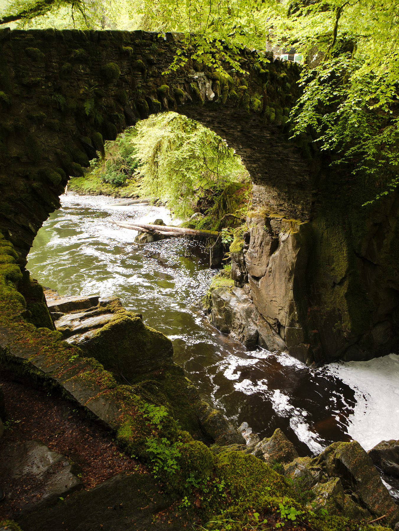
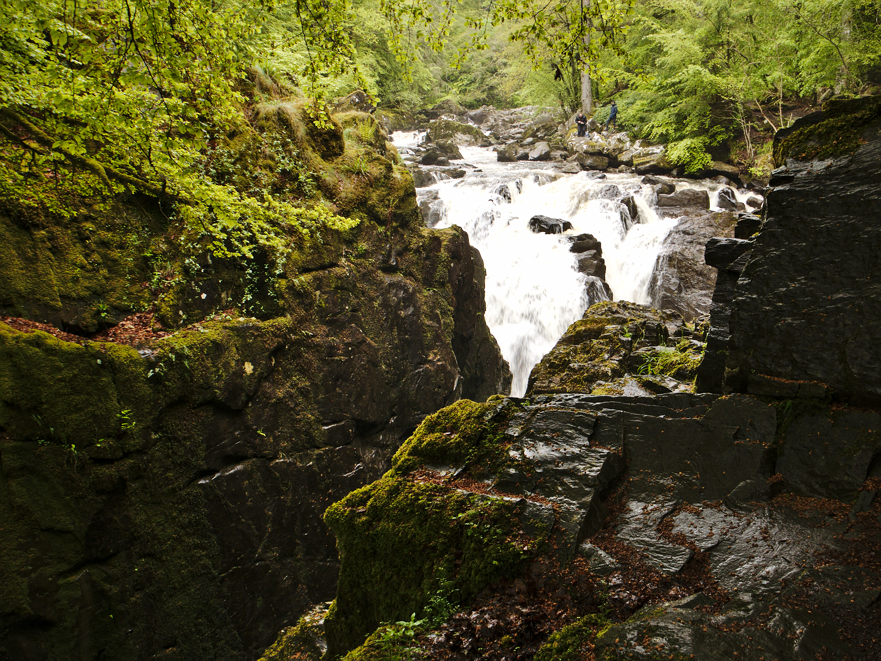
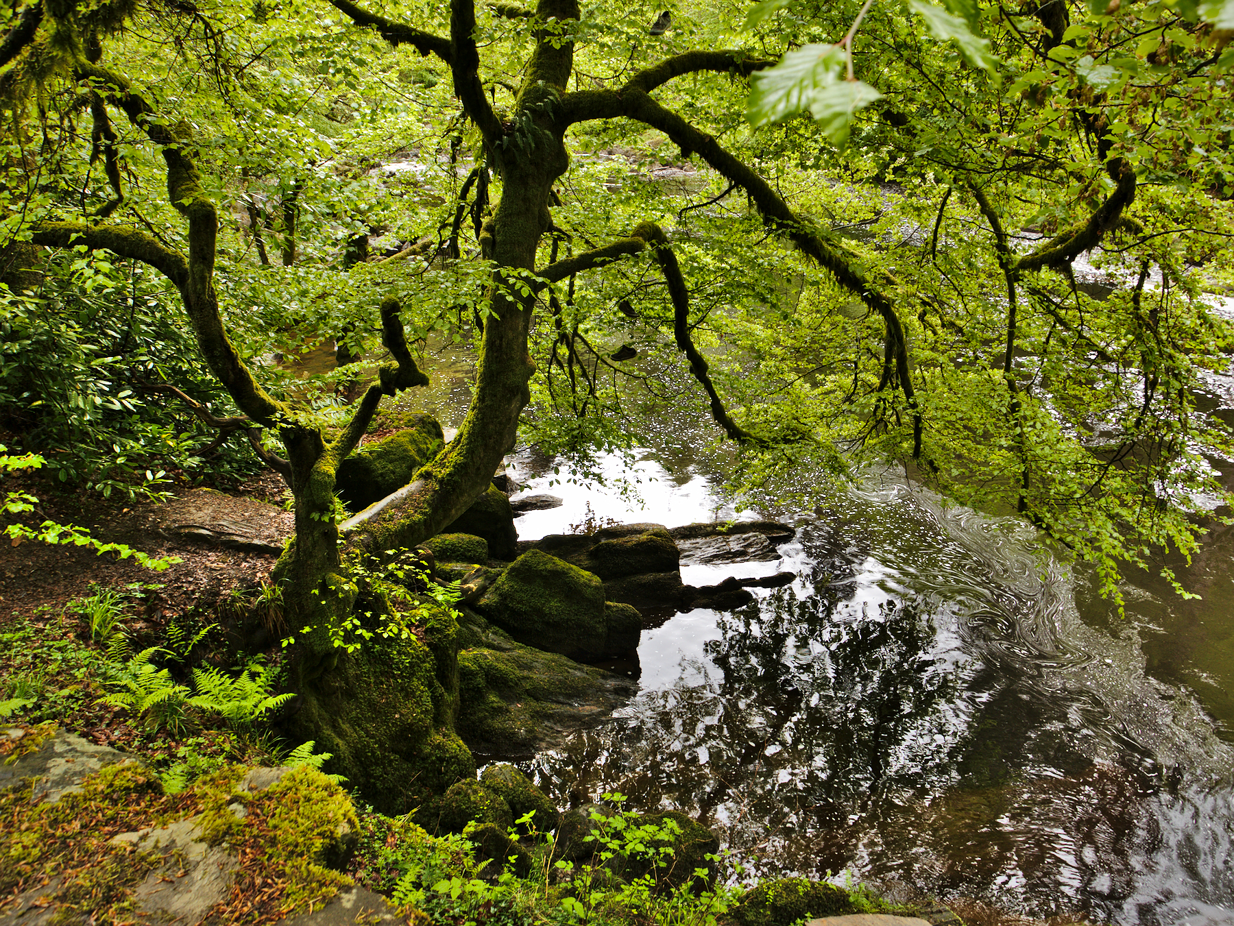
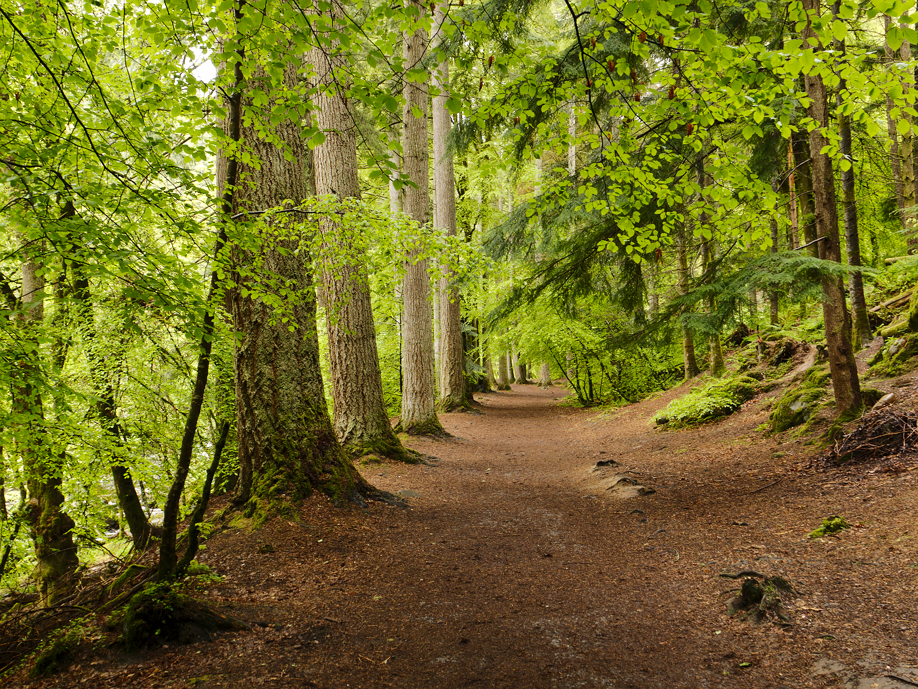
Although not far from that storied forest, The Hermitage was anything but foreboding. Part of the National Trust of Scotland, it was originally the private grounds of the Dukes of Atholl, before being deeded to the public. Dominated by tall Douglass firs, this section of Perthshire forest was nothing less than enchanting, and looked like the realm of fairies – or sidhe (pronounced “shee”).
Well-kept trails wound through the forest, accented by old stonework bridges and ultimately by Ossain’s Hall, an almost chapel-like building overlooking the falls. The Hermitage’s history is palpable as you walk through it; it’s more like a manicured forest garden than a wild wood, the trails lined with English bluebells and, of course, bracken, amid more shades of green than we could name.
Balnuaran of Clava
Balnuaran of Clava wasn’t on our original itinerary. It wasn’t even someplace that we knew about when we arrived in Scotland. It came about organically, in the course of conversation with Rob, in what would become a recurring theme and one of the true delights of our tour.
One moment we were discussing Outlander, a television show about a post-WWII English nurse who falls back in time prior to the Jacobite Rebellion of 1745 (and of course falls in love with a Highland Scottish warrior). The show – and the book series that preceded it – is very popular, and has been a contributing factor to Scotland’s tourist boom. In the show, the time travel takes place when the heroine touches one of the standing stones at an ancient site.
The next thing we knew, we were on our way to to see standing stones of our own, including the very stone that inspired the one from the books.
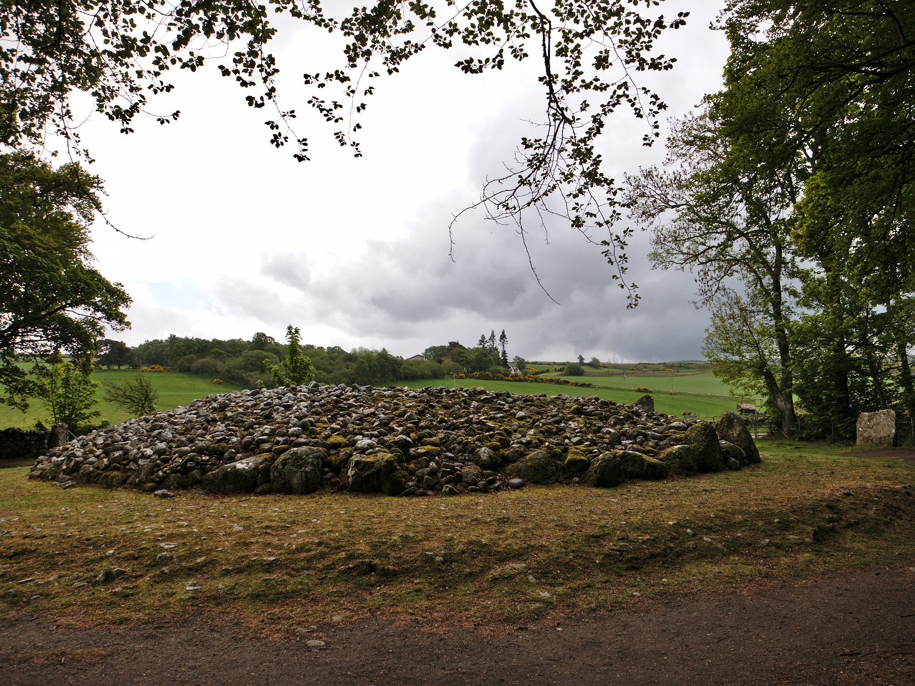
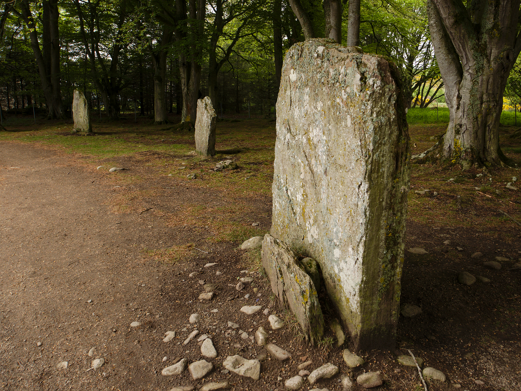
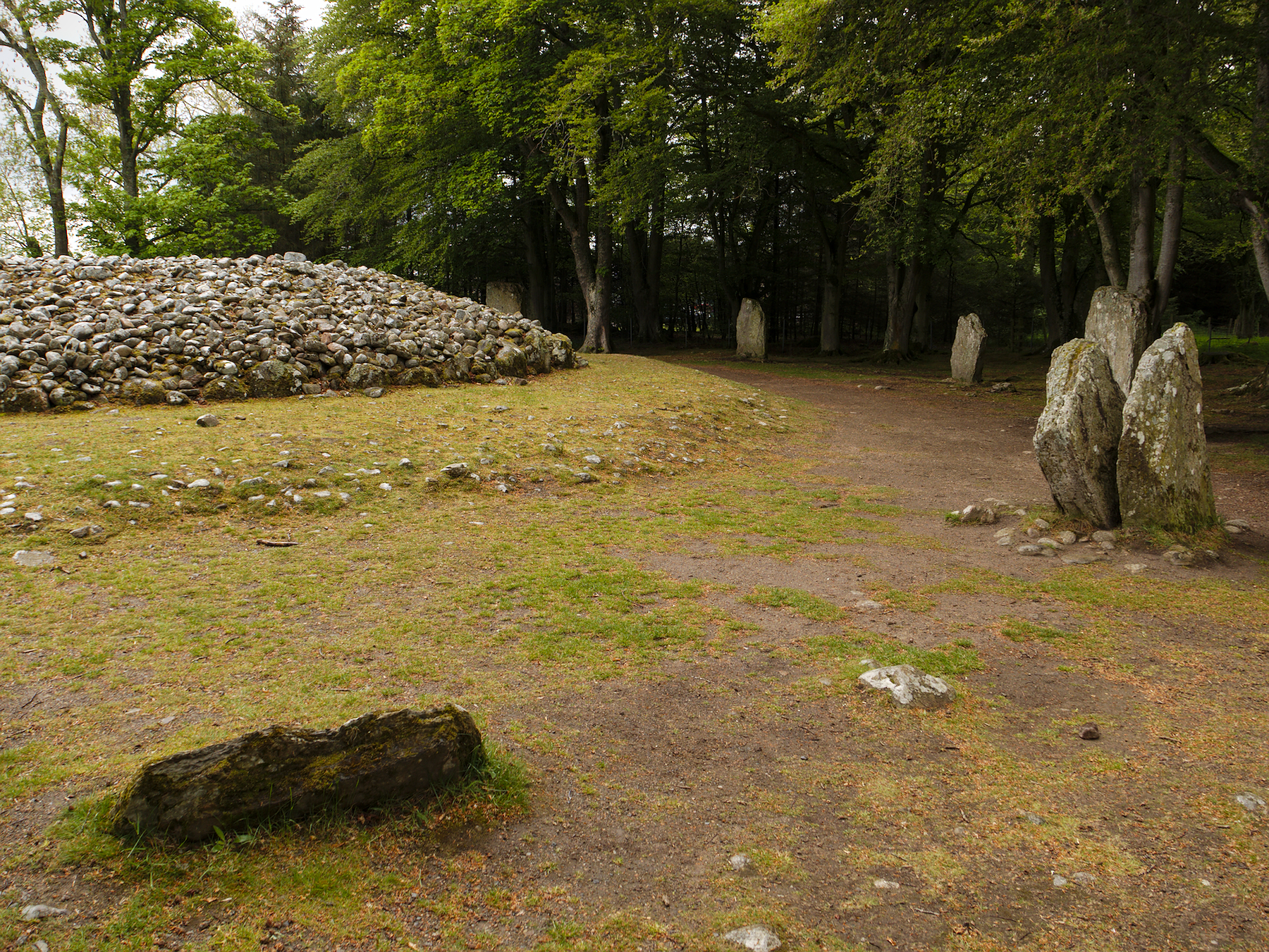
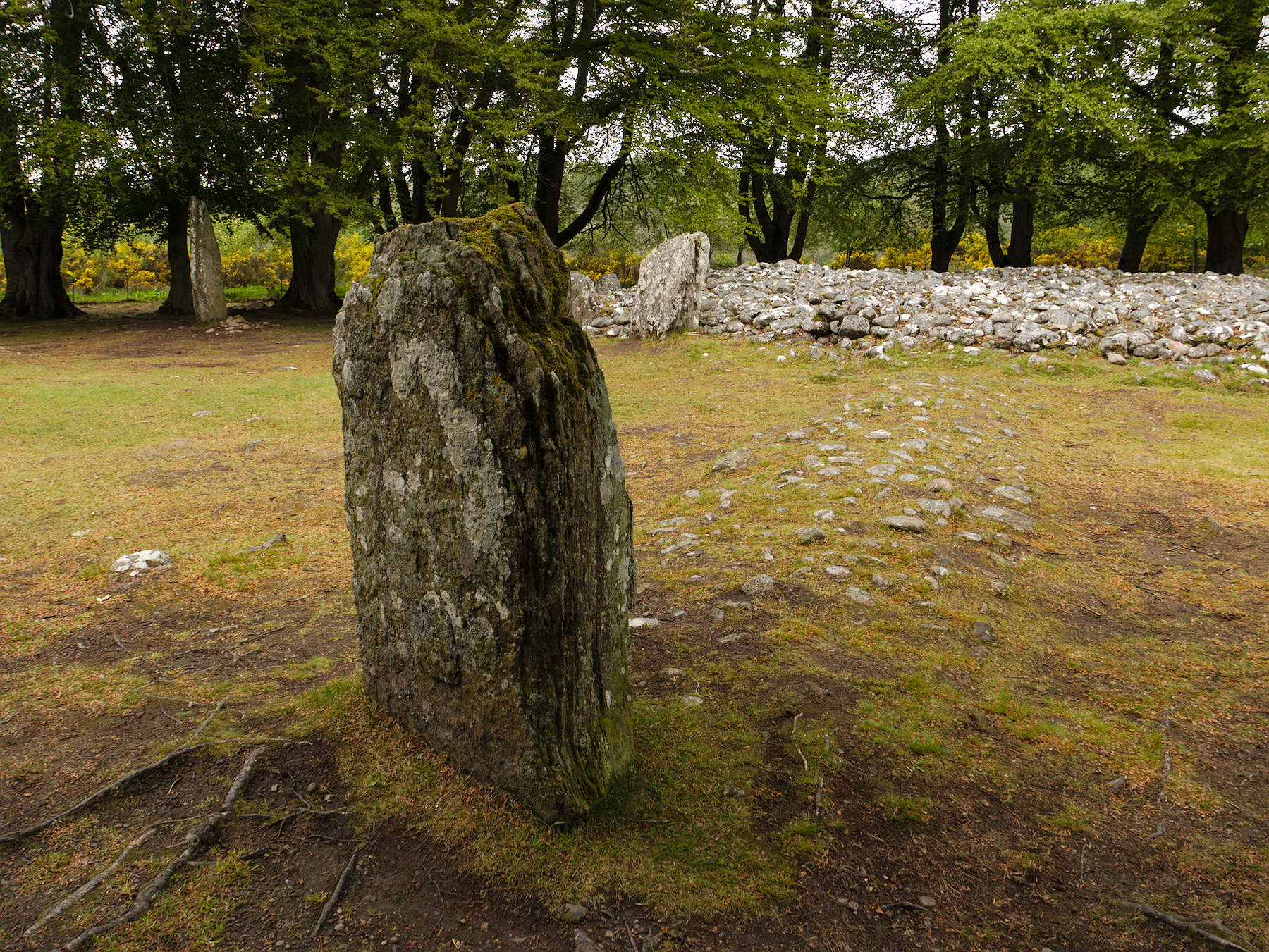
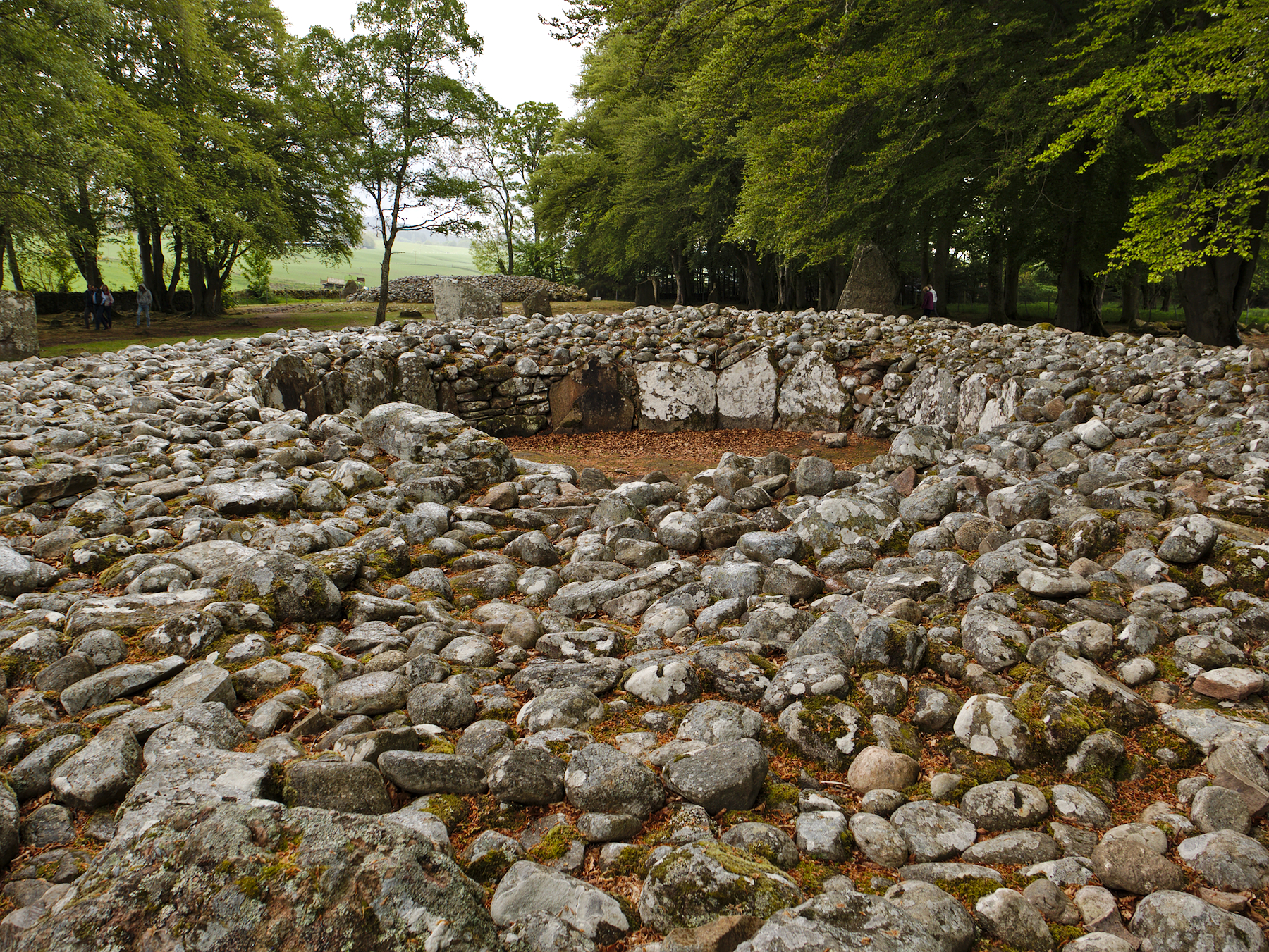
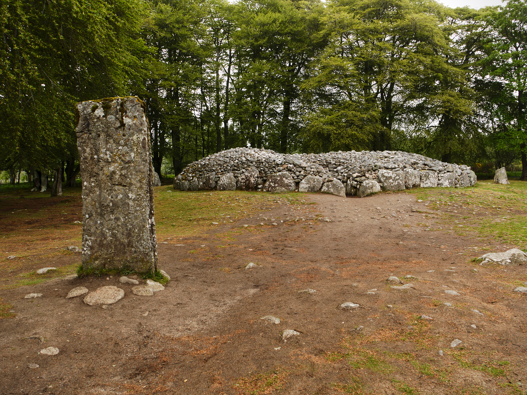
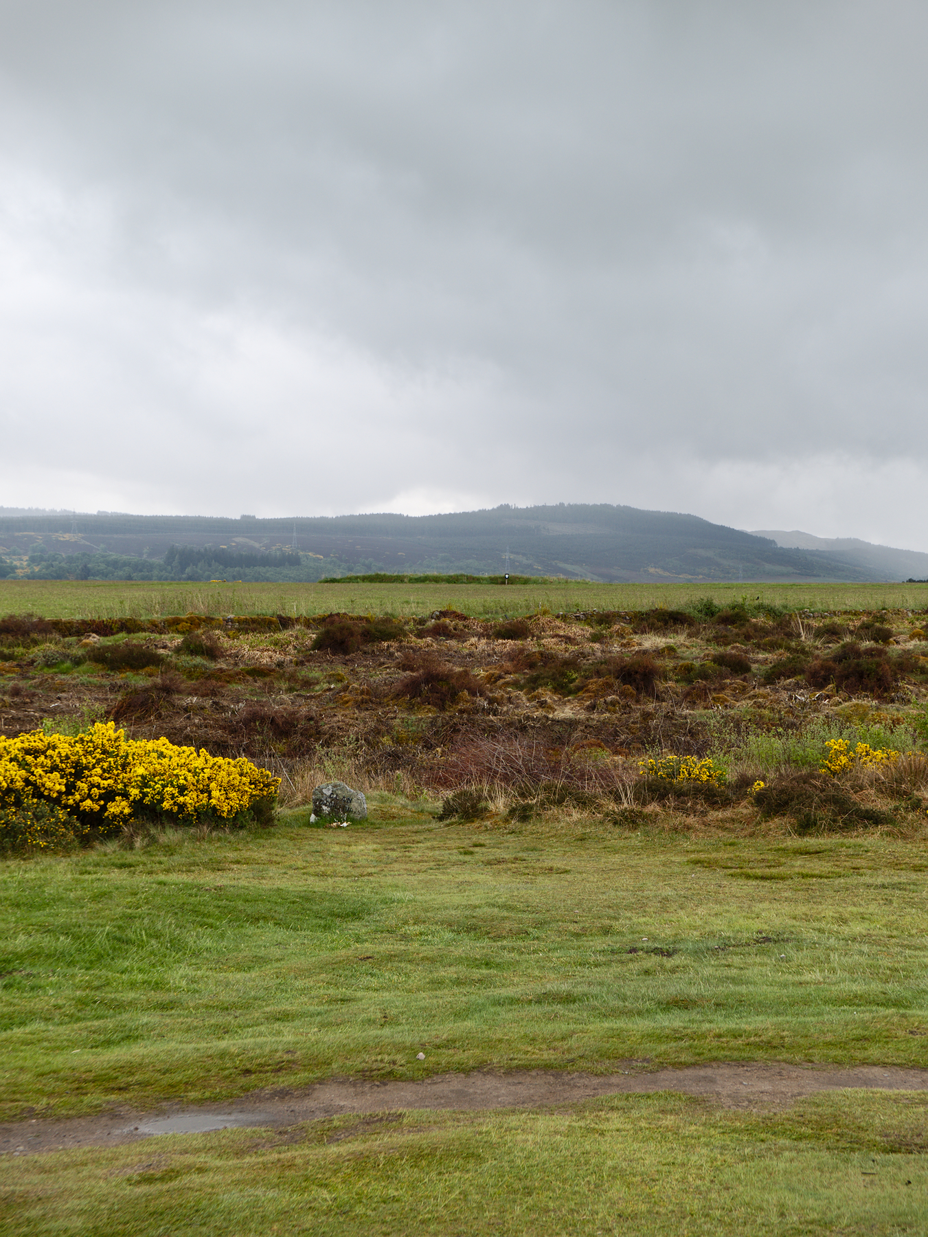
Balnuaran of Clava sits alone in the countryside, in a fenced-in plot along a backroad. If you didn’t know it was there you’d probably never find it. The site consists of three cairns – circular stone structures, all with small central chambers and two with entry passages. Built about 4000 years ago, around 2000 B.C., the cairns were likely religious in nature, and at one time did physically align with the midwinter solstice. In later centuries they were converted to burial chambers, before finally being abandoned.
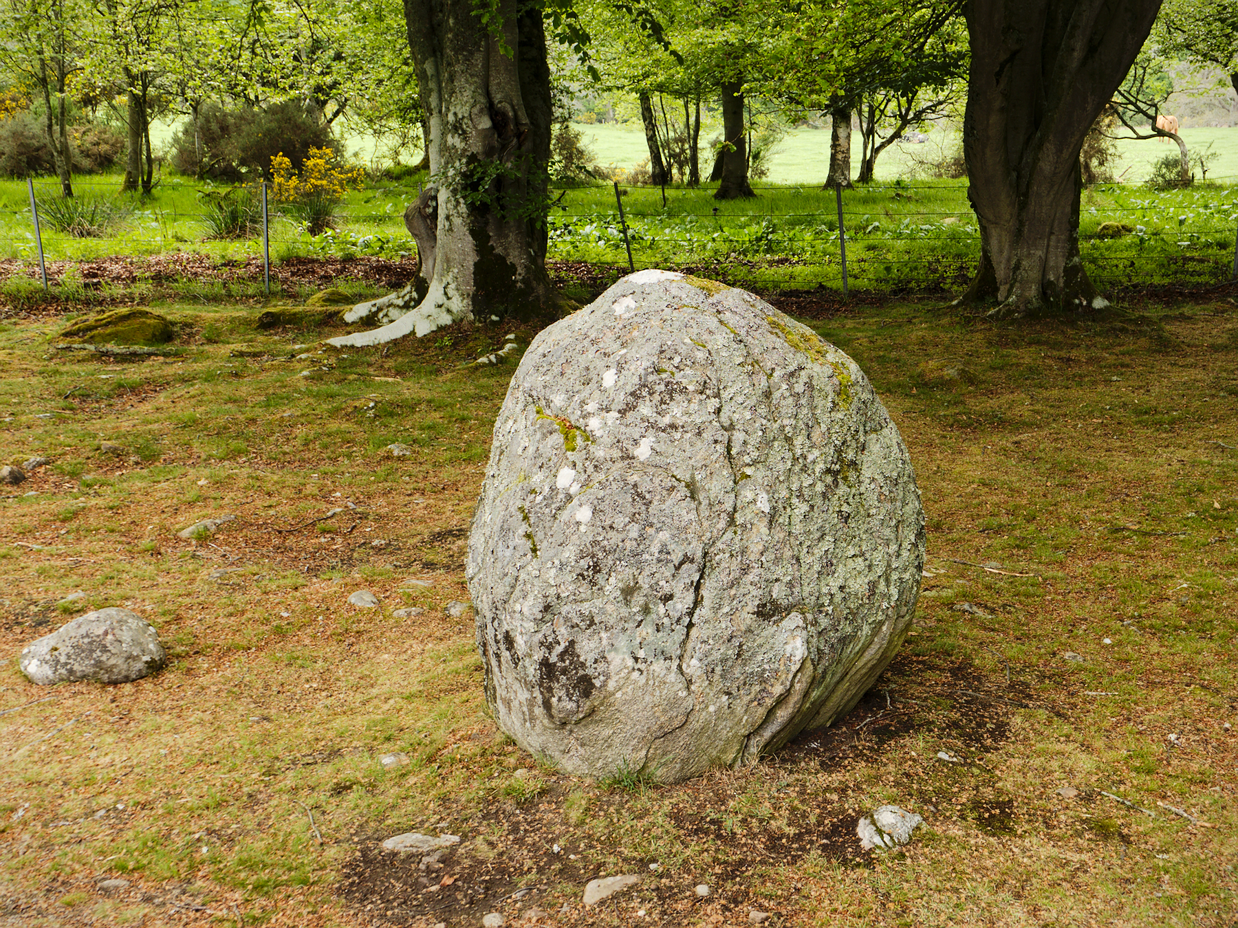
The purpose of the standing stones that encircle the cairns is nebulous at best. They don’t align to any known patterns, and their exact use can only be guessed at. The trees that shade the site, while stately and seemingly part of the landscape, are not original at all – they were planted by the site’s Victorian-era owner, who believed that the cairns and stones had belonged to the Druids, who, in his belief, would have considered the grove sacred.
Culloden Battlefield
Scotland’s history is filled with violence and warfare. “The Scots are a fighty people,” Rob told us. When they didn’t like the new mailboxes that the government installed some years back, they burned them all down. They are quick to take offense and are known to hold grudges, sometimes for generations. And despite sharing an island with England, they have a complicated history with their southern neighbors.
The Jacobite movement began in 1625 with the death of King James VI, a Stuart, who had united England and Scotland under joint rule. There followed over 100 years of political strife, as various rulers rose to and fell from power, and during that time the Jacobites staged several uprisings, none of which were successful. (“Jacob” is the Latin version of “James,” therefore the supporters of James’ heirs became known as Jacobites.)
It wasn’t until the Jacobite Rebellion of 1745 – known simply as “the ’45” – that Charles II, also known as Bonnie Price Charlie, returned from exile in Europe with an army bent on reclaiming the throne. Landing at Glenfinnan and supported by a mix of Highland Scots, Irish, and French, the Jacobite army was initially successful in a series of battles and skirmishes, and soundly beat the English several times as they began to move towards London.
The ’45 culminated at the Battle of Culloden, where the Jacobite army engaged English forces commanded by the Duke of Cumberland, which had returned from years of warfare in Europe specifically to deal with the Jacobite threat. The two armies met on April 16, 1746, and within an hour the battle was over and the Jacobite cause was lost, its forces smashed and scattered.
The battle was a mistake; Charles should have waited, but instead marched his troops 12 miles through the night, in the rain, to engage the English. It was a poor tactical choice, and one that his advisors warned against. The Jacobite army was routed, flanked by cavalry, and cut down as they fled, loosing between 1500 and 2000 troops to the English’s 300.
Bonnie Prince Charlie fled the battlefield and spent the next six months in “a game of cat and mouse” through the Scottish isles, narrowly eluding capture by the English, before finally escaping aboard a French ship while dressed as a serving woman (in what sounds like a Hollywood plot but is completely true).
The Stuarts would continue their quest to reclaim the monarchy, but the Jacobite defeat at Culloden had a profound impact on the Scots. It marked the end of the Scottish clans, amid brutal reprisals. The Disarming Act forbade Highlanders from carrying weapons, the kilt and tartan were banned, lands were seized, and Scotland was occupied by English forces bent on crushing its very culture.
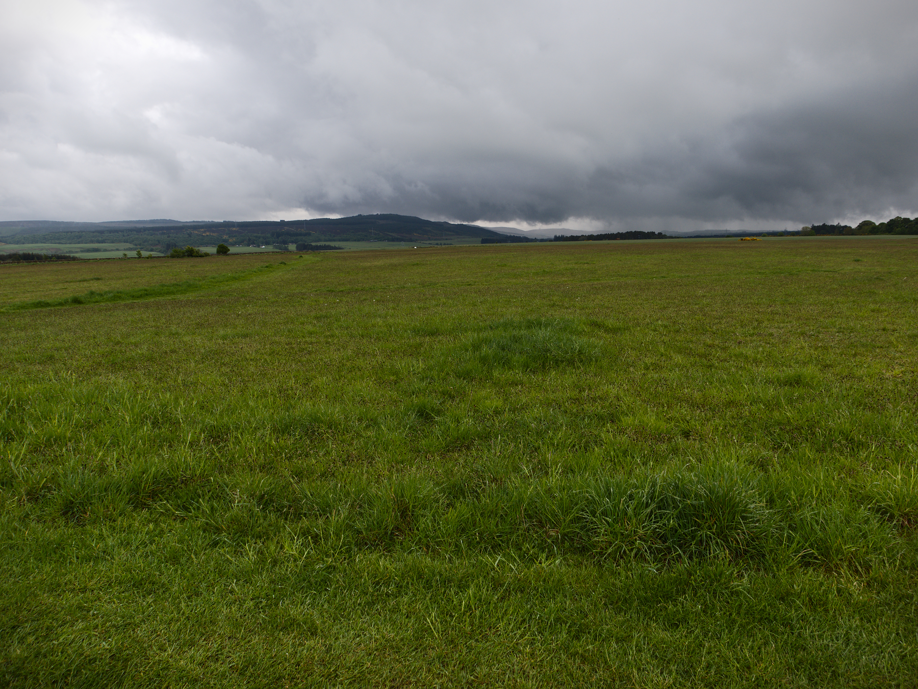
Like so many battlefields, the Culloden moor is now peaceful and lovely, perhaps all the more so under a leaden sky. The museum on the site is excellent, and provides two parallel tracks to show both the English and Jacobite perspectives leading up to the battle, and its aftermath.
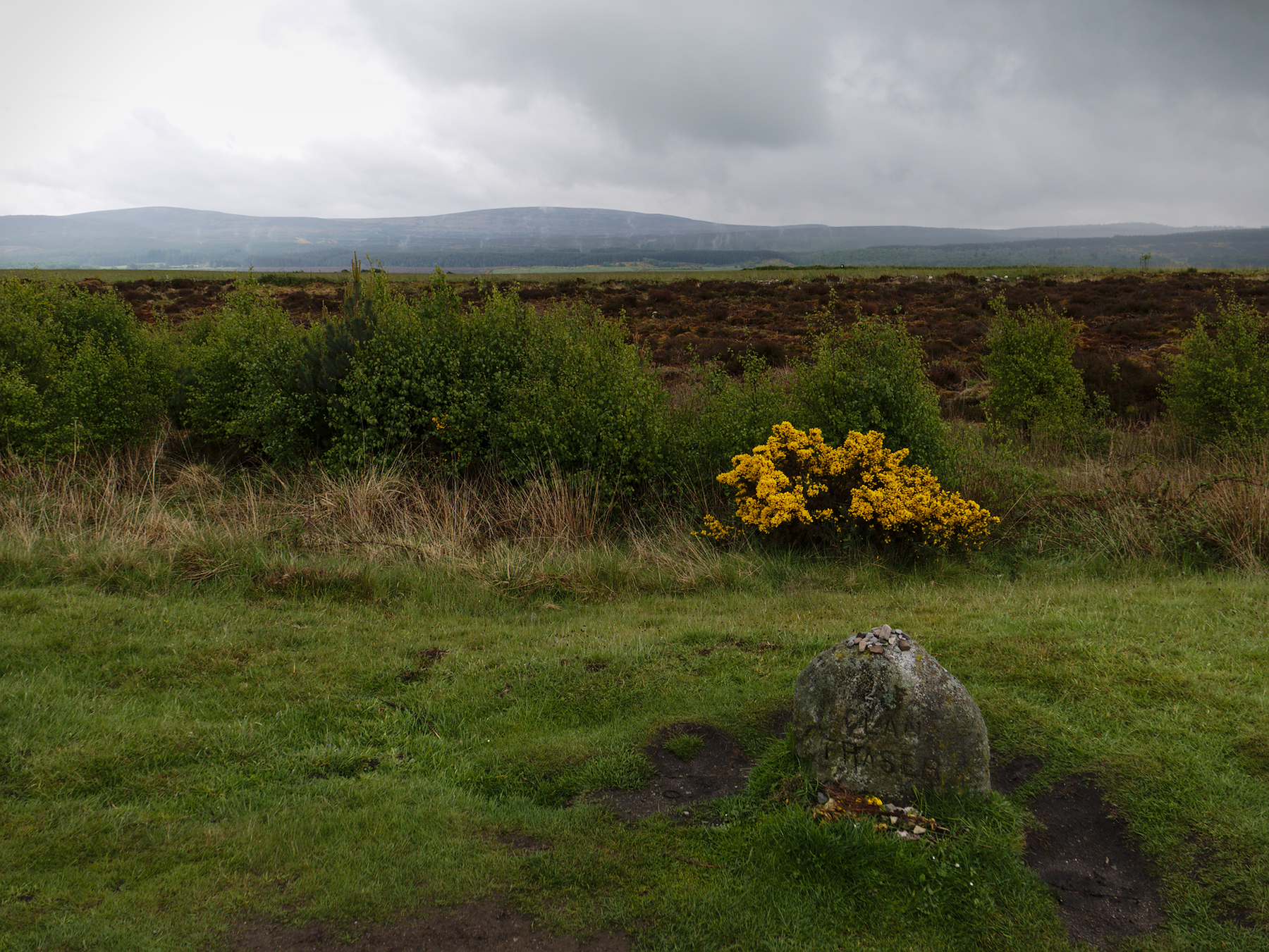
On the field itself, flags mark the lines for each side, and a series of stone markers engraved with the names of the Scottish clans line the field. All of them are surrounded by grass save for the Fraser clan marker, which thanks to its fame due to Outlander, has a path worn to it, and is surrounded by flowers and small items left by fans.
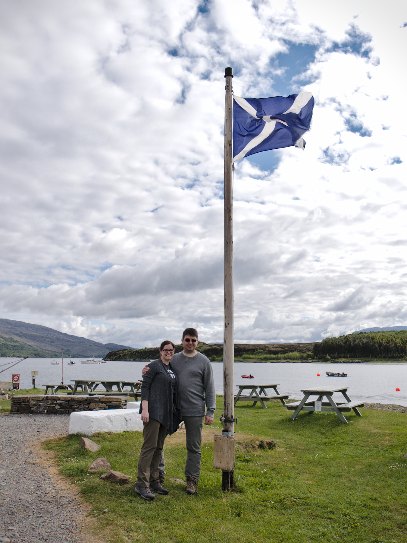
Plockton
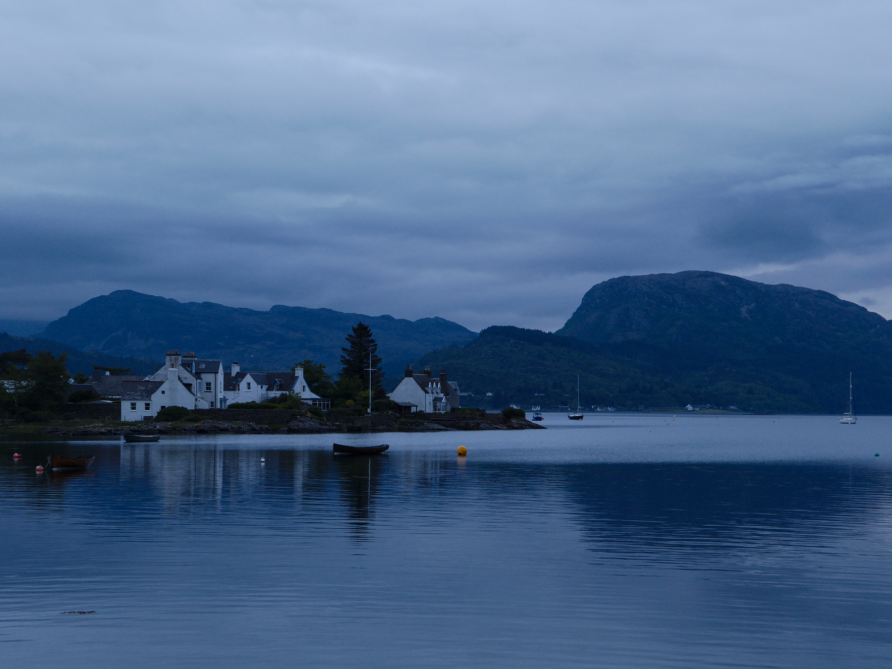
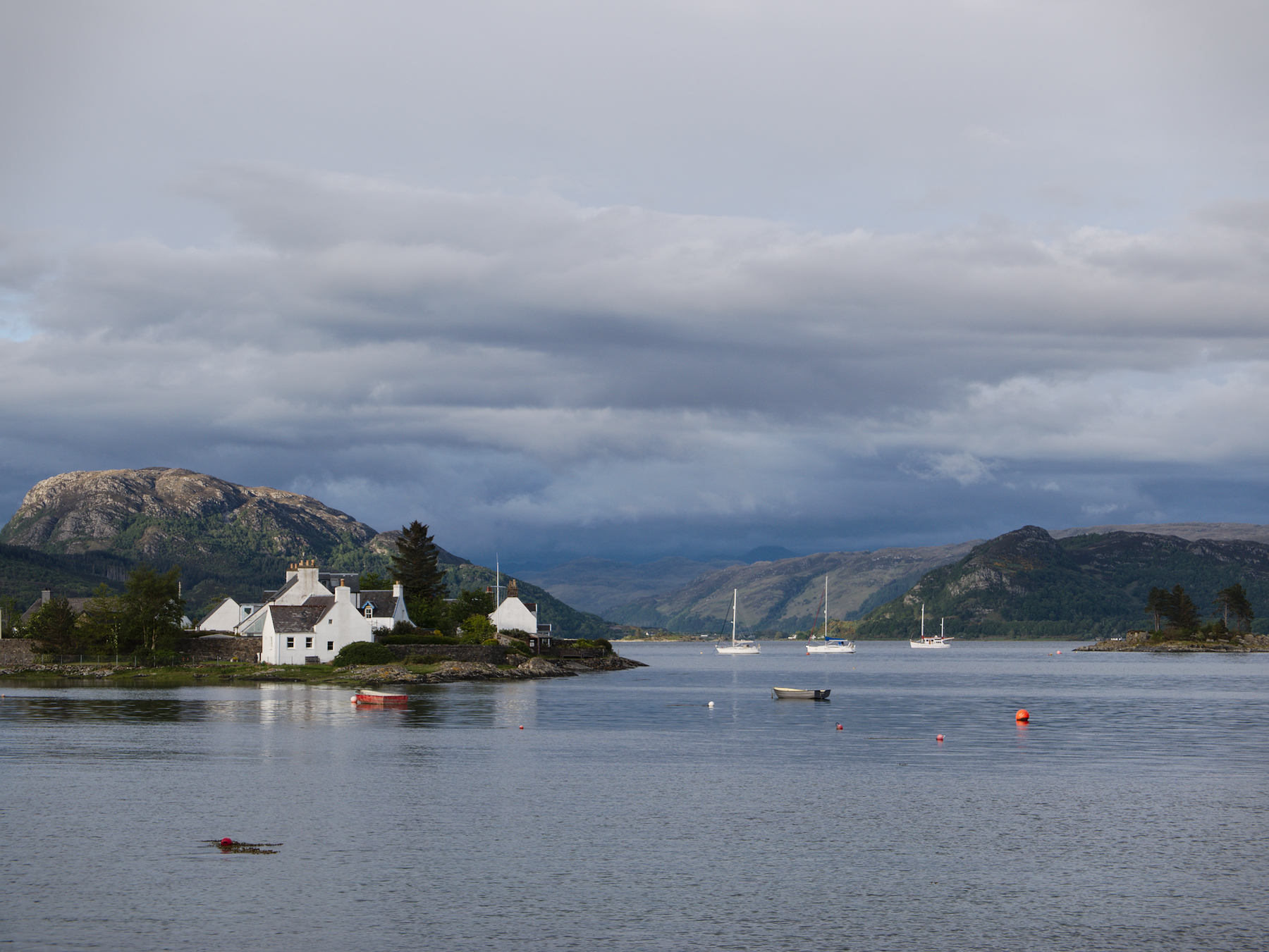
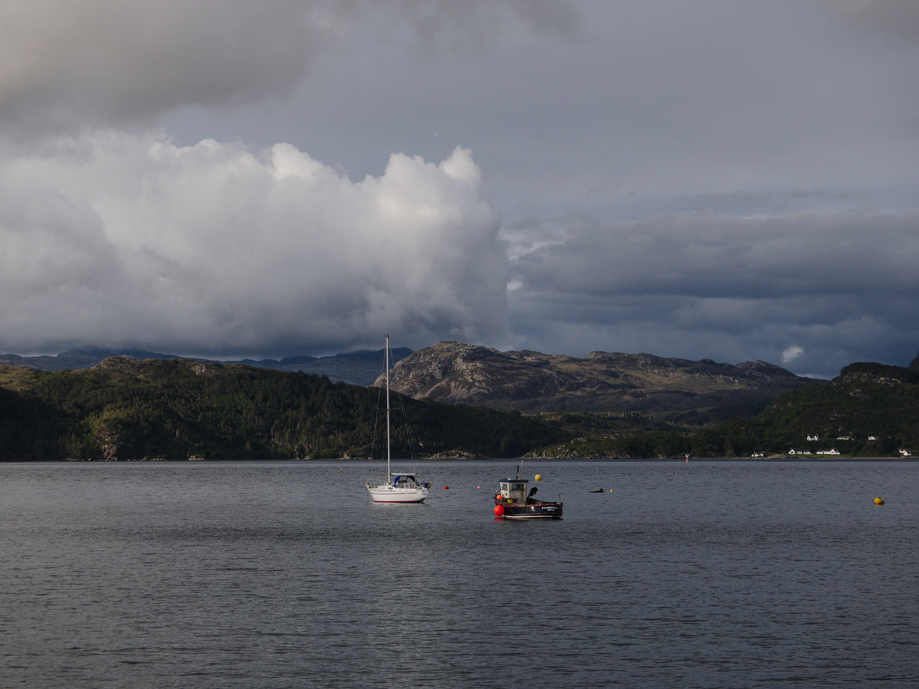
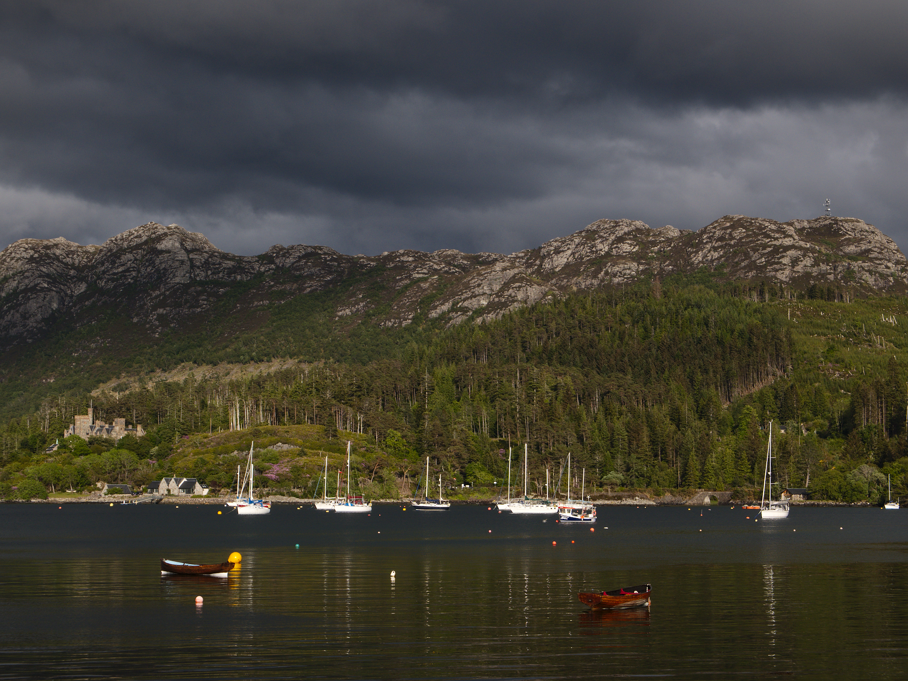
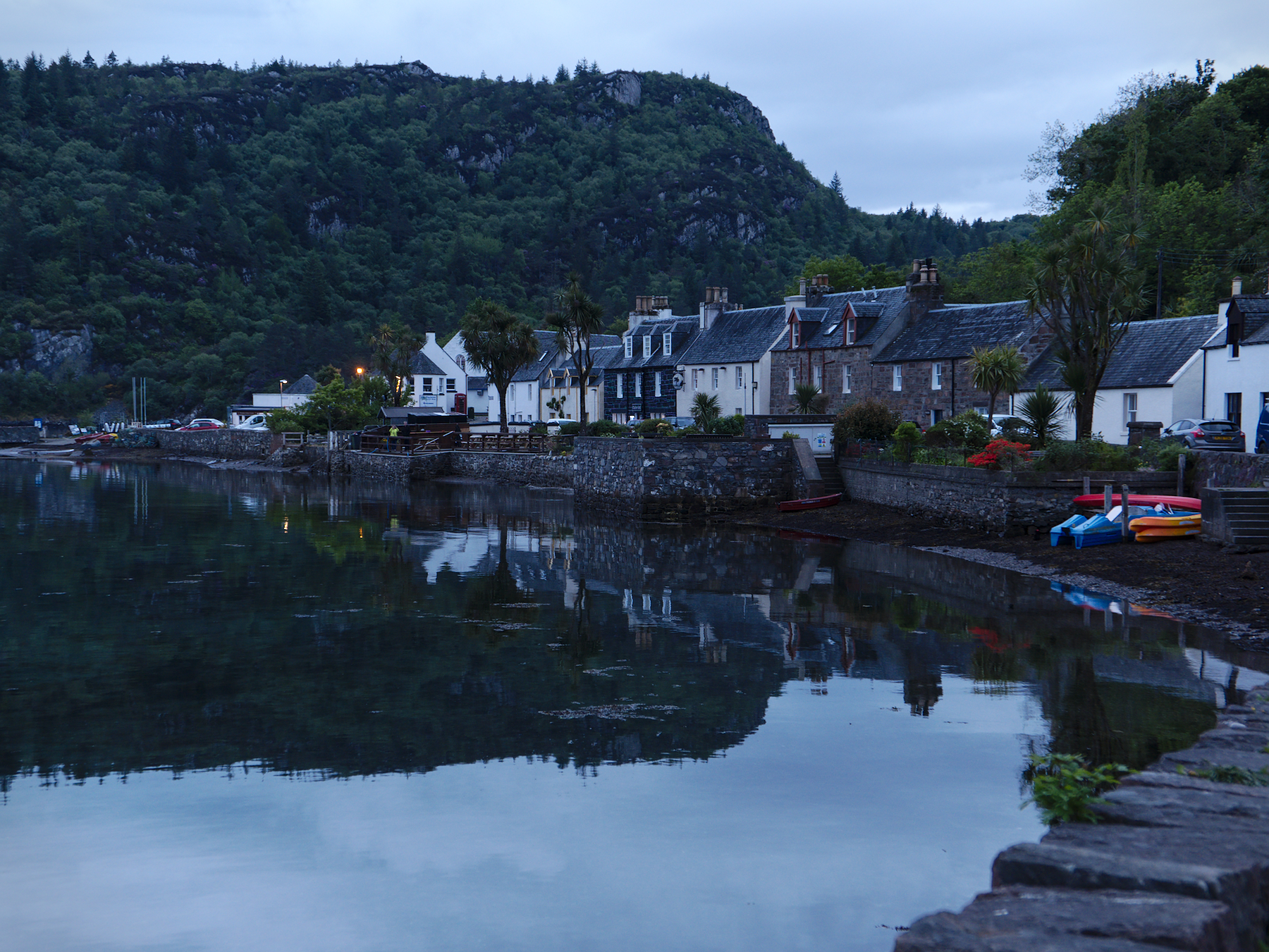
We ended our first day of the tour in the tiny fishing village of Plockton, which sits on the southern shore of Loch Carron, on the western coast of Scotland near the Isle of Skye. The village dates from the early 1800s and is home to fewer than 400 souls, although it has become popular with tourists. Indeed, the main street is populated largely with inns and guest houses, and a small number of restaurants, all in lovely plaster and stone buildings.
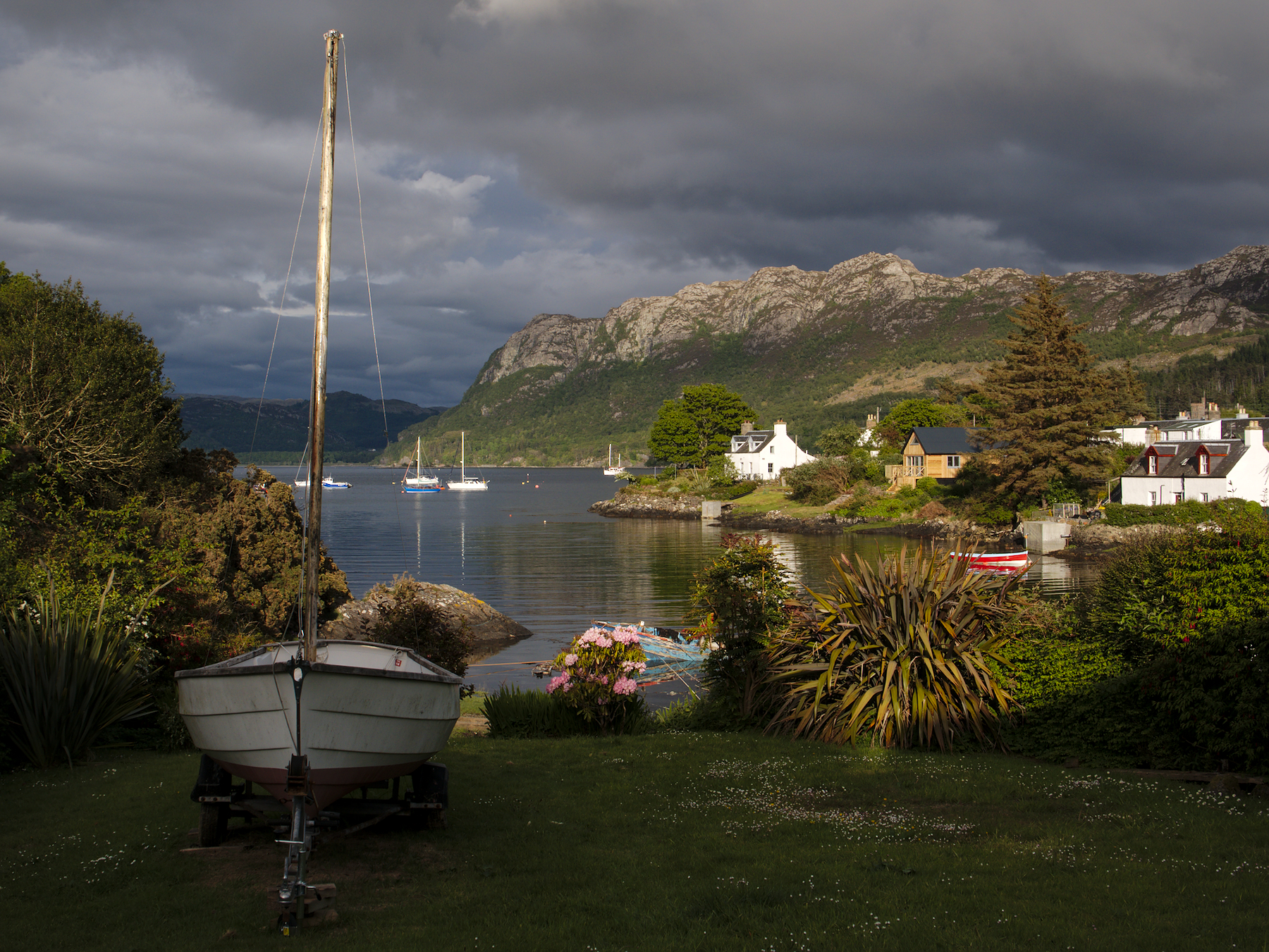
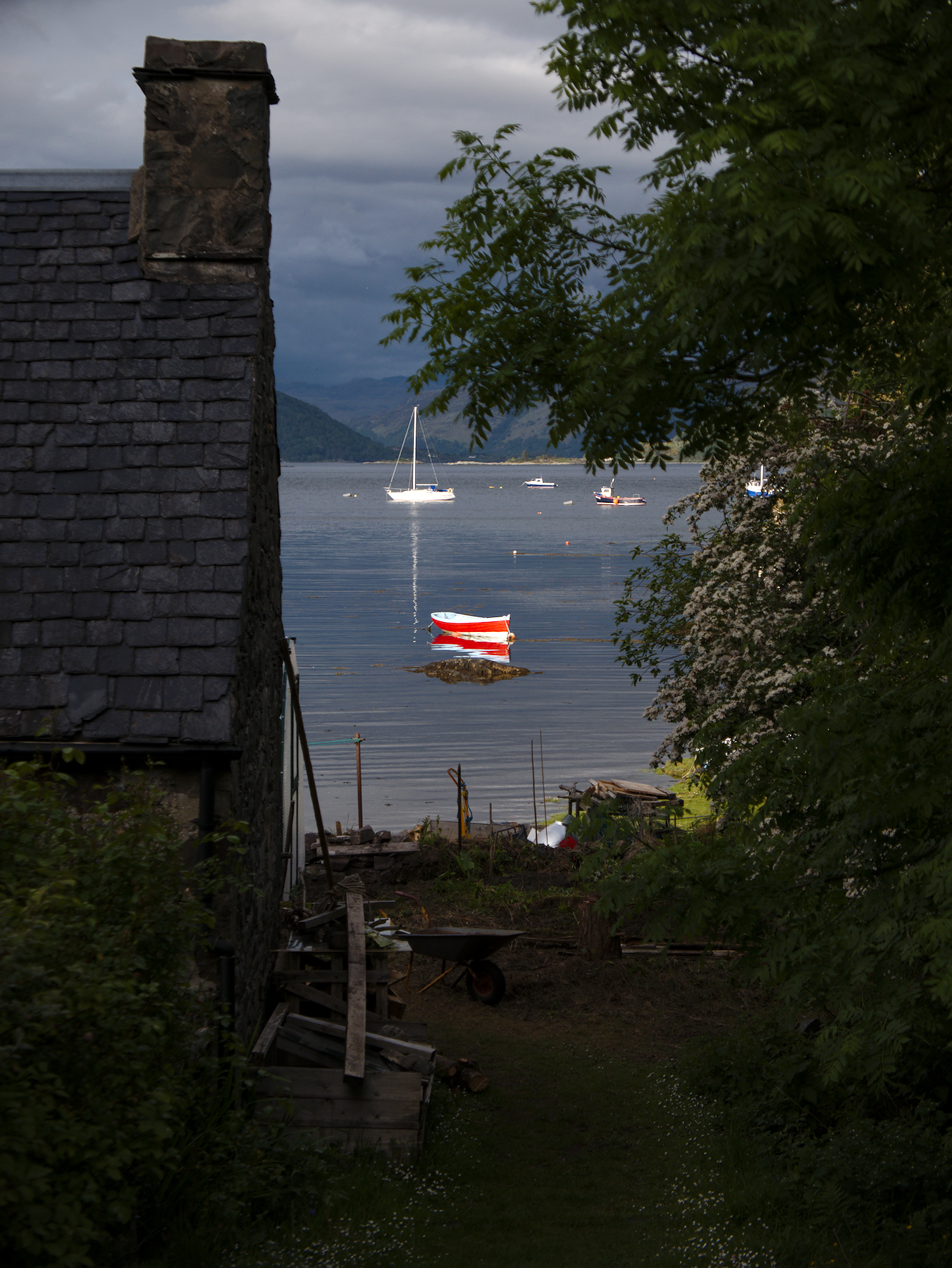
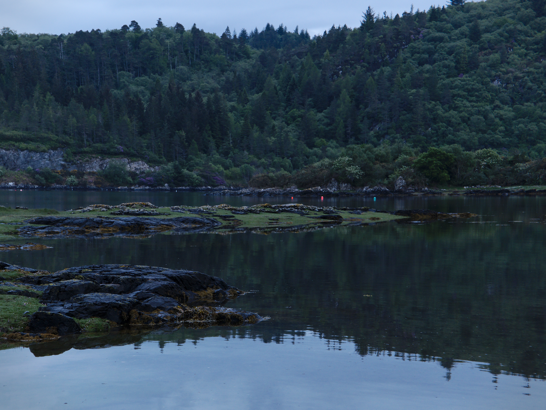
Plockton is a chimera setting, a mixture of unlikely components that come together to form scene of breathtaking beauty. The mountainous shores of the loch give it the feeling of a Scandinavian fjord, while sections of the rocky shoreline look to have been lifted from the coast of Maine. And in the small garden plots that line the waterfront, palm trees grow and drop coconuts on the grass.
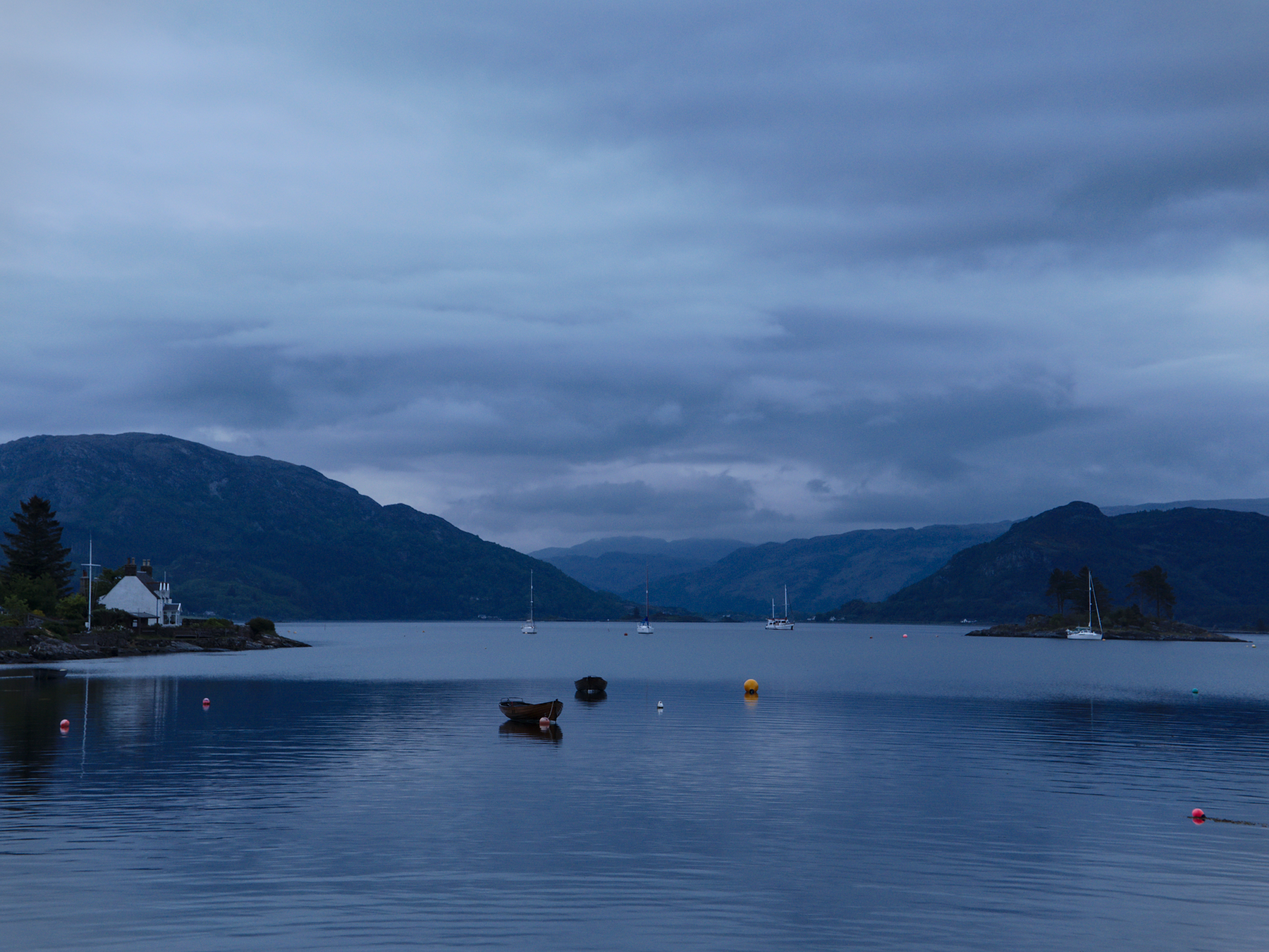
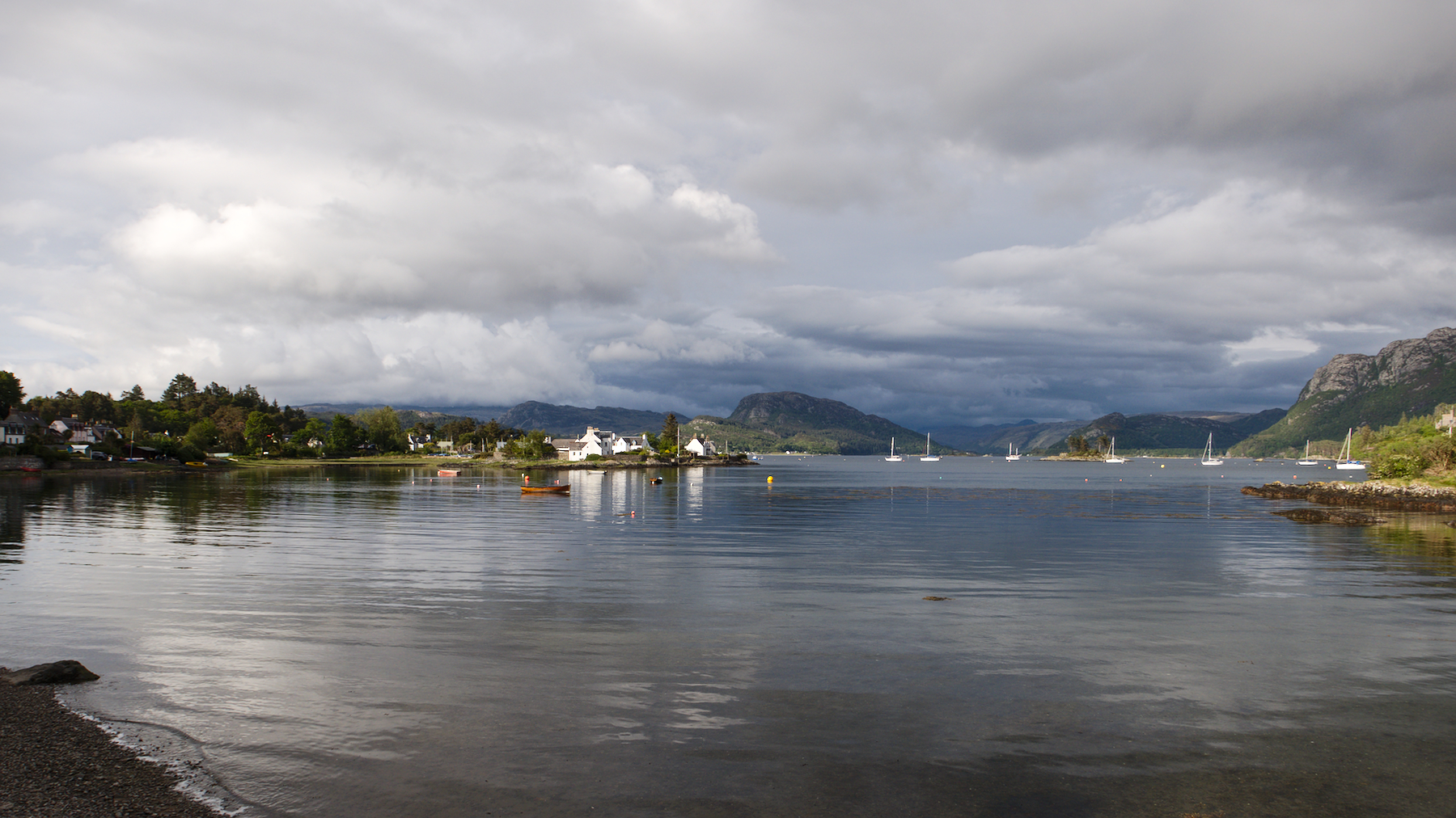
We walked down the seafront street the first night, in dim light under the clouds. The second night of our stay, the sky had cleared and the evening light was lovely. During the summer, it remains light out until after 10 PM, and we stayed out walking nearly that long, watching the boats as the tide came in.
It’s small towns like this that really give you a feel for a place, and for the people who live there. We spoke with one of the locals the second night; he approached us while we were out walking, asking if we were Americans and wondering why we had chosen to stay in his little village. He seemed pleased that we had, and that we were enjoying it so much.
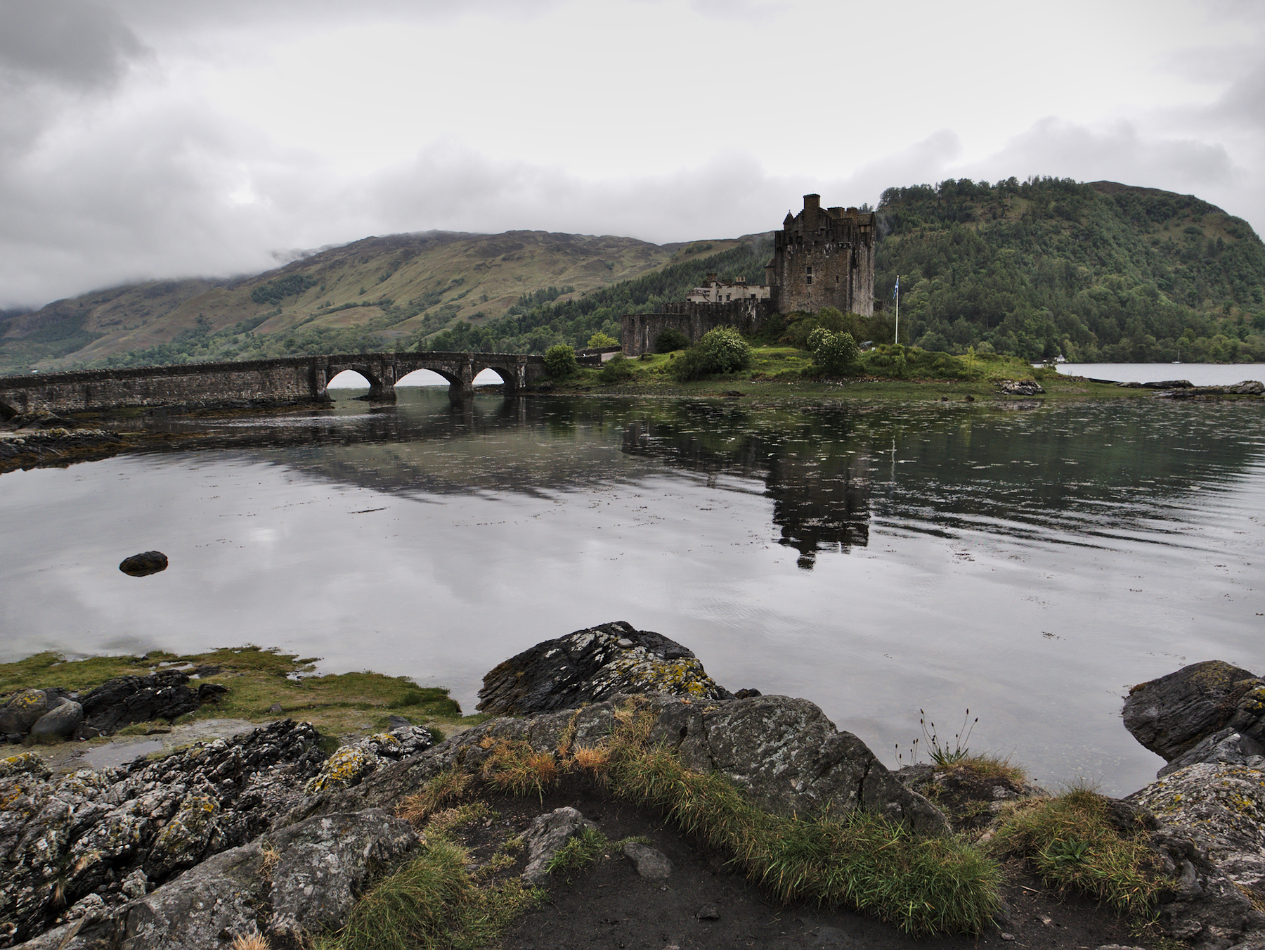
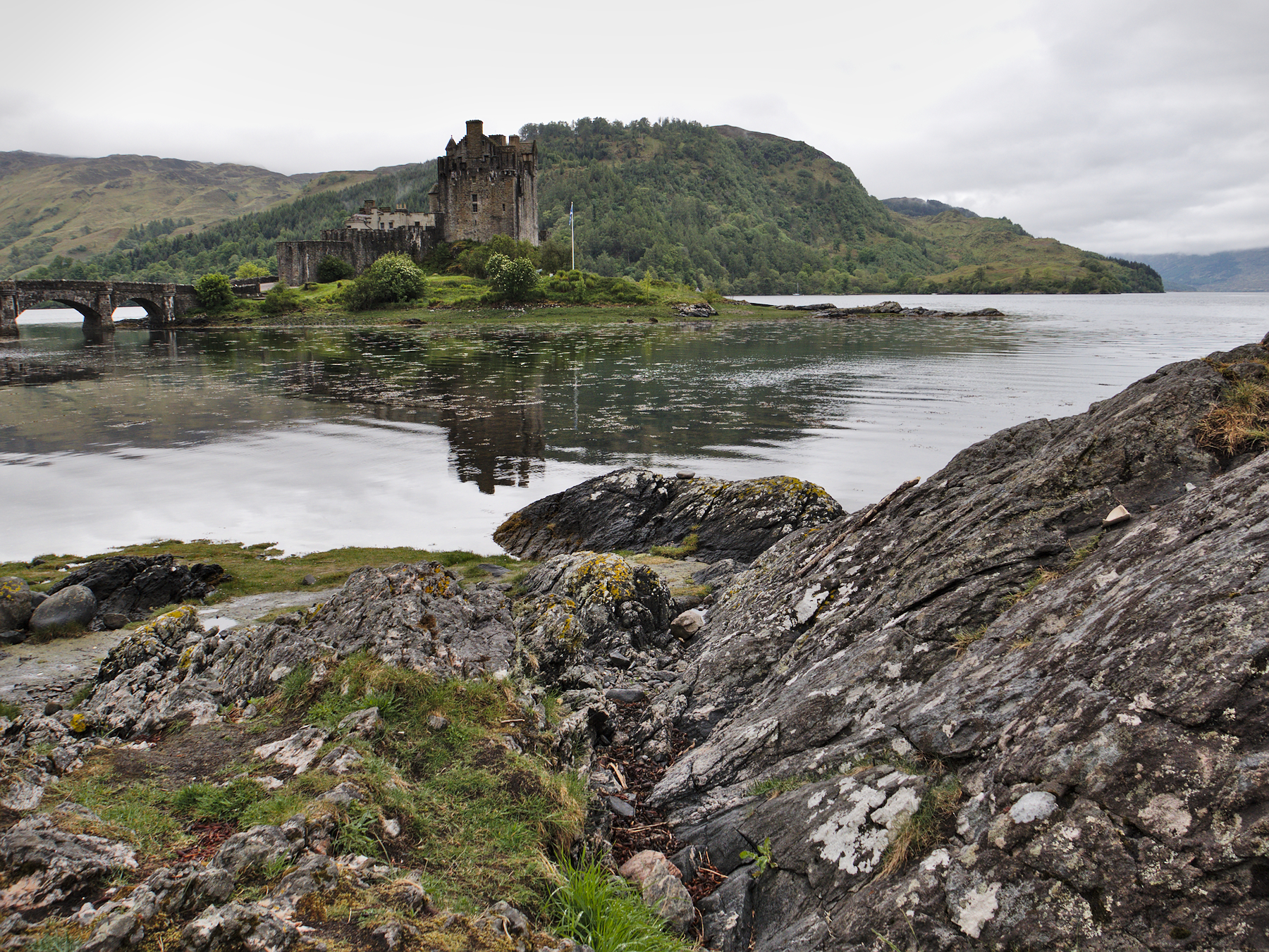
Eileen Donan
Years before Bonnie Price Charles arrived for his encounter at Culloden, an earlier Jacobite uprising arose in Scotland. It was an effort to restore James Stuart to the throne he was judged to have abdicated, and there was the promise of Spanish aid. In fact, several hundred Spanish troops landed in Scotland in the early 1700s, in Mackenzie territory, and the clans responded as hoped, joining the cause.
In an odd turn of events, however, the rebellion had too many arms and too much ammunition. So while the main force began to march on Inverness, the surpluses were stored in Eliean Donan castle, and left guarded by a garrison of Spanish troops.
The English Royal Navy was on reconnaissance in the area and found out about the troop movements and the supplies, and three frigates sailed up the loch to the castle.
It went downhill from there; the frigates opened fire, bombarding the castle for several days before landing a force ashore that captured it – and the 300+ barrels of gunpowder within. The Navy removed the prisoners, confiscated most of the matériel, then detonated 20-30 barrels and blew up the castle.
It wasn’t until the early 1900s that restoration work began, under the direction of the Macrae family. The repairs were completed using original methods and materials – or the nearest available approximation – in an effort to remain authentic. Much of the castle was restored to its former glory, although portions of it were updated in the Edwardian style.
Eilean Donan is now part of a historical trust, and is open to the public, although one remaining family member still lives in the upper chambers. It has also appeared in a number of movies, including a James Bond film.
Fun fact for the Star Trek fans out there: one of the vessels that bombarded the castle and effected its capture was none other than the 44-gun frigate HMS Enterprise.
Cuillins, Sligachan, & Skye
The Isle of Skye sits off the western coast of Scotland and may be the most lovely, most enchanting landscape in the whole of the British Isles. The island’s Norse name translates to “isle of clouds” or “misty isle,” and in Scottish lore it is the last domain of the sidhe after they were driven from the mainland.
If there are still fairies anywhere in the world, it is probably here.
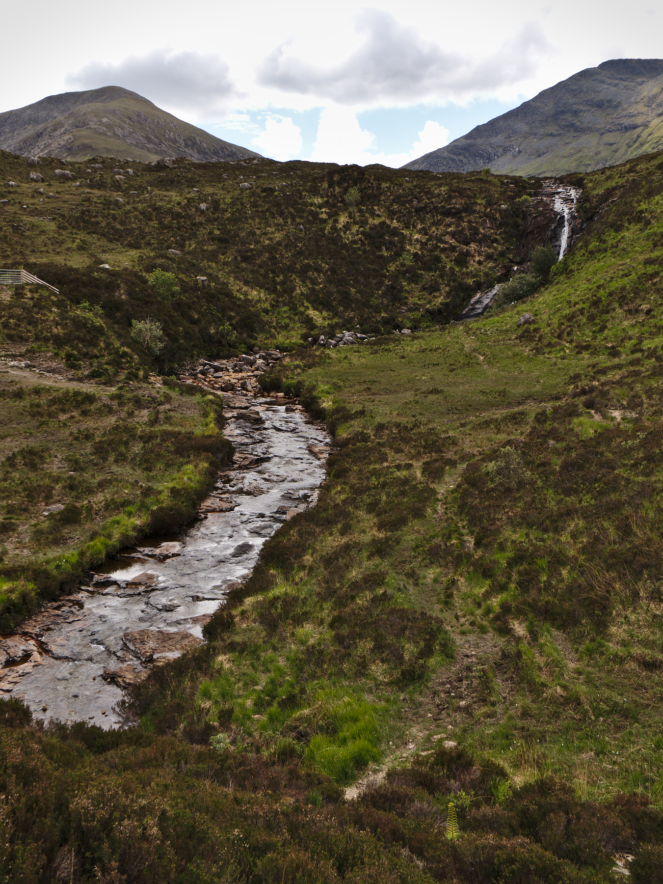
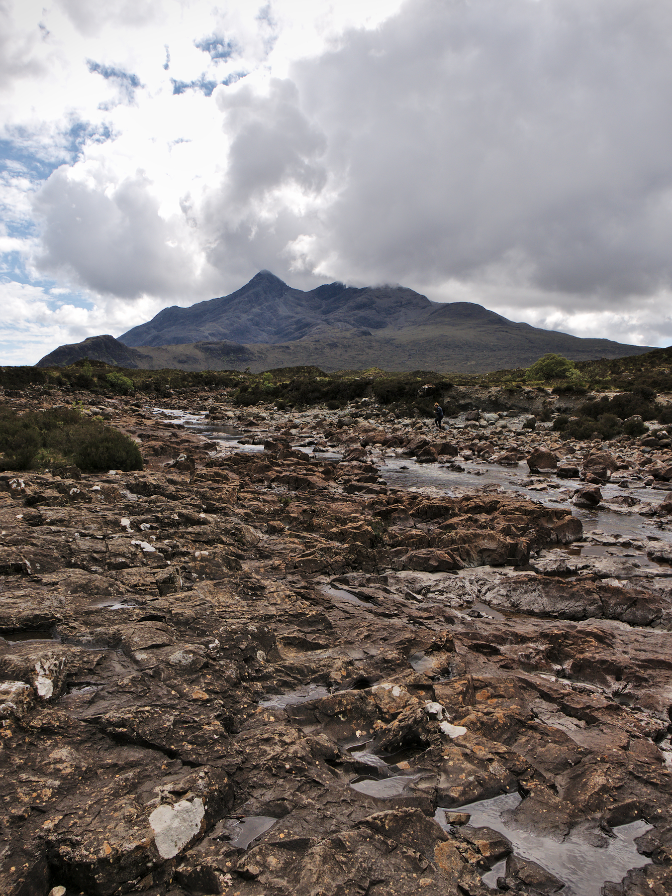
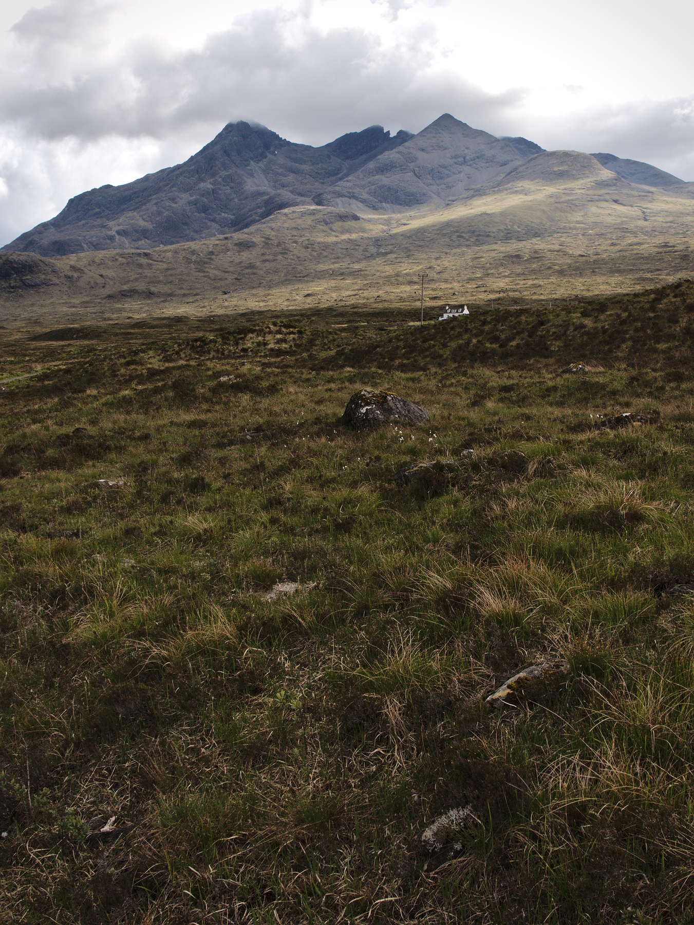
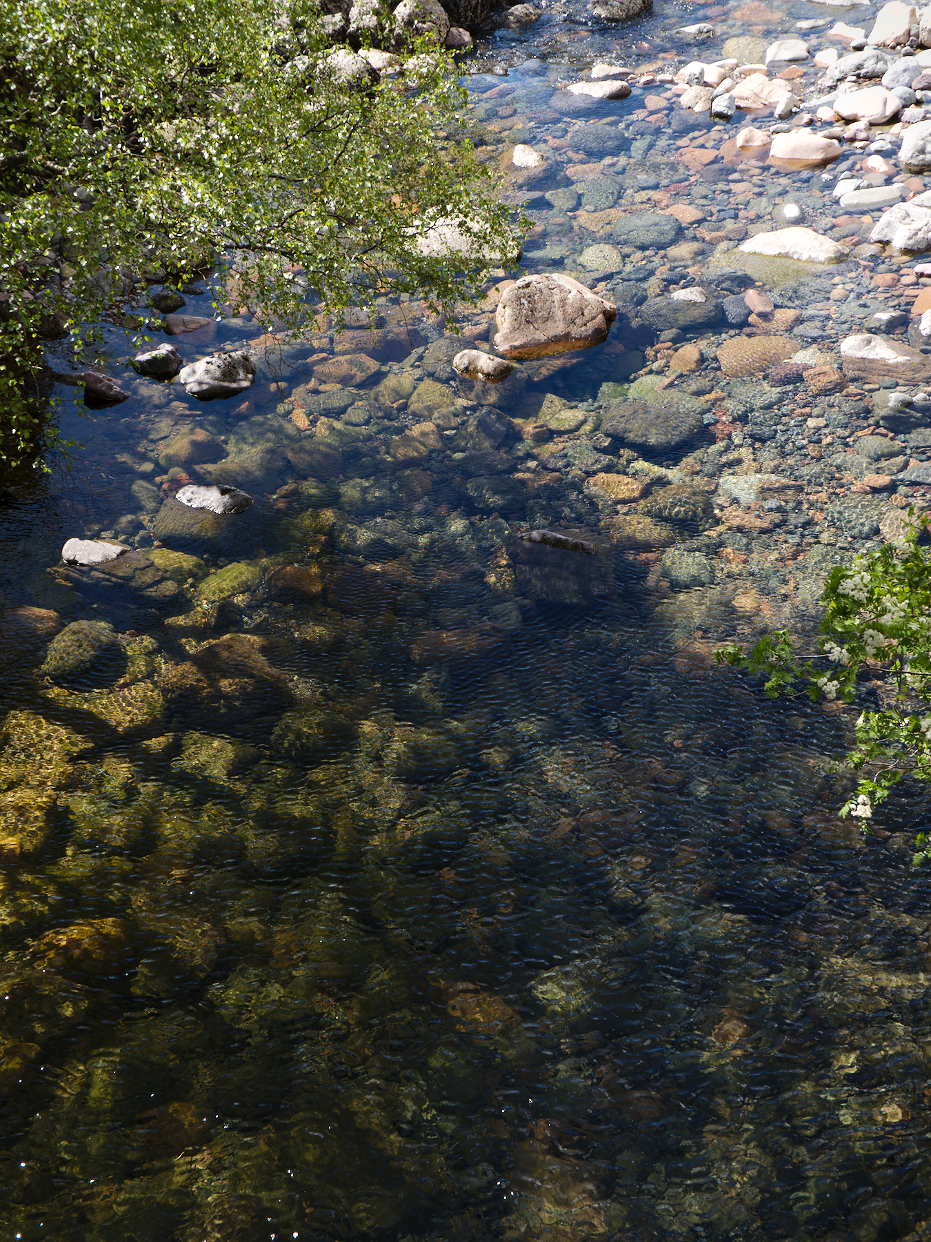
The southern portion of the island is dominated by the Cuillin Mountains, both the Red Cuillins and the Black Cuillins, named for their general coloring, a result of their differing geologies. Streams and rivers run down from the mountains, and although all of Scotland was experiencing a drought, there was still flowing water amid the rocks.
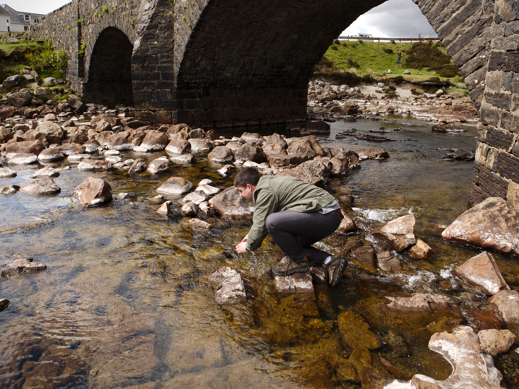
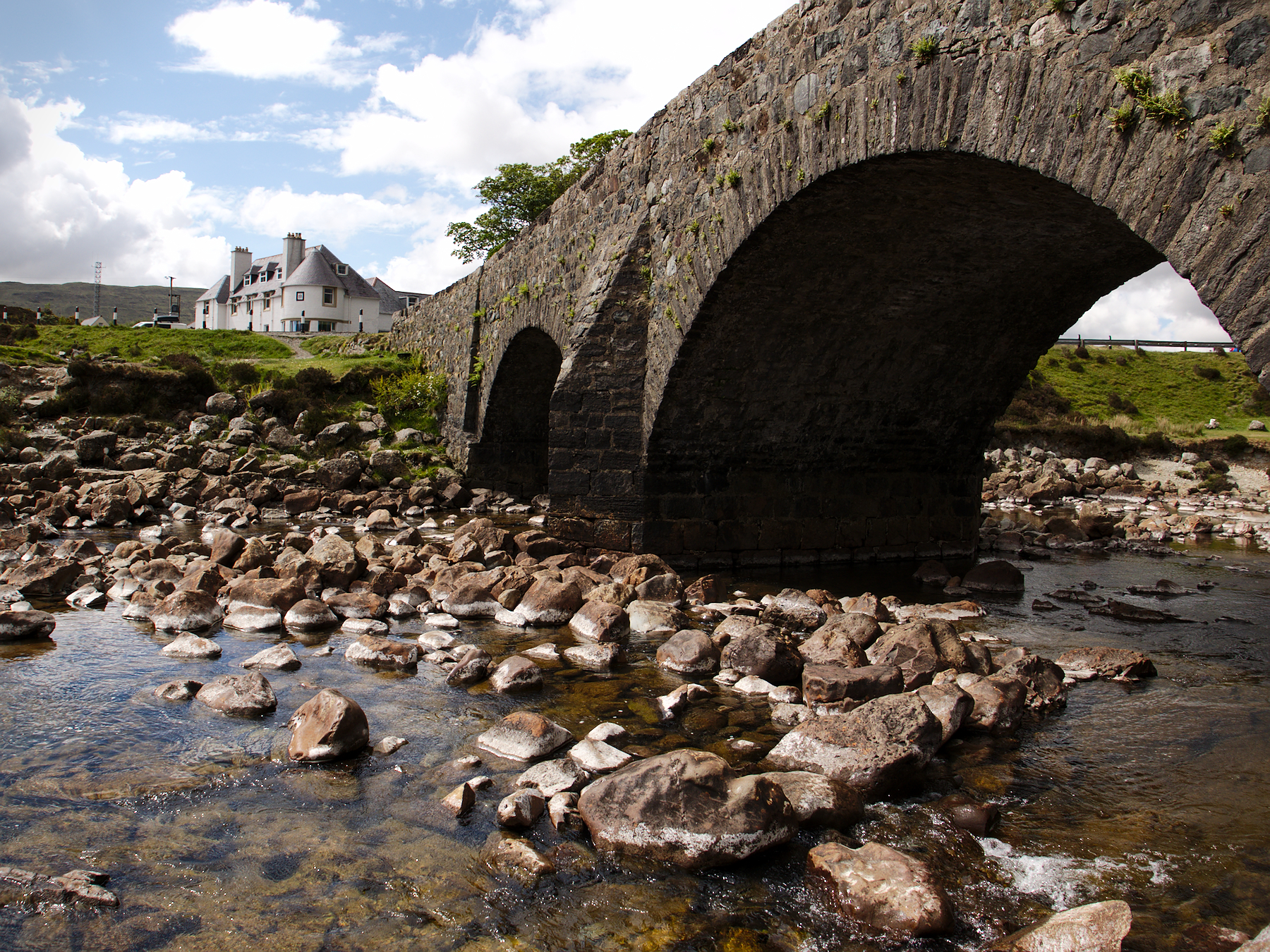
Not far from the bridge that connects the isle to the mainland, the Sligachan River tumbles down from the jagged, volcanic peaks of Sgurr-Nan-Gillean. Legend has it that washing your face in the river water will grant eternal youth. All I can say for sure is that the water is crystal clear, cold and crisp.
There is nothing but wilderness from the old Sligachan bridge, which hails from the 1600s, up to the headwaters on the mountain, leaving it pure and unadulterated. And breathtakingly beautiful.
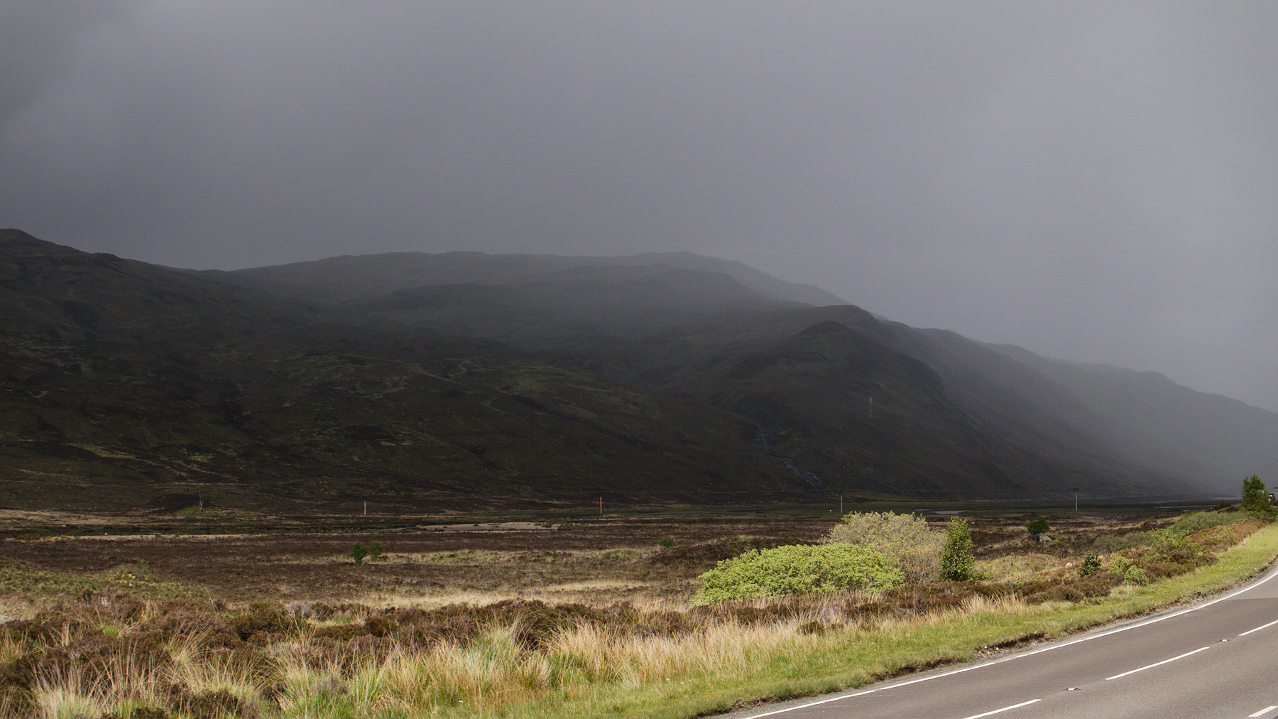
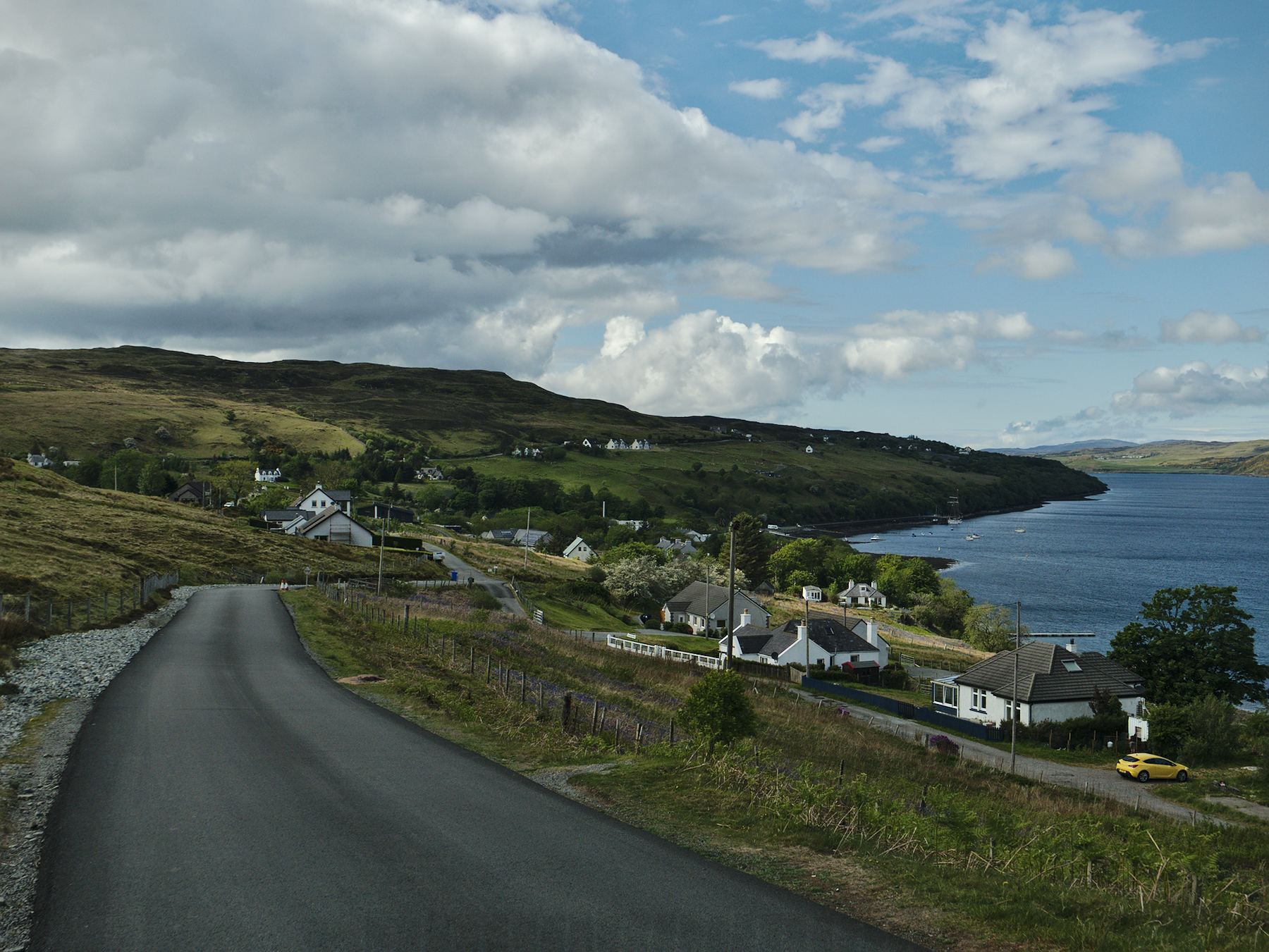
Most of Skye’s roads are single-lane width, with frequent bulges to one side or the other to allow cars to pull over so that oncoming traffic can pass. Moving north, the roads climb into highlands along the coast, passing moors and peat bogs.
Peat is still used for heating all across Scotland. It is free for the taking, as it has been for thousands of years, and from time to time we’d pass a site where it had been dug by the locals.
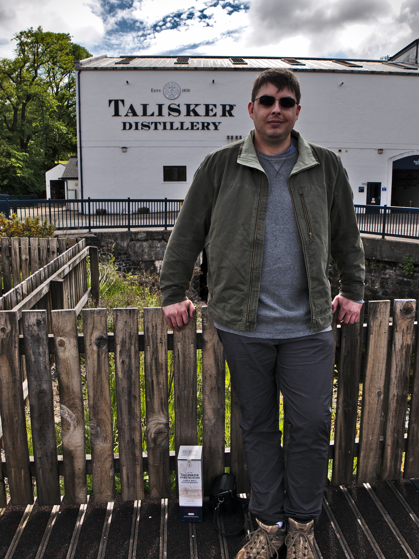
Talisker Distillery is on Skye, the only distillery on the island, and brews some of the best scotch I’ve tasted. We stopped to taste one of their specialty batches, finished in port wine casks. I came home with a bottle.
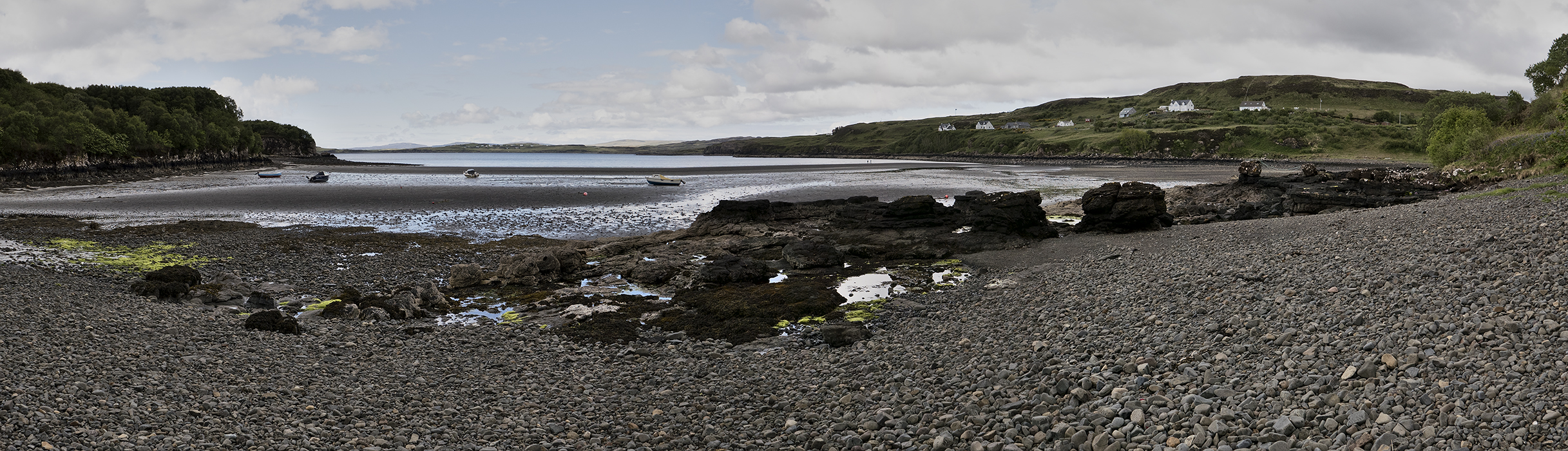
Beyond Talisker, we visited a wave-rounded stone beach where the fishing boats sat stranded while the tide was out. It was remote and generally out of the way for most visitors, although a new hostel nearby may change that. It was the only time in Scotland that we were greeted with anything but kindness; two locals walking on the beach gave us dirty looks as we arrived.
Dun Beag
Hiring a private guide is more expensive than joining a group tour, but it offers a lot more, and one of the best parts is the ability to personalize the experience. As Rob got to know us, he got a sense of what kinds of things we were most interested in. After the clear success of our visit to Balnuaran of Clava, Rob made another suggestion for our final stop that day on Skye: the ruins of the ancient fortress of Dun Beag.
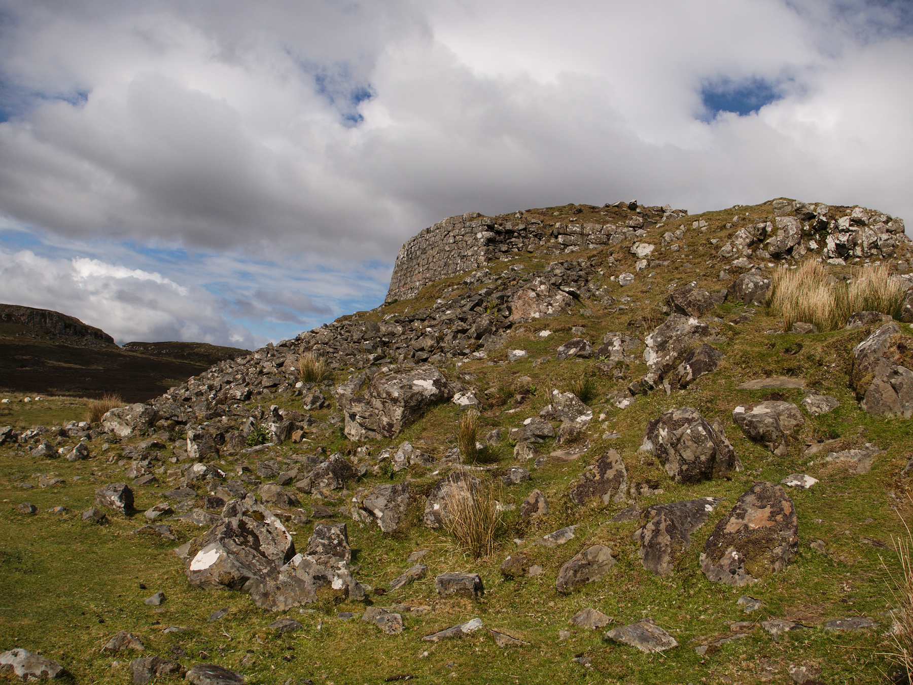
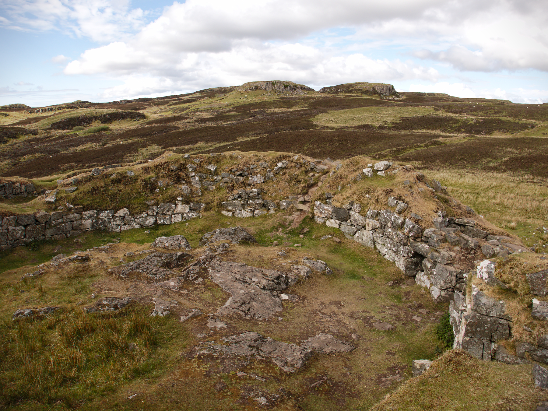
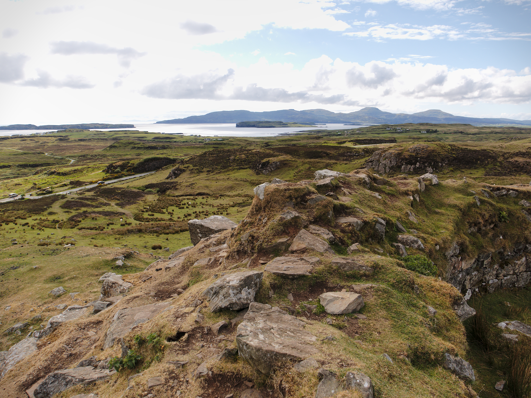
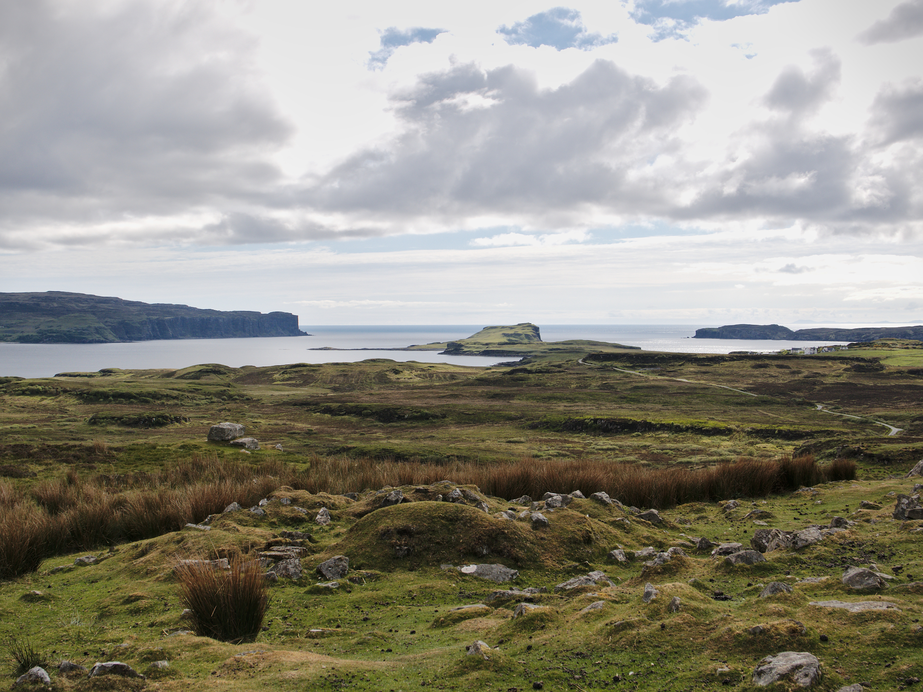
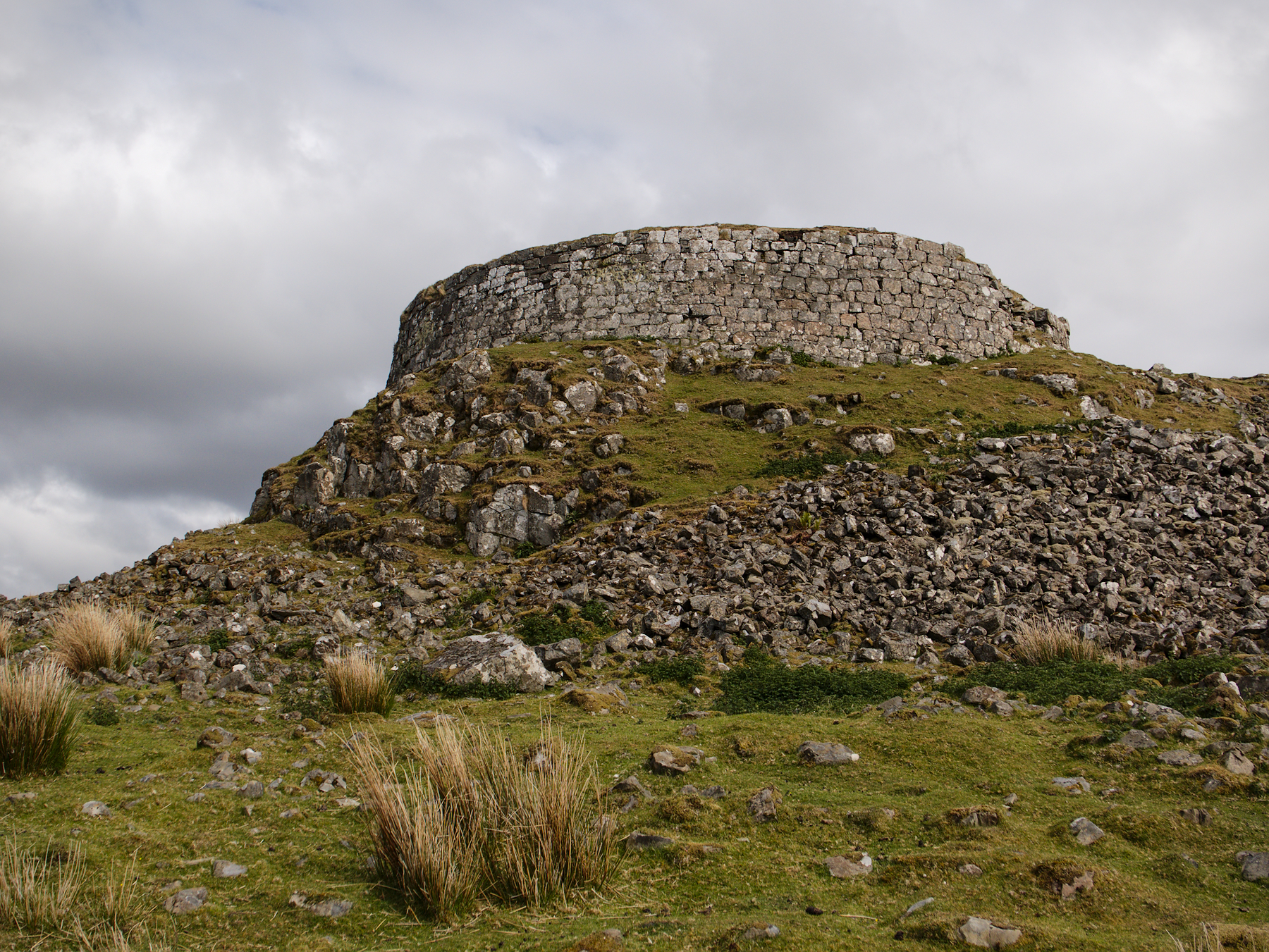
Dun Beag is a type of circular fortress unique to Scotland, known as a broch. Measuring 40 feet in diameter, it was built of blocks of volcanic stone atop a rocky hilltop. It was constructed at least 2000-2500 years ago, during the Iron Age, as a protective fortification. During its peak it would have been surrounded by yurt-like structures, while the clan’s leading family likely lived within the multi-leveled broch itself. With its commanding views out across the island and lochs, it would have served as a watchtower, and should an invading force approach, the clan could take refuge inside the easily defended fortress, with its single entrance.
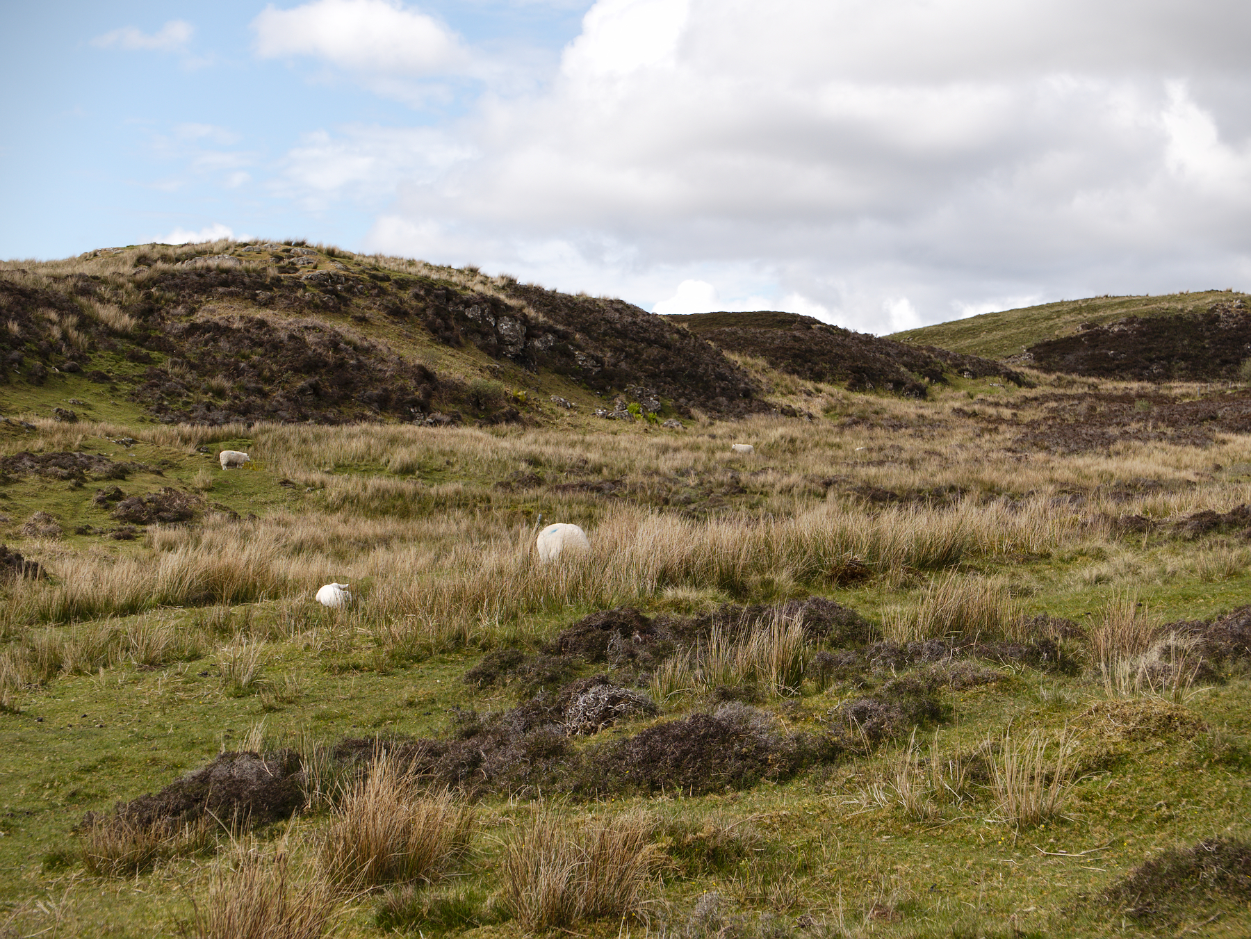
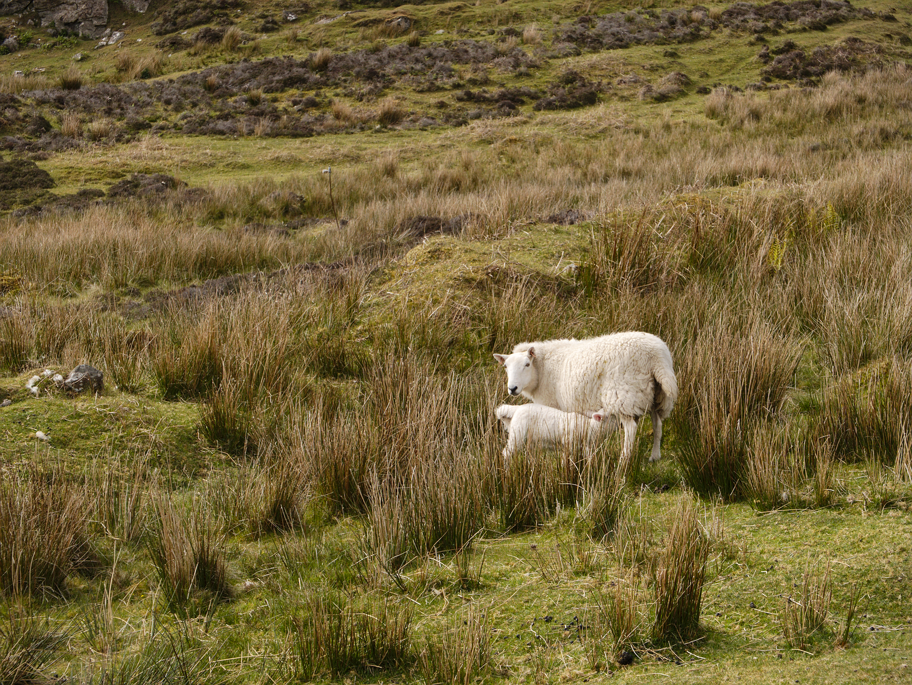
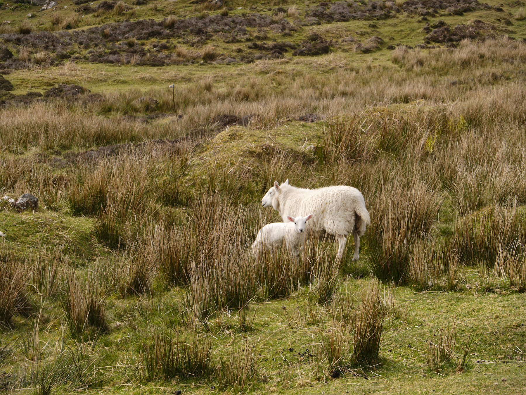
The broch sits in a sheep pasture; visitors park in a simple dirt lot and cross the road, letting themselves into the pasture through a metal gate and climbing the hillside. There are no other fences, guides, or restrictions – just an informational placard at the top.
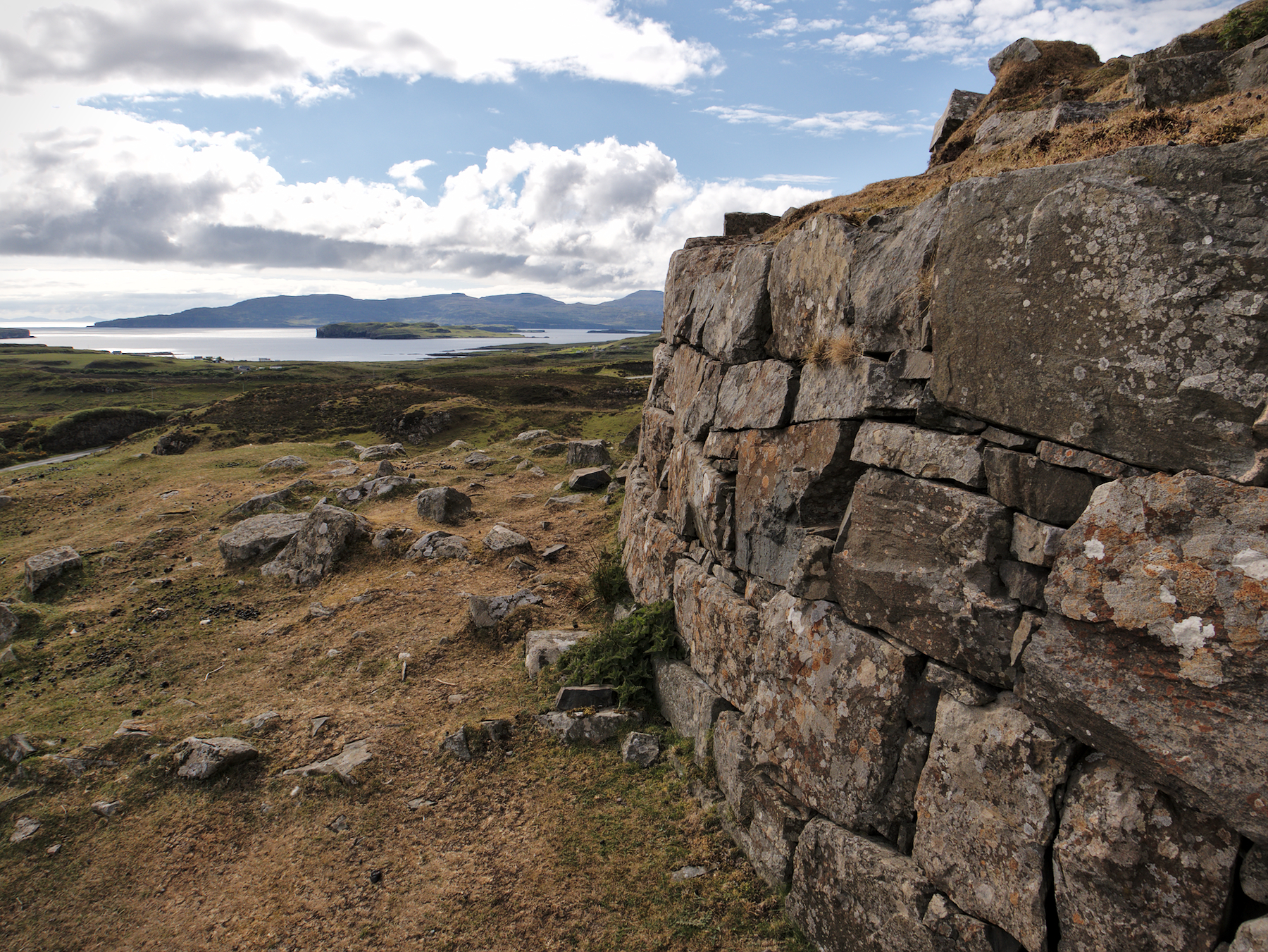
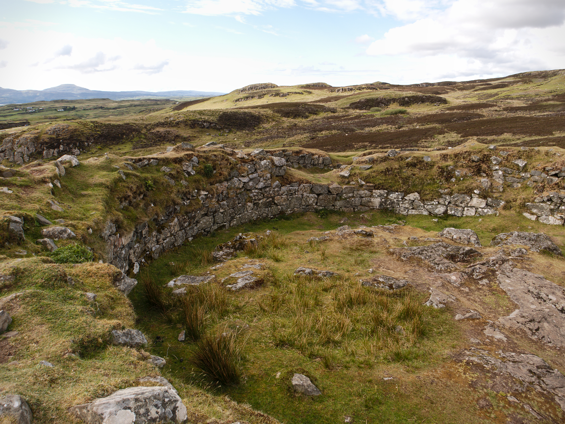
Only about 25% of the broch remains, and stones from its former height are scattered across the hillside where they have fallen over the centuries. The entrance is still well defined; there is a circular chamber to the right that may have been a cistern, and the remains of a staircase to the left, which runs between the inner and outer walls. At the base of the staircase is a small room, which Rob indicated may have been a toilet, but other sites have identified as a possible guard room.
I climbed the 20 remaining stone steps and stood on the ancient wall, looking out across Skye to the sea. It was one of the most incredible experiences I’ve ever had, to stand in a truly ancient place, where men and women stood and lived thousands of years before, in a surprisingly complex structure built before the year 0.
It was awesome and quiet and beautiful, and aside from Rob and myself there was nobody else around, nothing but some grazing sheep who largely ignored us.
Over the Sea from Skye
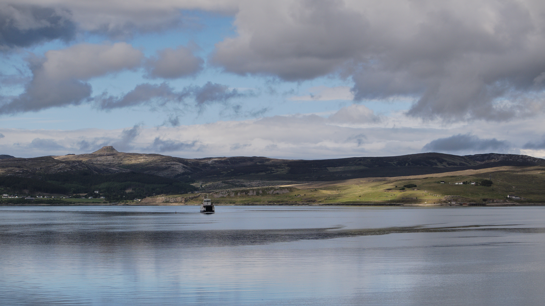
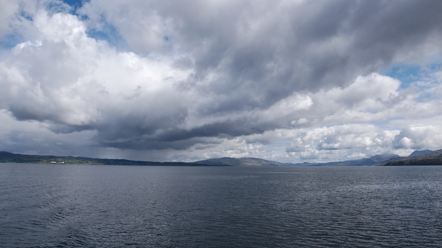
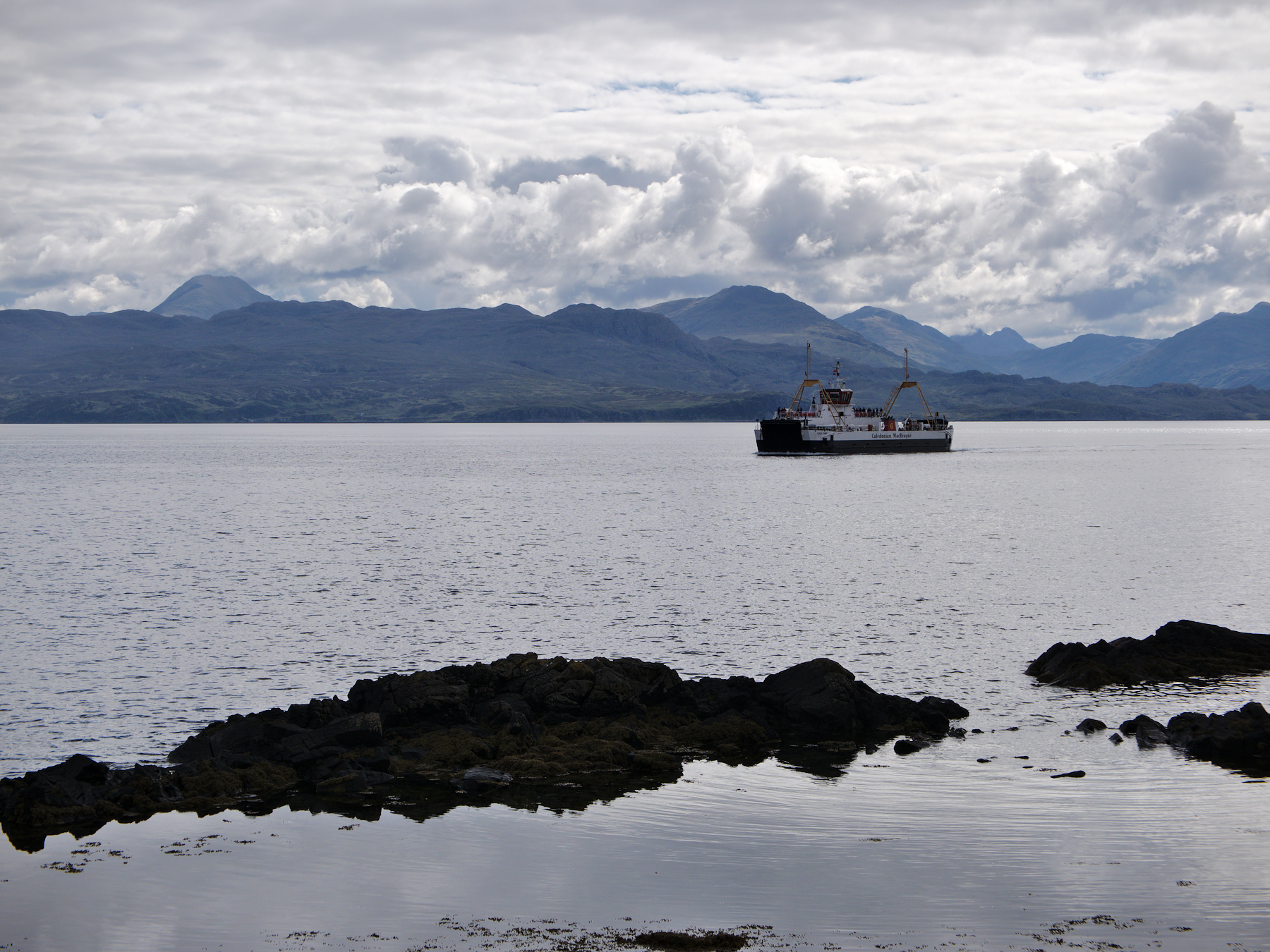
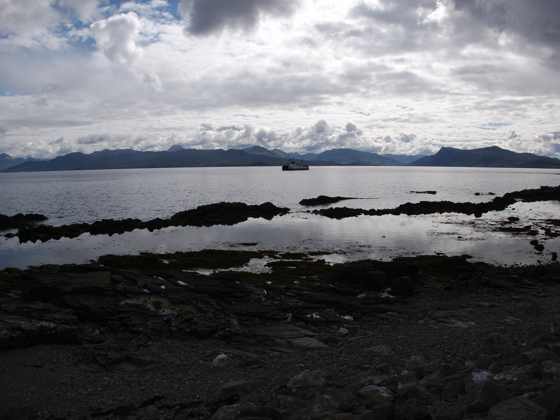
We couldn’t stay on Skye forever, sadly, and day three saw us crossing the southern end of the island to the ferry terminal in Armadale. With a couple of quick stops to admire castle ruins and the always-lovely landscape, we drove aboard-ship and set sail.
Mandy and I agreed that we had never seen water as clear and blue as the water around Skye, and we marveled at it for the whole crossing. And marveled at the mist-shrouded mountains on the mainland.
A century and a half before, Bonnie Price Charles had gone the other way, “over the sea to Skye,” staying one step ahead of the English who pursued him after the disaster at Culloden. He was finally smuggled to the island while disguised as Flora MacDonald’s maid, and from there he reached a French frigate and returned to Europe, closing out an adventure that has gone down in popular history.
“The Skye Boat Song” recounts that adventure and has become an indelible fixture of Skye. I’m partial to this version: The Skye Boat Song by Ella Roberts (the visuals are a bit trite, but the vocals are excellent).
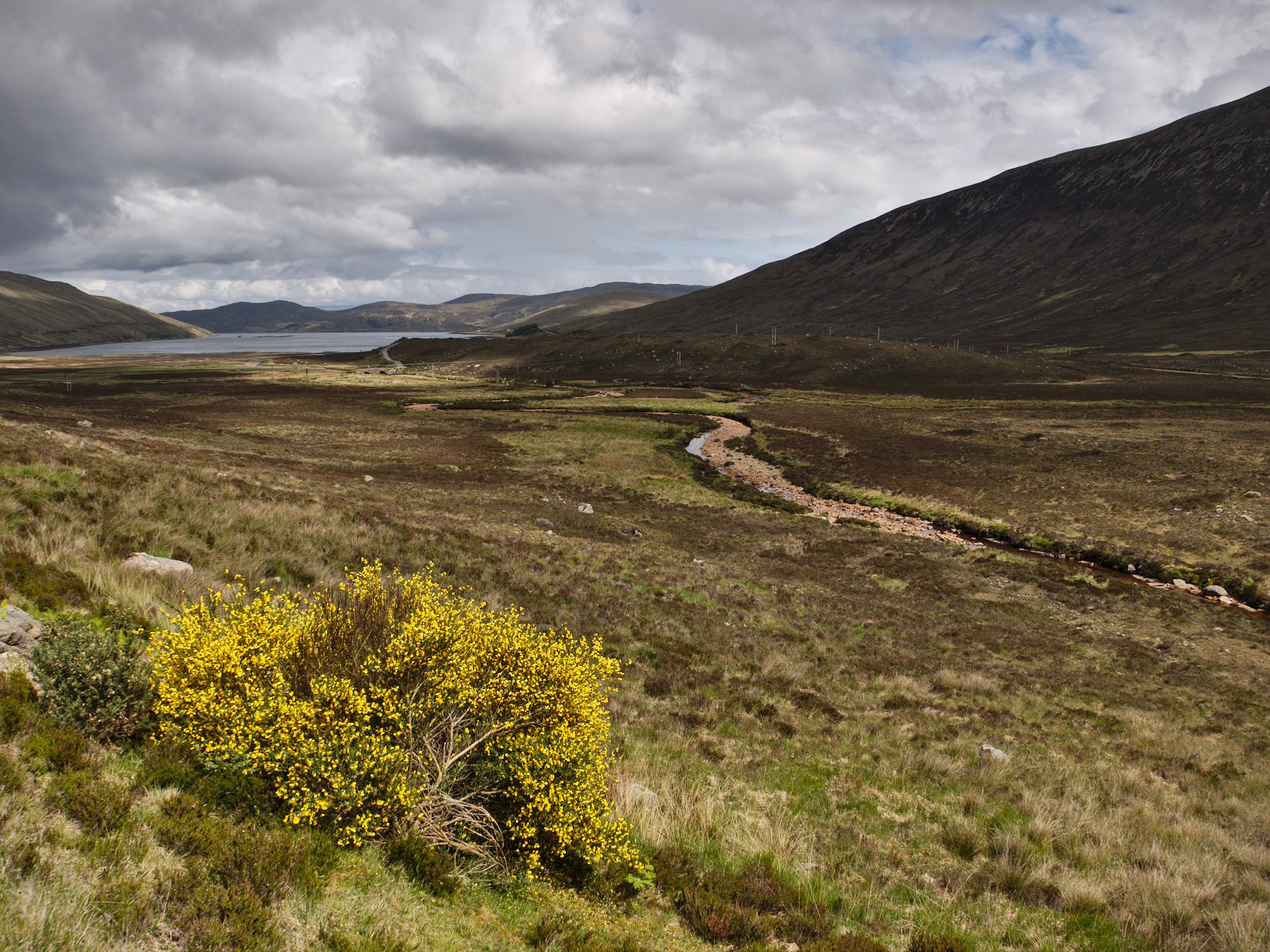
Camusdarach Beach
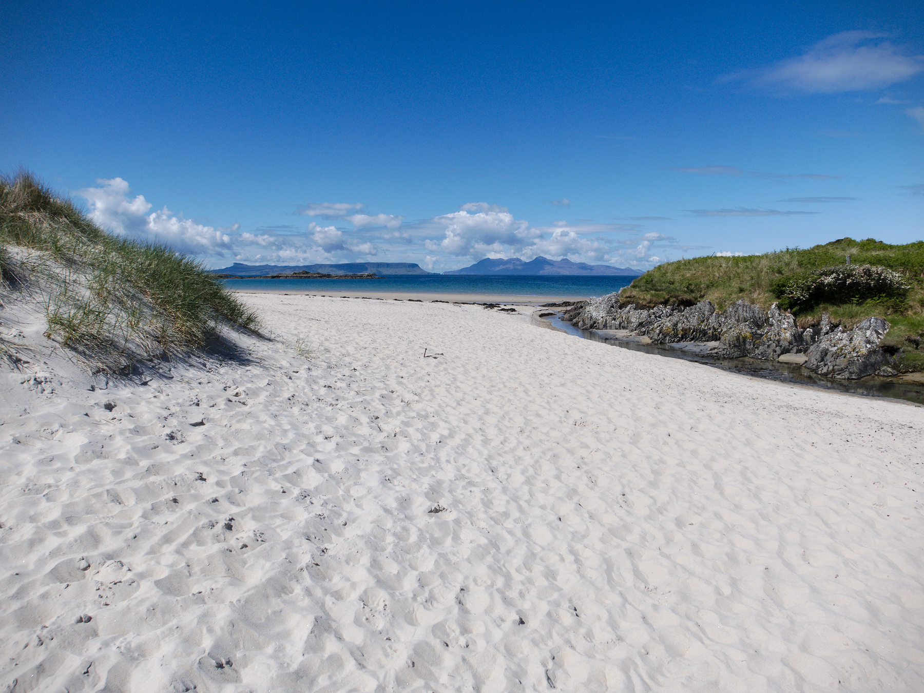
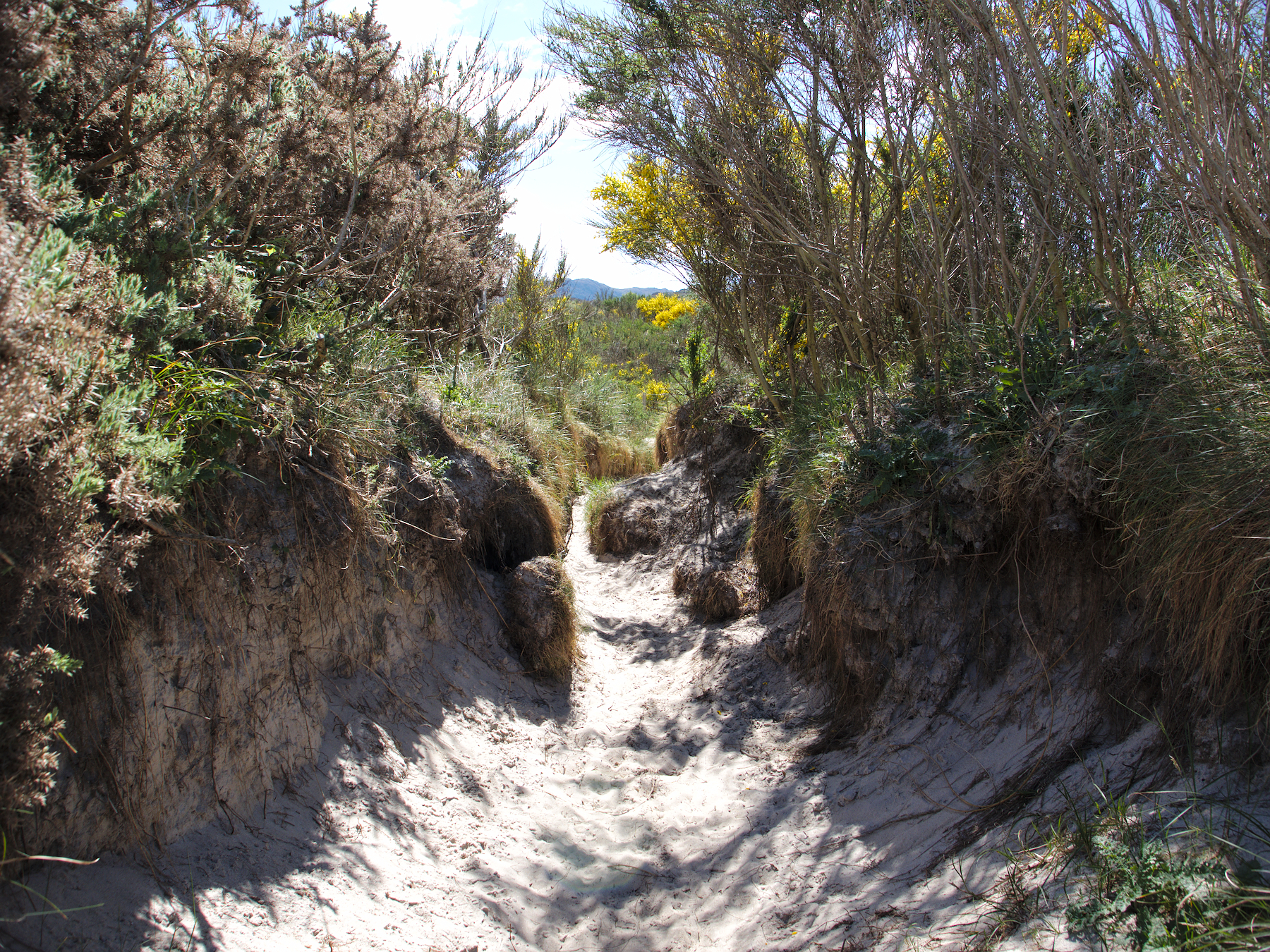
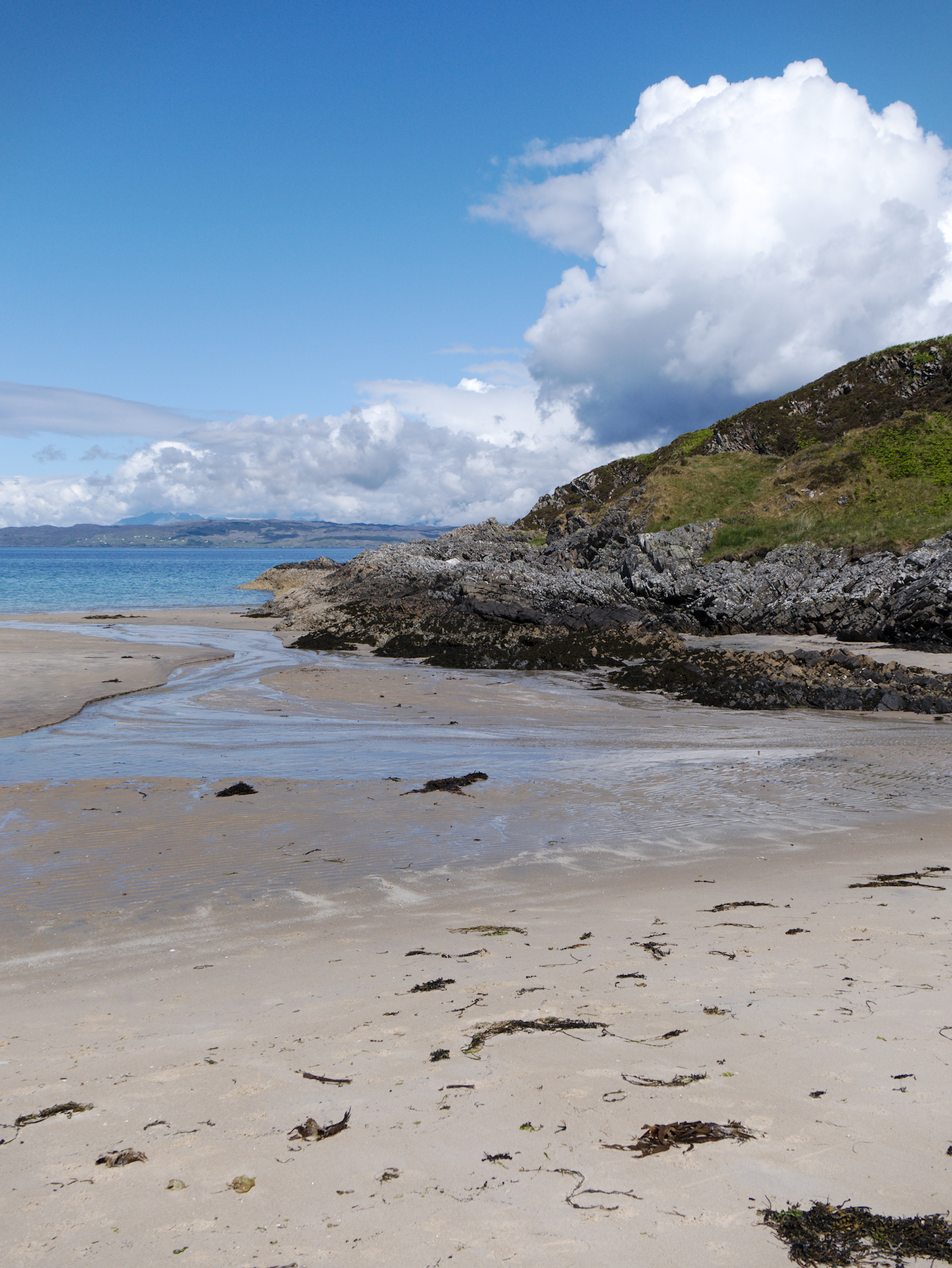
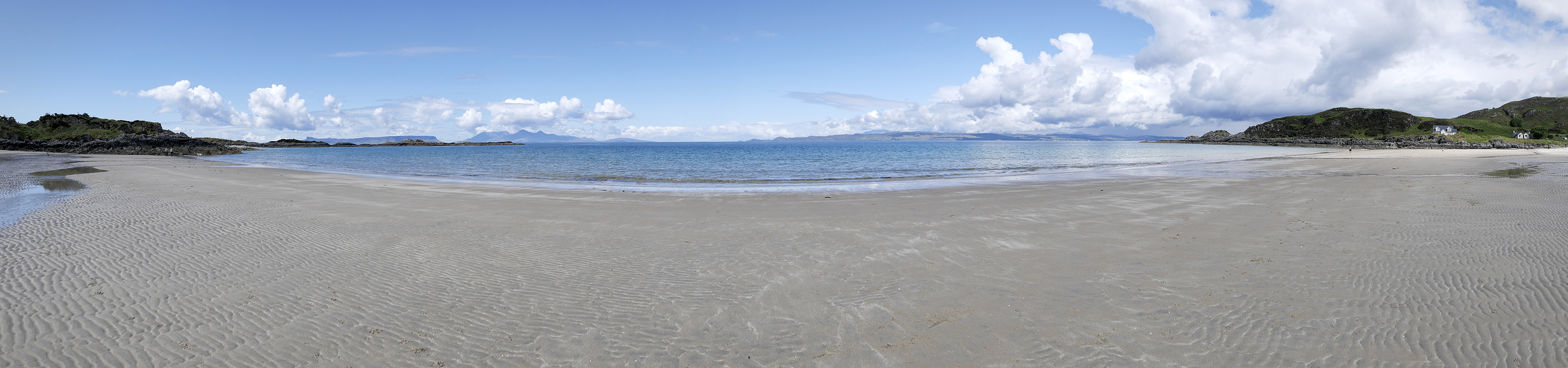
We got off the ferry amid mountains, thankful for our jackets in the stiff breeze. The next thing we knew, we were walking down a sandy path lined with rhododendrons, bracken, and gorse (the bushes with the yellow flowers).
The path ended on the beach next to a stream, only a few dozen feet from the ocean, and left us both standing with our jaws hanging open.
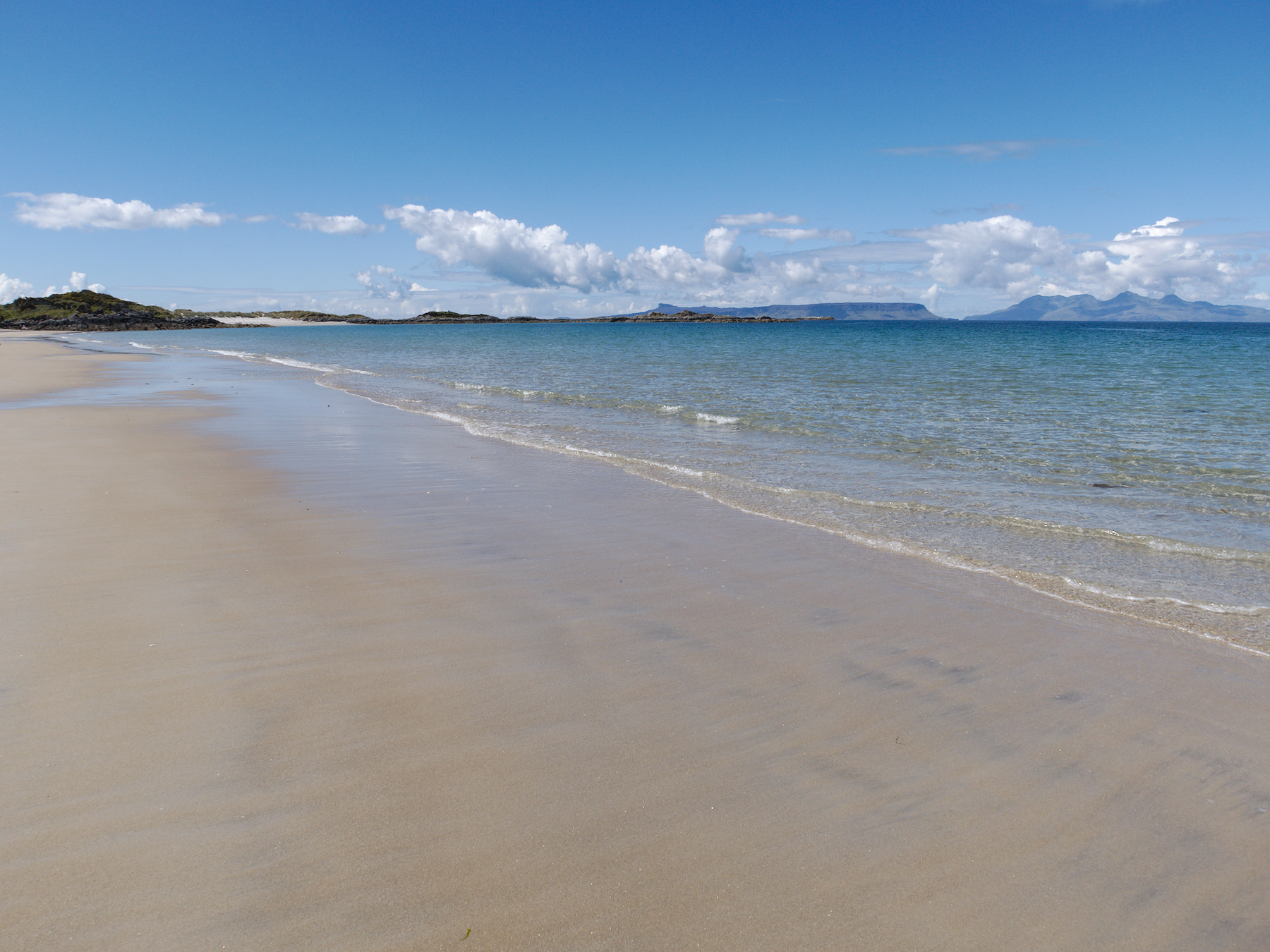
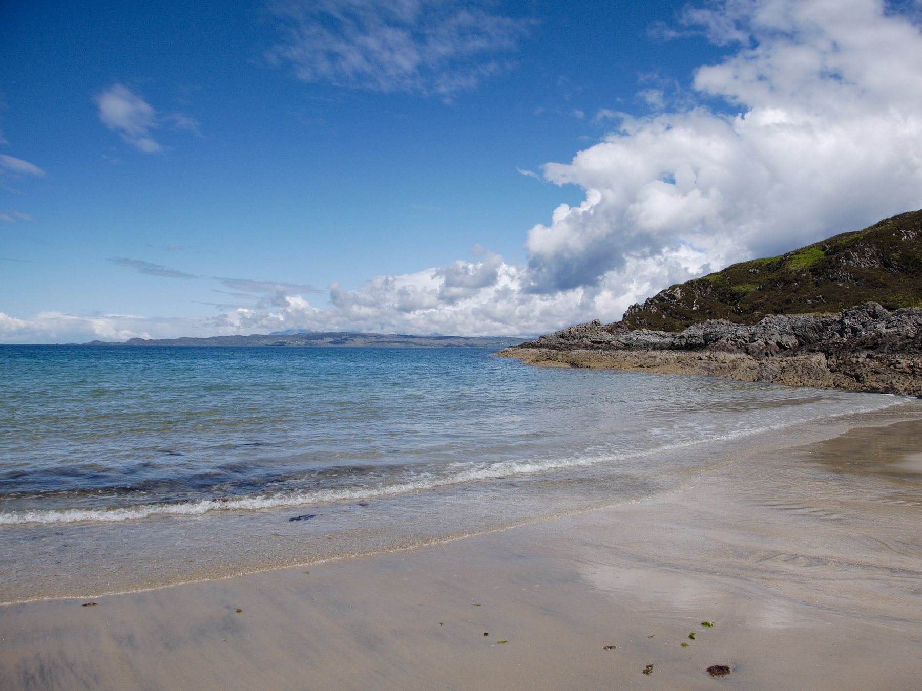
We’d seen some stunning views, but nothing had prepared us for Camusdarach Beach. With its white sand and crystal blue water, it could have been lifted straight from the Caribbean. Dunes backed the beach, tall grasses waving in the wind, while the peaks of Skye and the lesser islands stood offshore.
It would be overrun with tourists in a matter of weeks, Rob told us. And I could believe it. But at the moment we only had to share it with maybe a dozen other people, including a French family. We watched the dad try to work up the courage to go into the waves, failing to entice his kids to join him. After a lot of slow, hesitant progress, he finally made it, then immediately fled back up onto the sand.
Meanwhile, Rob had taken off his shoes and socks and was wading, or “paddling” as the Scotch call it. We weren’t even brave enough for that.
“I’ve found our new house,” I said, pointing back up the stream to a modern looking home nestled against the side of a small mountain. “It’s got it all. We can walk to the beach when we want to go to the beach, and I can climb a mountain whenever I want to.”
Mandy just nodded. “Sure. Now I’ll never have to choose.”
It’s nice to dream.
Harry Potter & Glenfinnan
Among everything else, Scotland is the land of Harry Potter. Hogwarts School of Witchcraft and Wizardry is located there in the books, and scenes of the movies were filmed there. The whole thing has kind of taken on a life of its own in recent years, and tour companies now offer Harry Potter trips for fans, taking them to all the major sites.
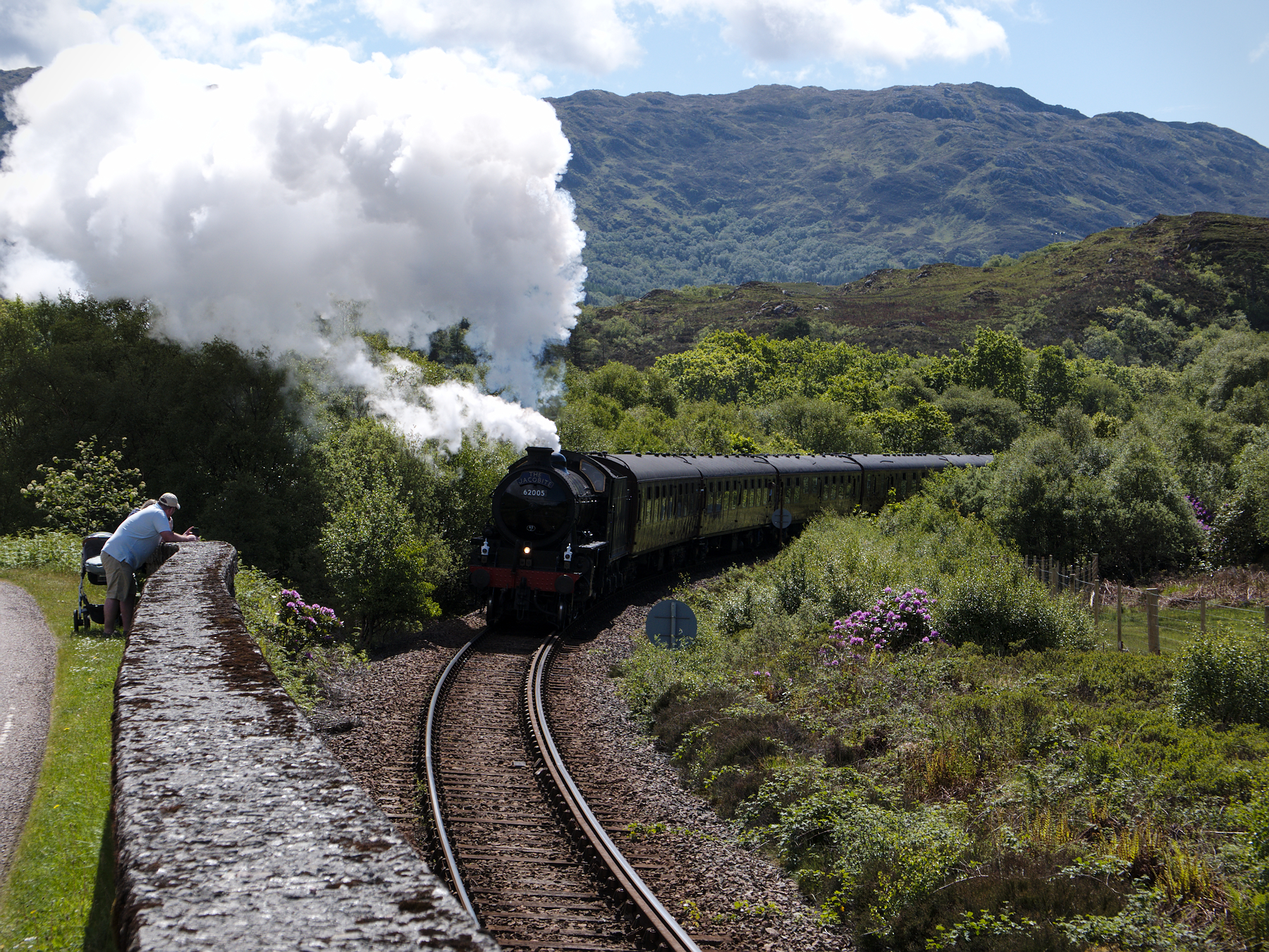
Even if you aren’t a diehard Potter fan, it’s hard not to see a few of them. We had already seen Victoria Street in Edinburgh, which inspired the fictional Diagon Alley. Now Rob’s timing was, as always, impeccable, and as soon as we left the beach he drove us up around nearby Mallaig where the railroad tracks ran alongside the road.
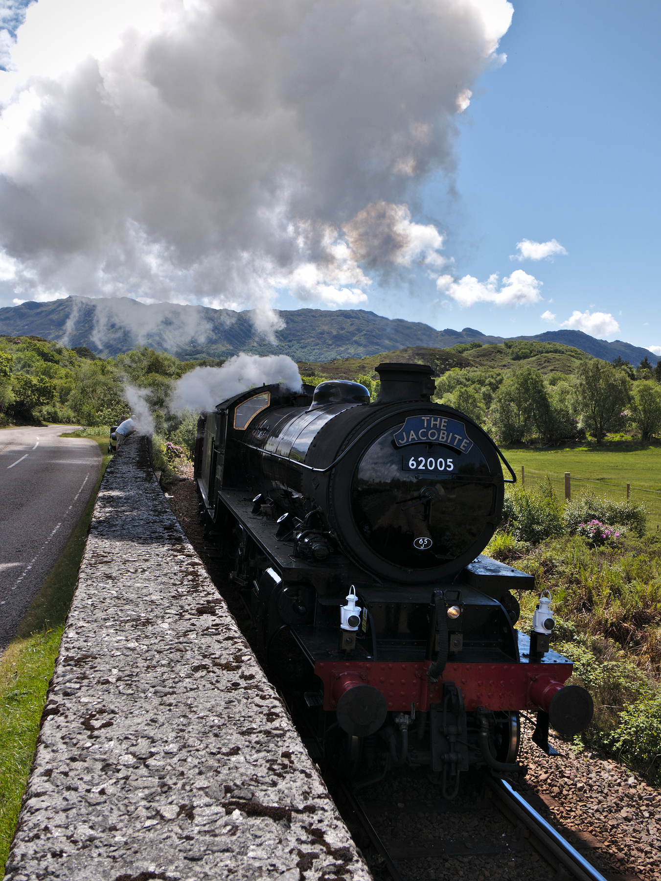
We could hear the train as soon as we got out of the van, and moments later the Jacobite Steam Train came chugging around the bend, blowing its whistle for us and another couple who had showed up to watch. In the films, this is the train that played the role of the Hogwarts Express, and although it has been repainted since then, it was both instantly recognizable and iconic.
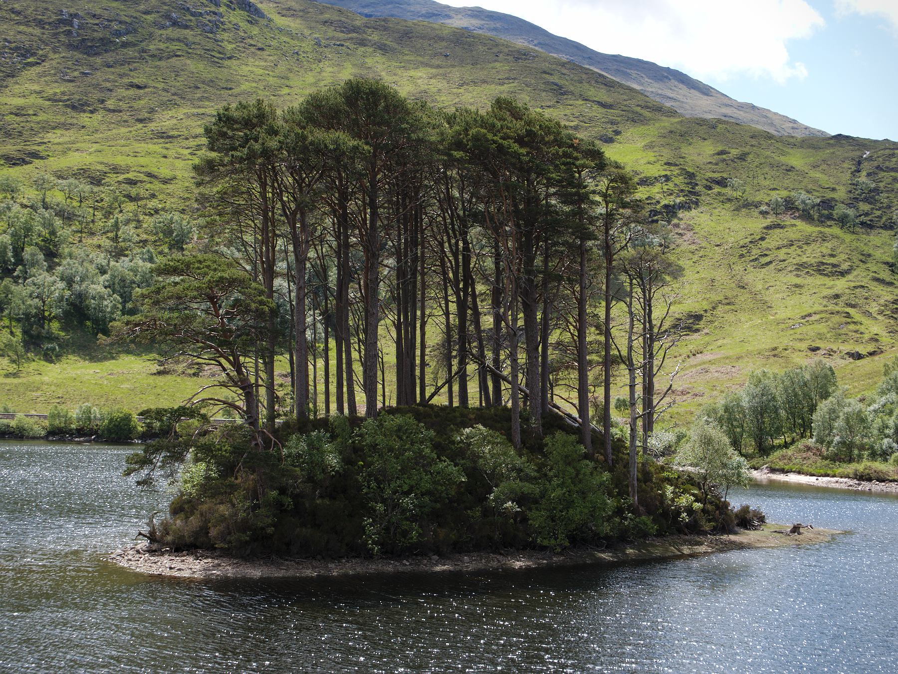
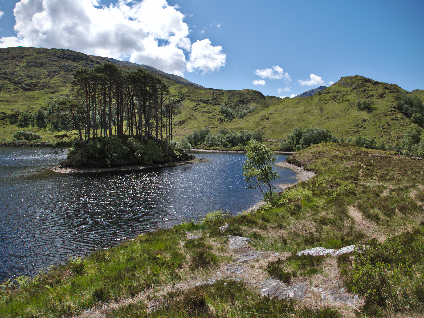
A little while later we stopped in a dirt pull-off on the side of the road, in what appeared to be the middle of nowhere. We could see the end of a loch glistening through the trees a short distance away, and the drought proved to be a blessing as we crossed an area that was usually marshy, ending up on a small rocky rise on the lakeside.
A small island sat just offshore, rising sharply from the water and covered in trees. In the films, this was the island that served as Dumbledore’s grave. Of course the filmmakers had used some CGI magic to spruce it up a little, but it was clearly the same.
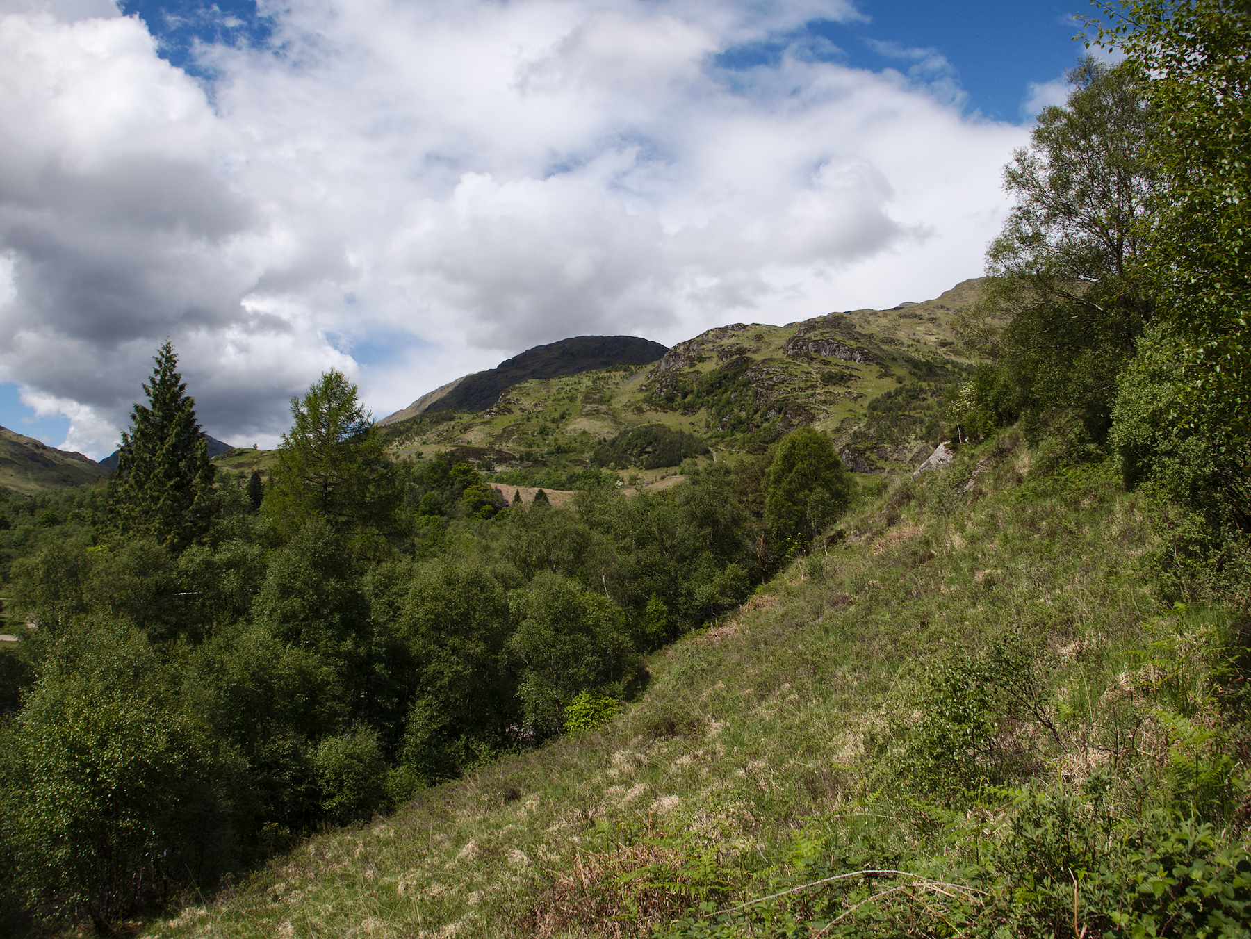
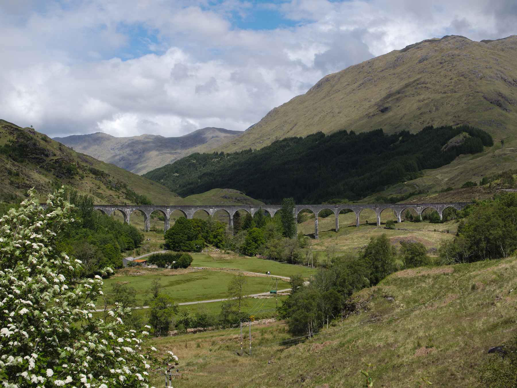
Just moments later we were parked at Glenfinnan and climbing a trail that wound up the side of a mountain to a small shoulder. Off to the right was the Glenfinnan Viaduct, very impressive on its own and the site of the famous flying car train chase scene from the third Harry Potter film.
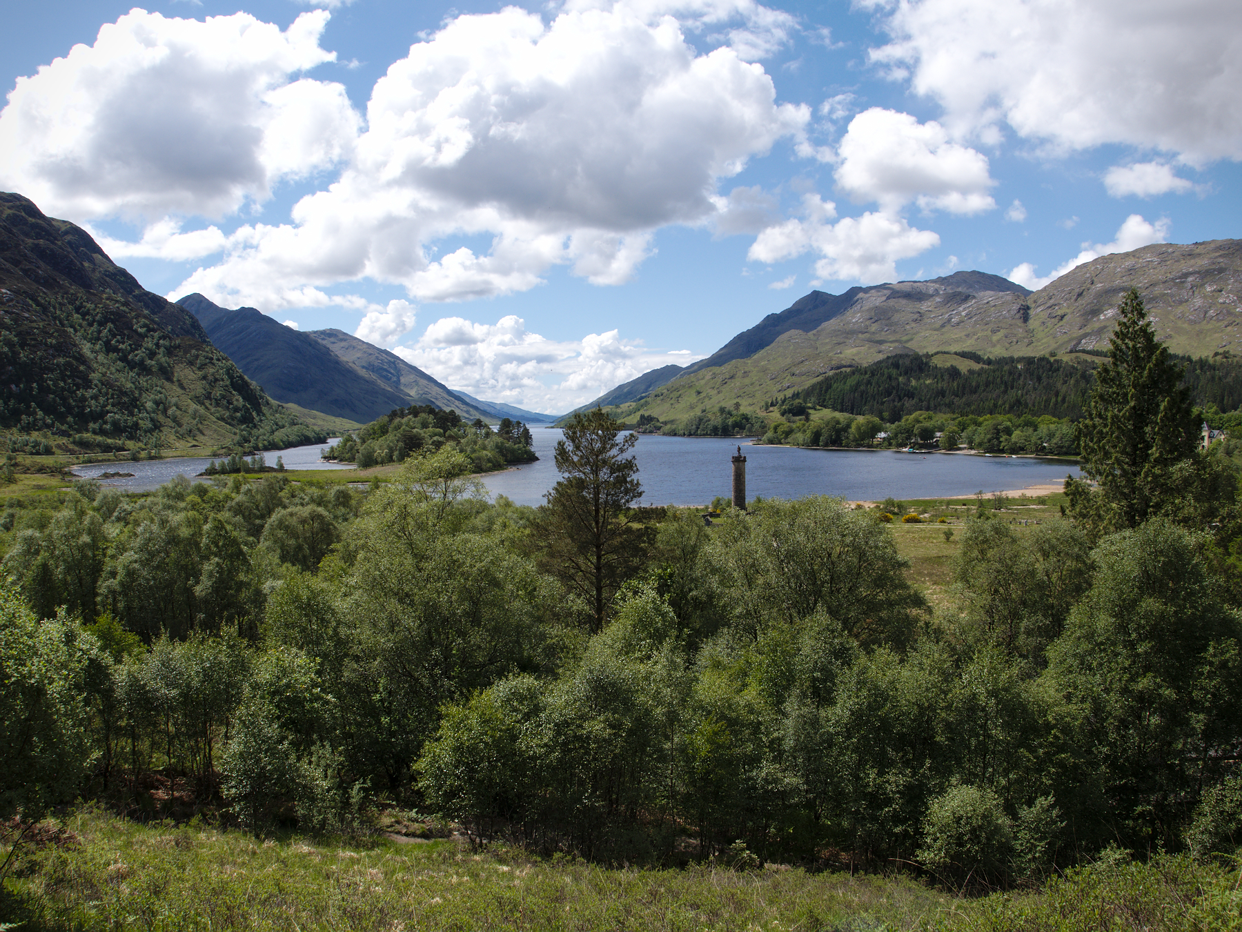
To the left, Loch Shiel stretched out to the horizon, nestled down in between the mountains. Shiel served as the Hogwarts lake in the films, and in fact Hogwarts itself had been CGI-placed onto the mountainside amid a patch of dense pine forest on the northeast shore.
As always seems to be the case in Scotland, everything eventually comes back to the ’45. The tower visible in the photos, at the end of Loch Shiel, commemorates Bonnie Prince Charlie’s landing in this very site at the start of the Jacobite Rebellion. He and his forces camped there in Glenfinnan for a short time before moving inland to join with their Scottish supporters.
Glen Coe
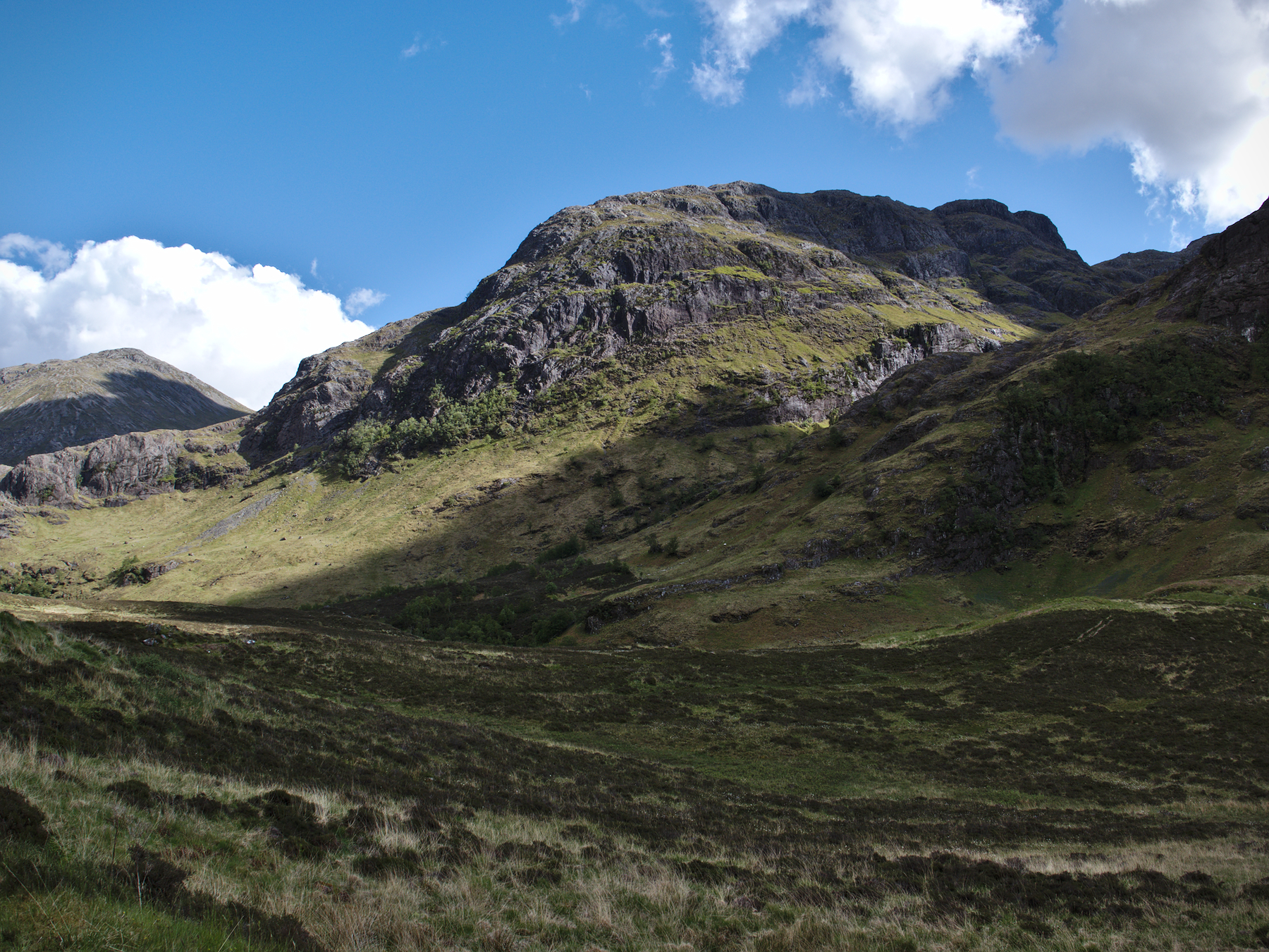
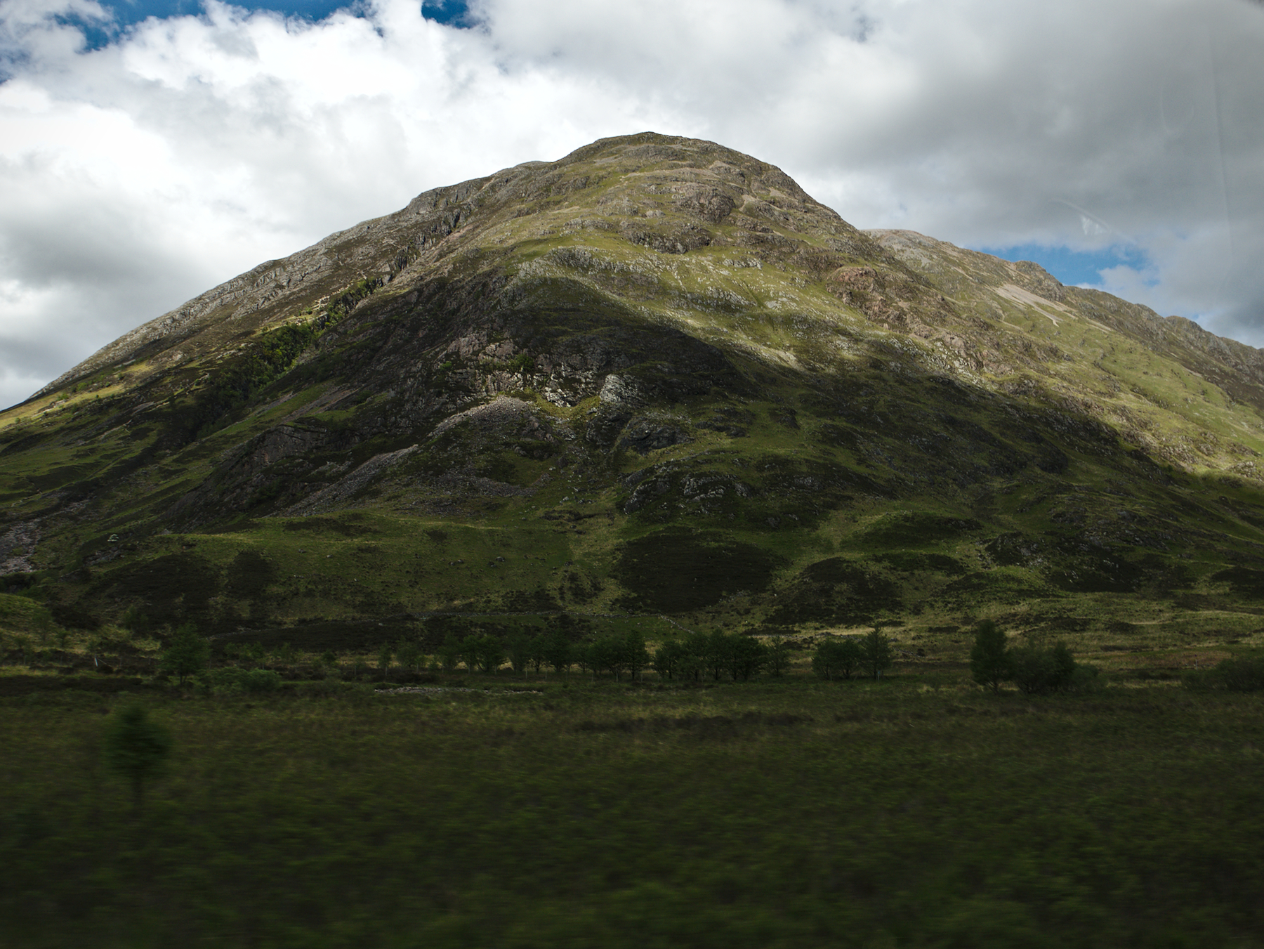
We saw mountains all across Scotland. It’s a land of mountains, and there must be a hundred different kinds of them. Gaelic, being the detail-specific language it is, describes each kind in their names. We saw short, rounded mountains; craggy island mountains; mountains with granite faces and mountains covered in heather and bracken. We even saw Ben Nevis, the tallest mountain in the whole of the British Isles.
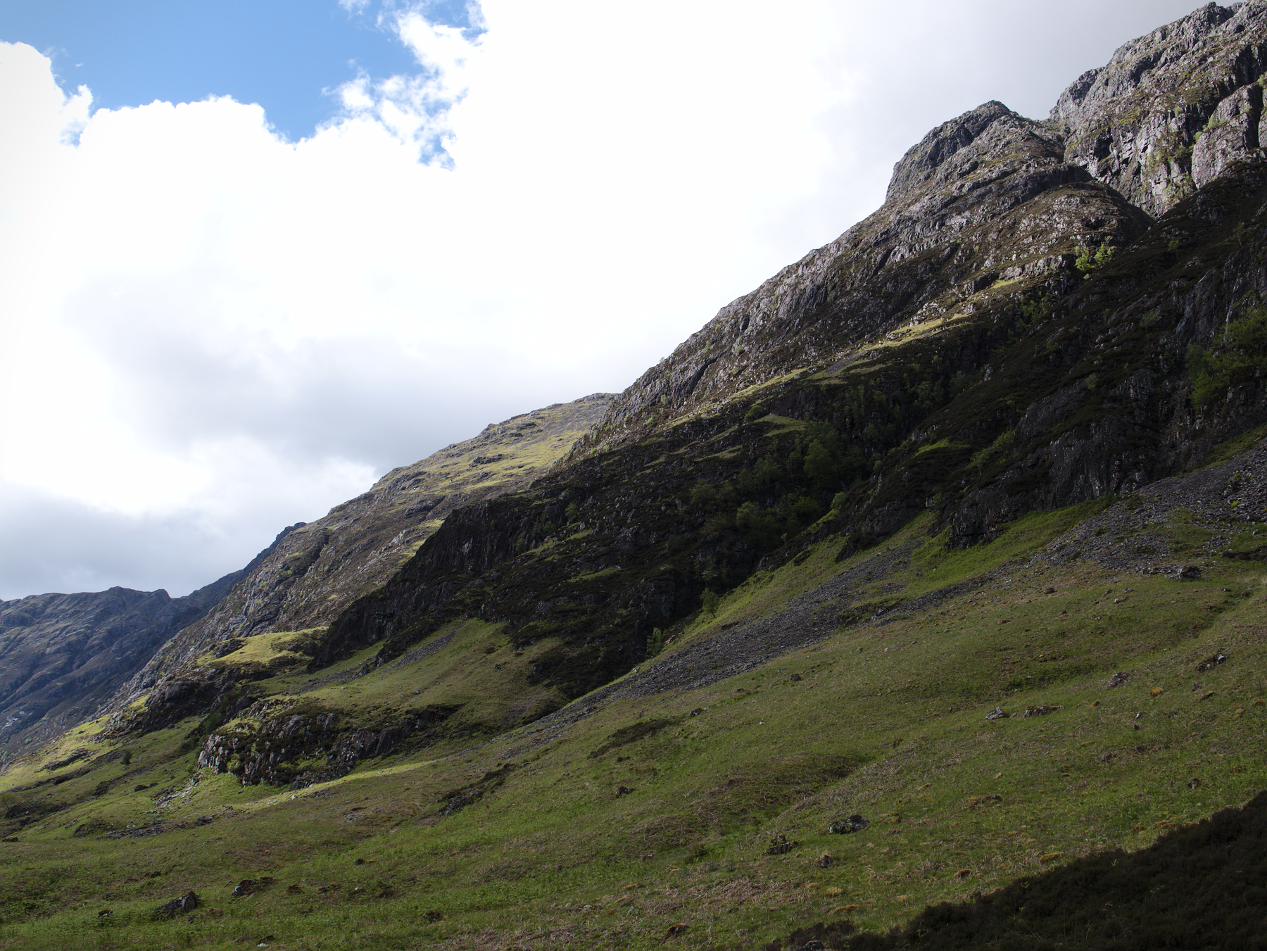
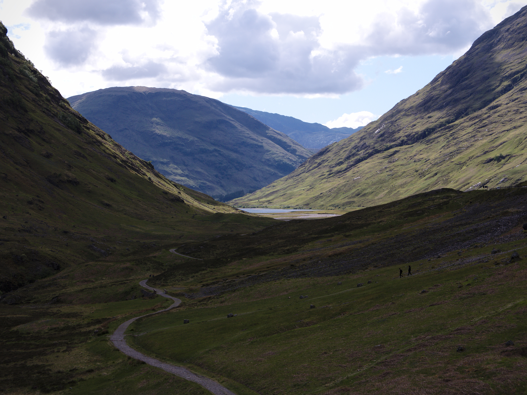
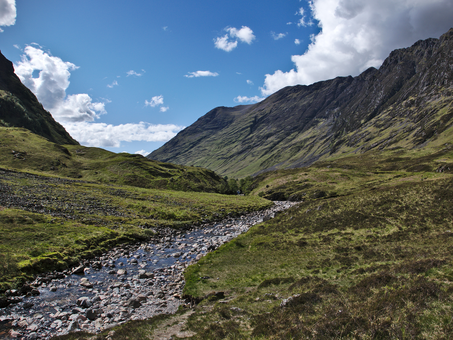
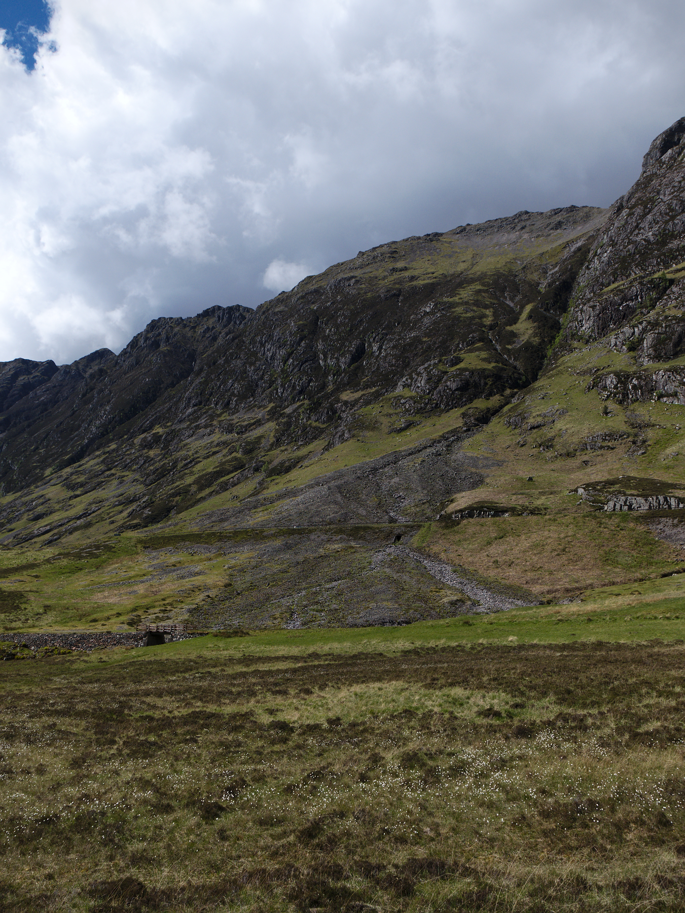
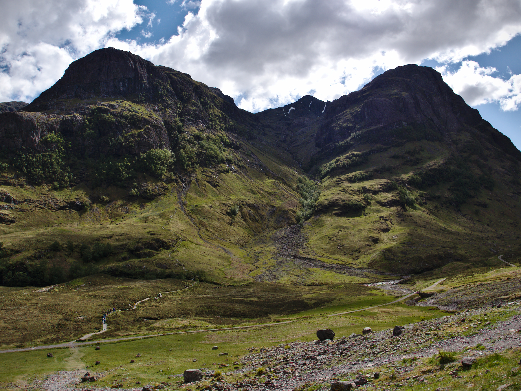
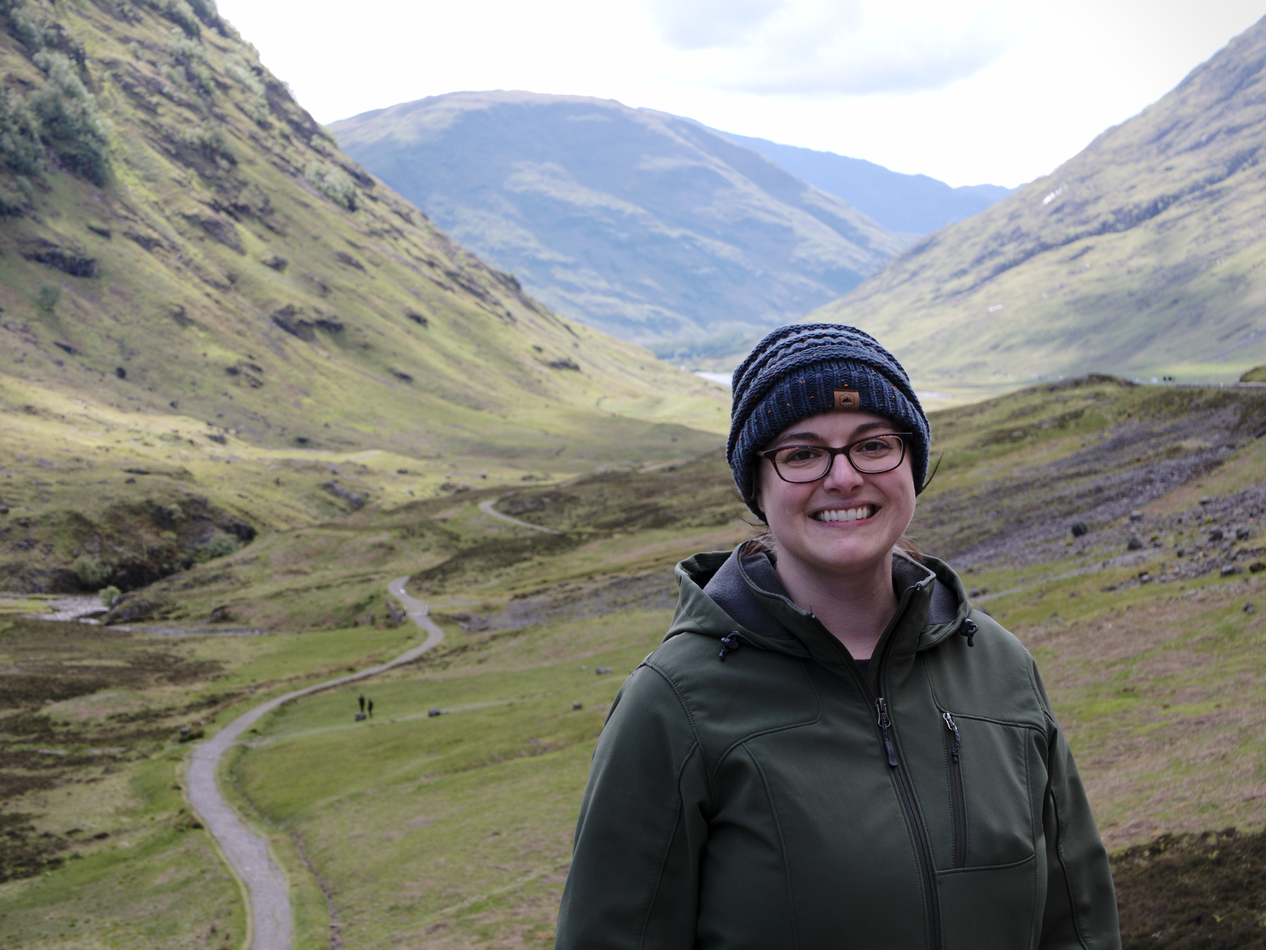
None of them compared to Glen Coe. Technically, a glen is the space between mountains, what we would call a valley or holler in America. And Glen Coe is a glacial, U-shaped valley formed in the ancient caldera of an extinct supervolcano. (How cool is that?)
The glen is rich in history; it has been a pass through the mountains for as long as mankind has wanted to travel between them. The massacre of Glencoe took place in the nearby village, when the MacDonald clan was wiped out by government forces.
But mostly it’s just beautiful beyond all words and reason.
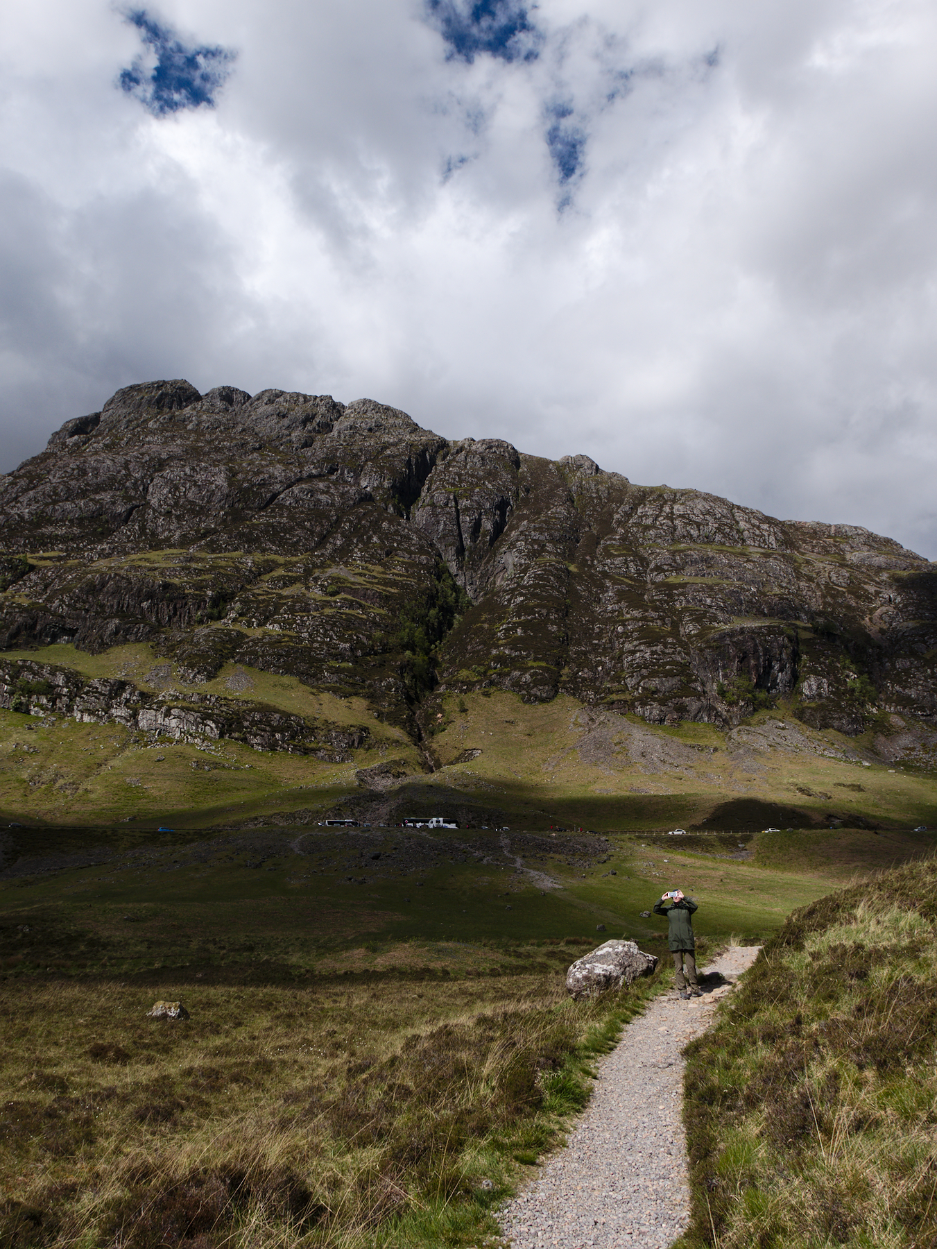
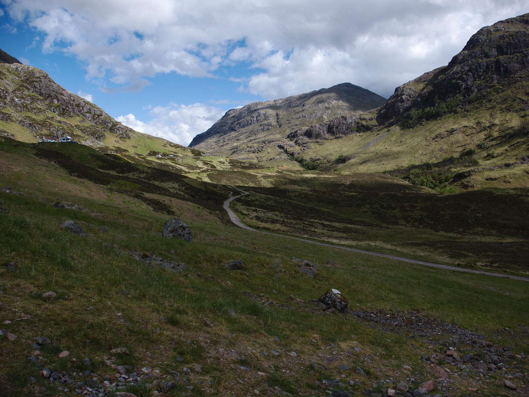
Rob let us out at a car park within the glen and said he’d meet us at the next one, maybe a quarter mile up the road. Mandy and I descended the steep trail toward the valley floor, swiveling and craning our heads as we tried to take it all in, and marveled at all of it. Looking west we could see the sparkle of Loch Leven, while the view to the east climbed with the road to eventually exit out onto the moors.
We crossed an alpine stream at the bottom and walked a little ways up the side of the mountain before turning back; it was tempting to keep going, but to leave the floor of the glen was to head into some serious hiking very quickly.
It was hard to keep a sense of scale. Everything looked nearby, like it would only take a few minutes to reach it. But that scale was deceptive; it took us almost an hour to reach the next car park, although we certainly weren’t in any hurry. When we turned and looked back, people on the trail we had just come up were insect-sized.
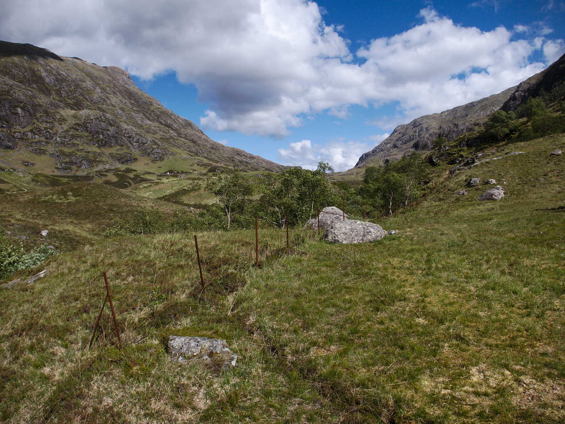
And this is just a small piece of the inside of the glen; the whole approach from the west was just as lovely, just as impossibly rugged and appealing. To really treat Glen Coe with the respect it deserves would take a full day, at least. So, maybe next time…
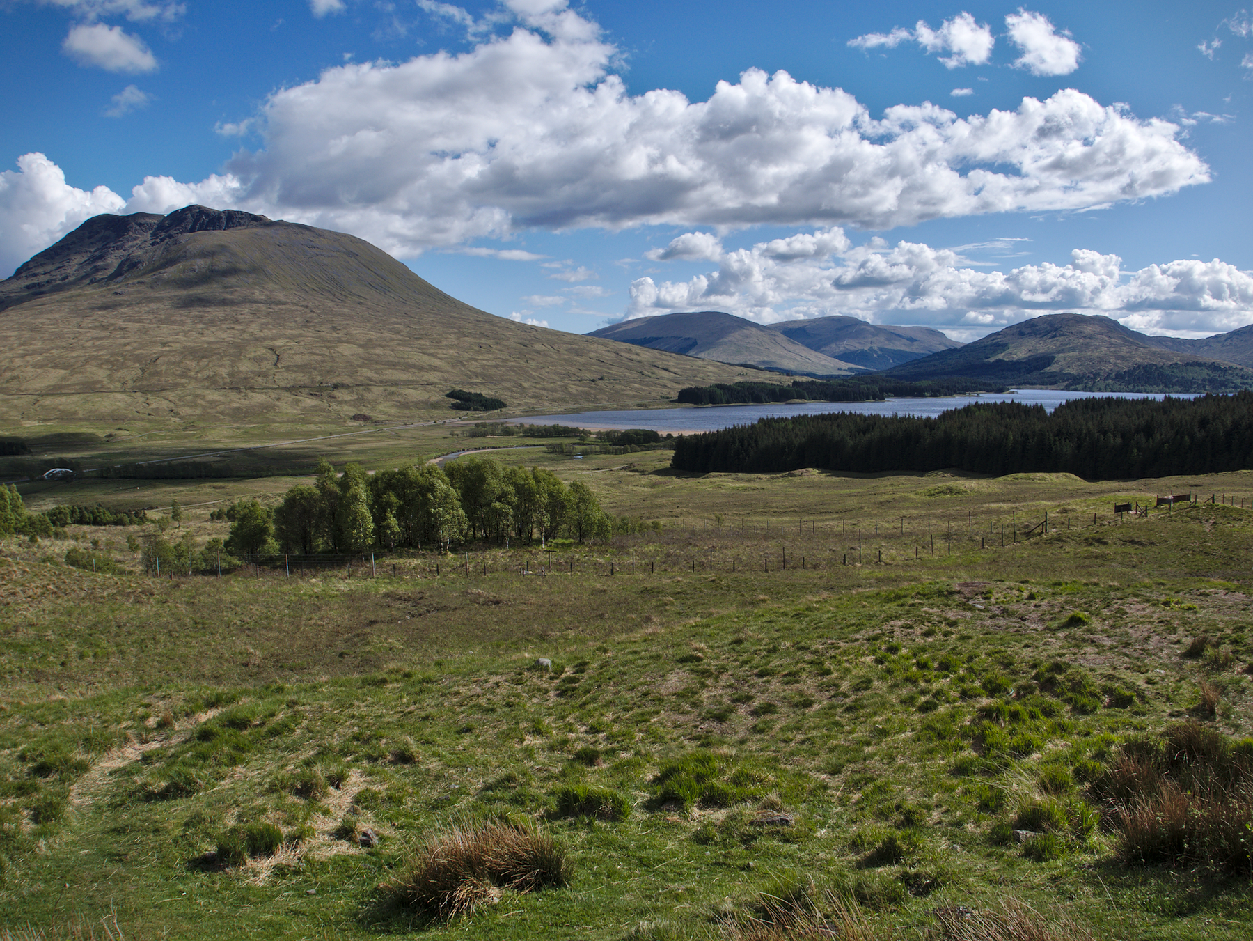
When we drove out onto the moors, the empty landscape seemed uninspired compared to what we’d just seen. We stopped a couple of times, just for a few minutes, to admire a few lochs on our way to Callander for the night. But I don’t think our heart was really in it – we’d left it behind in the glen.
Hairy Coos & Piglets
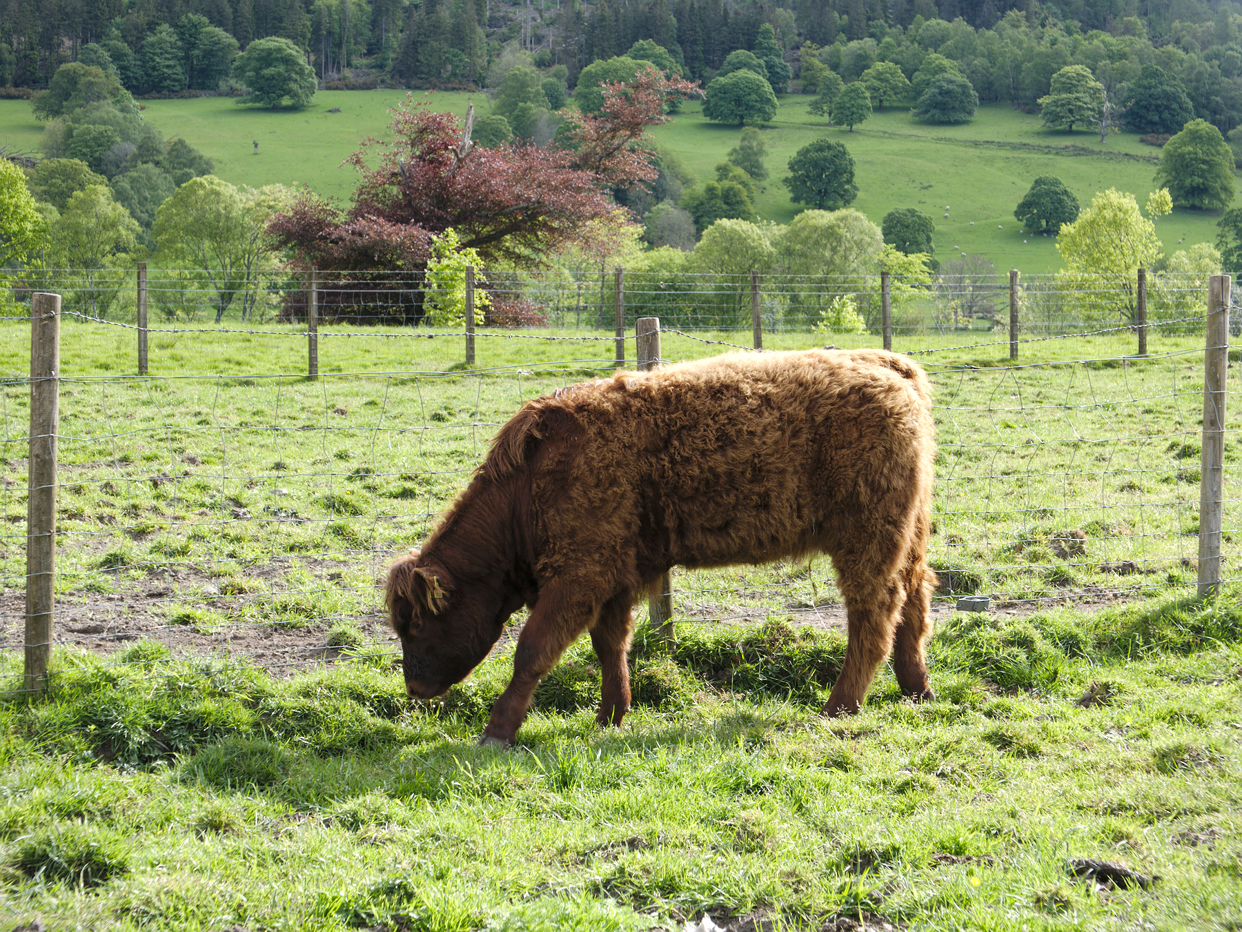
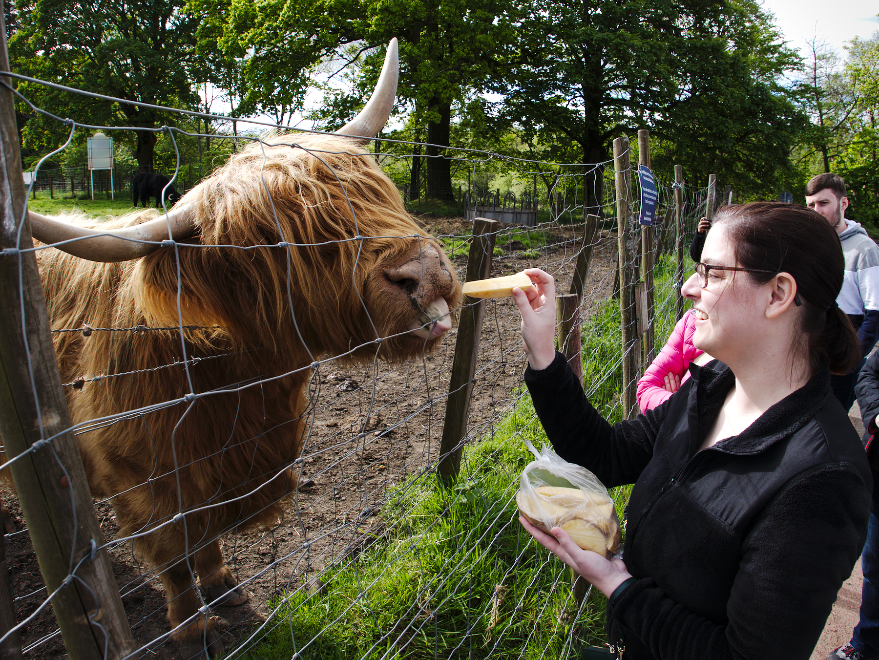
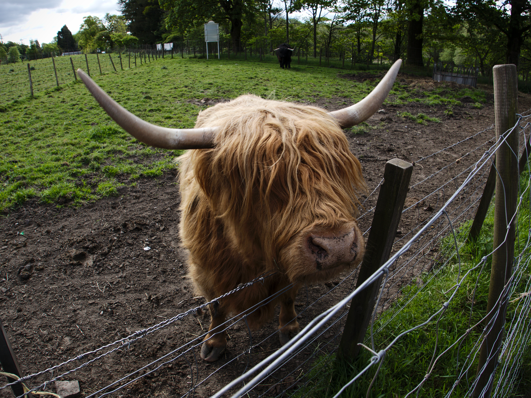
Sometimes on vacation, you just have to do the tourist things. So we started the final day of our tour with a stop at the tourist center outside of Callander, parked alongside tour buses (“coaches,” as they call them). Our purpose: to let Mandy meet, and feed, some hairy coos.
“Hairy coos” is Scottish for “hairy cows,” and when used in the plural the “coos” is pronounced with almost a “z” sound at the end, like “cooz.” Otherwise known as Highland cattle, hairy coos are common across Scotland, and are known for their hardy but gentle nature.
Their extra long coats make them ideally suited to the Scottish weather, as they lack the fat layer common in other breeds of cattle. Instead, their extra long hair shields them from wind and rain in the winter, and from biting insects in the summer.
Mandy fed one of them potato slices amid a crowd of jealous tourists, then we all chuckled as she scratched her neck against the wire, tossing her head and looking content.
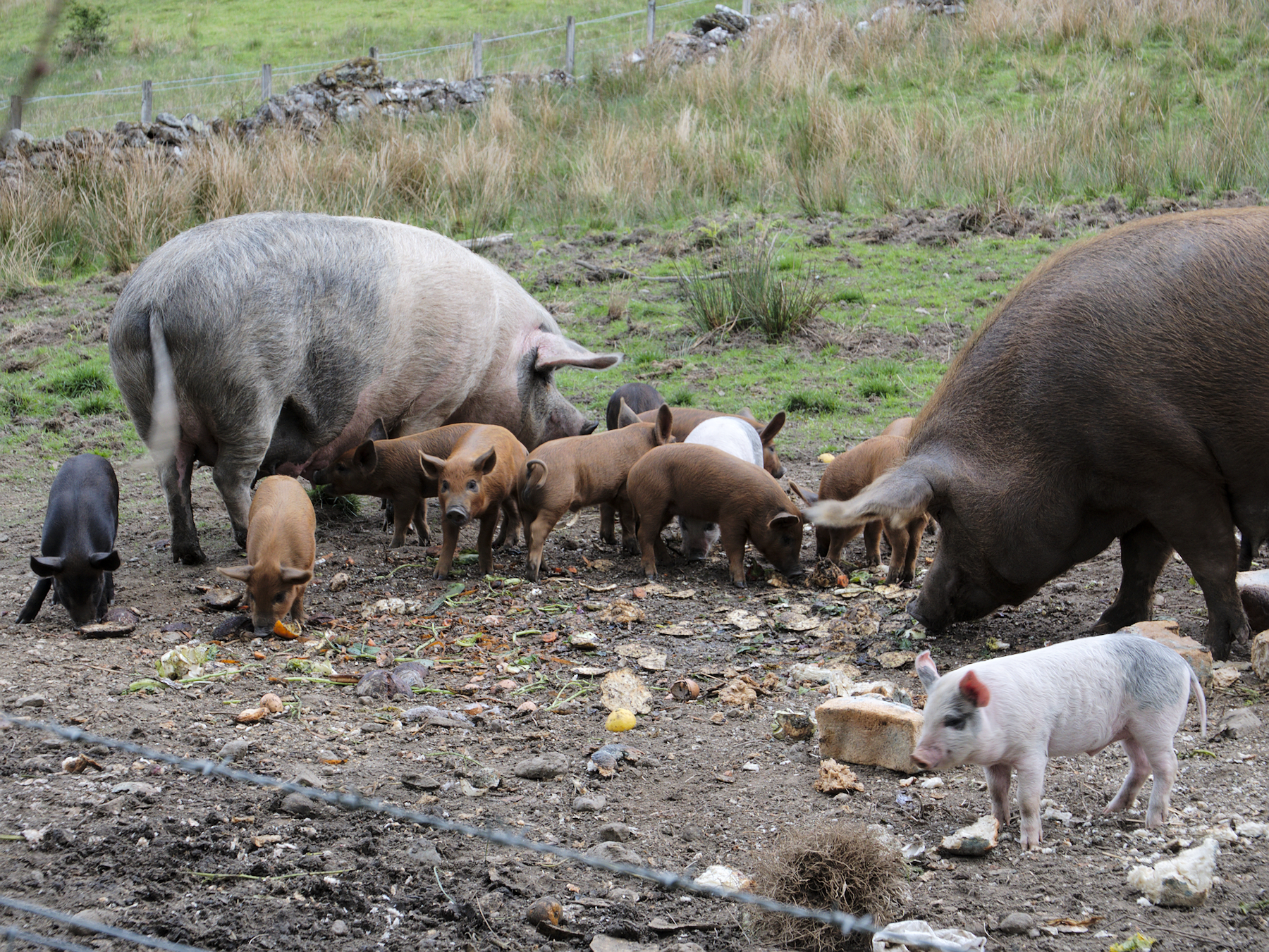
The piglets were an unplanned stop. We were driving through the countryside on the way to our next stop when we saw them, and there was a convenient place to pull over, and the next thing you know we were standing next to the pig pen and watching a whole herd of piglets charge around, jumping and playing.
Rob Roy's Grave
“He was a rascal, a rogue, a rapscallion, a murderer, a rapist, a ne’er-do-well, a thug,” said Rob, adding at least a few more colorful descriptors to the list before adding, “He was a real bad guy. He was the Al Capone of Scotland. Except he made Al Capone look like a nice guy.””
He was describing the infamous Rob Roy MacGregor, the actual inventor of blackmail, and a man who was feared and reviled throughout the Trossachs region of Scotland throughout his life in the late 1600s and early 1700s.
The trouble with Rob Roy is that he has become divorced from his own truth over the centuries, romanticized into a sort of folk hero, a Scottish Robin Hood. But the real Rob Roy never stole from the rich and gave to the poor; he stole from everyone and kept it for himself, managing a massive protection racket and cattle-rustling ring that terrorized indiscriminately. He even tried to extort the local gentry, which ultimately led him into a years-long feud with the Duke of Montrose, who seized all of Rob Roy’s lands and holdings.
After that, Rob Roy focused all his attention on the Duke of Montrose – much to the relief of everyone else.
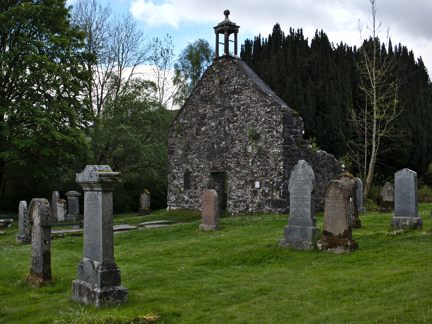
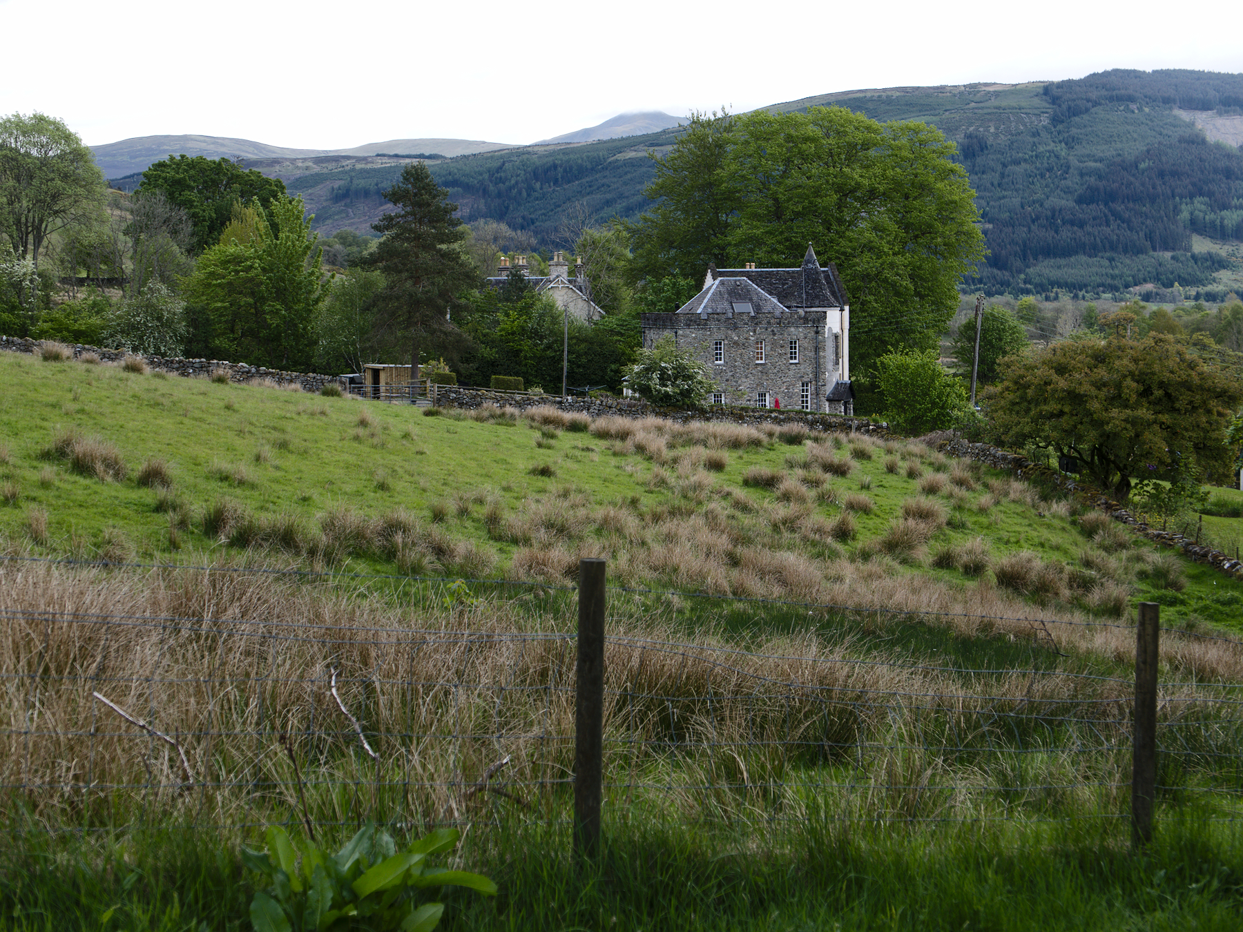
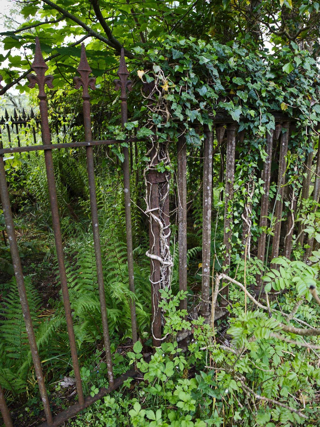
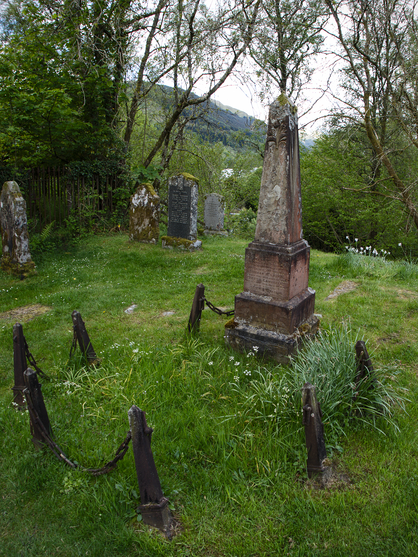
Despite his infamy, Rob Roy MacGregor lies buried in a quiet, remote churchyard in the Trossachs, between his wife and two sons, under a stone engraved with “MacGregor Despite Them,” in reference to his continued use of the MacGregor name after it was outlawed and the clan eliminated.
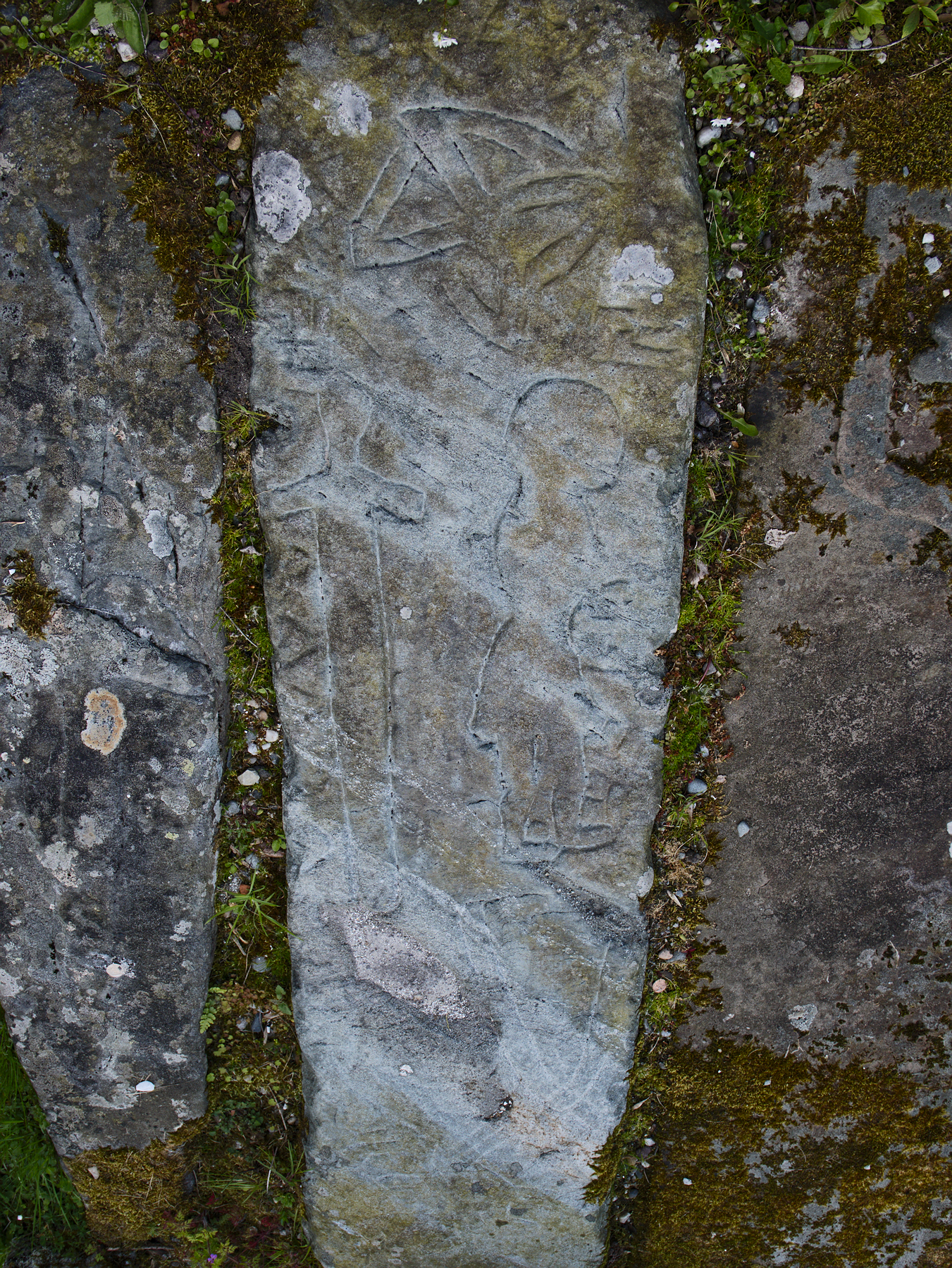
His grave is so nondescript that the most interesting aspect is actually the grave’s capstone, which is ancient in origin and is engraved with what are most likely Pictish carvings. How it came to be used in his grave is a mystery.
We spent a fair bit of time in the old churchyard. And it is old, with the runs of the old kirk standing just beyond Rob Roy’s grave, most of the walls fallen in and dismantled. A new church stands by it, and that’s what it is known as – the new church. It celebrated its 150th anniversary only a few years ago, according to the charming exhibit inside.
That’s pretty common in Scotland. Anything from about 1750 and onward is considered “new.” In Edinburgh, the New Town expansion is about that age, and it’s still called New Town. I guess that’s what happens in a country as old as Scotland, time takes on different meanings.
Amazement of Bluebells
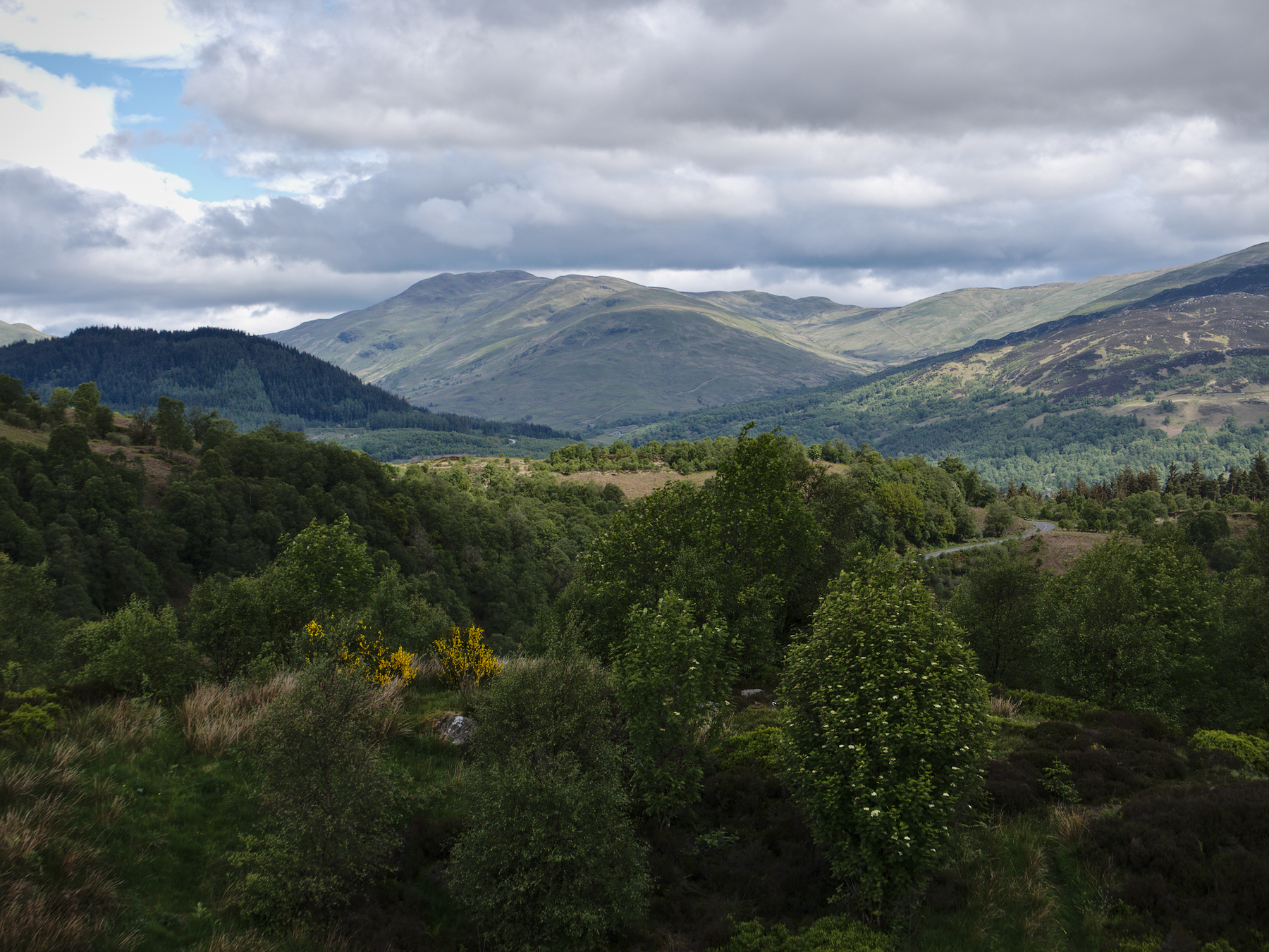
How did we get here? This wasn’t a planned stop, but rather one of those fortunate discoveries along the way. After leaving Rob Roy’s grave we drove through the Trossachs and stopped at a scenic overlook called “Three Lochs.”
Mandy and I hiked the few hundred feet from the parking lot to the lookout spot. There were no lochs. Nothing in sight but mountains and forest. When Rob joined us a moment later, he broke into laughter. “Worst tour guide in all of Scotland!” he boomed. He hadn’t been to this particular spot in several years, and during that time, the trees all grew up and hid the lochs from view.
Oh well. We’d seen other lochs, and we greatly enjoyed the humor of the moment. I grabbed a couple of photos, mainly of the bog cotton growing along the trail in a damp area, and we were off again.
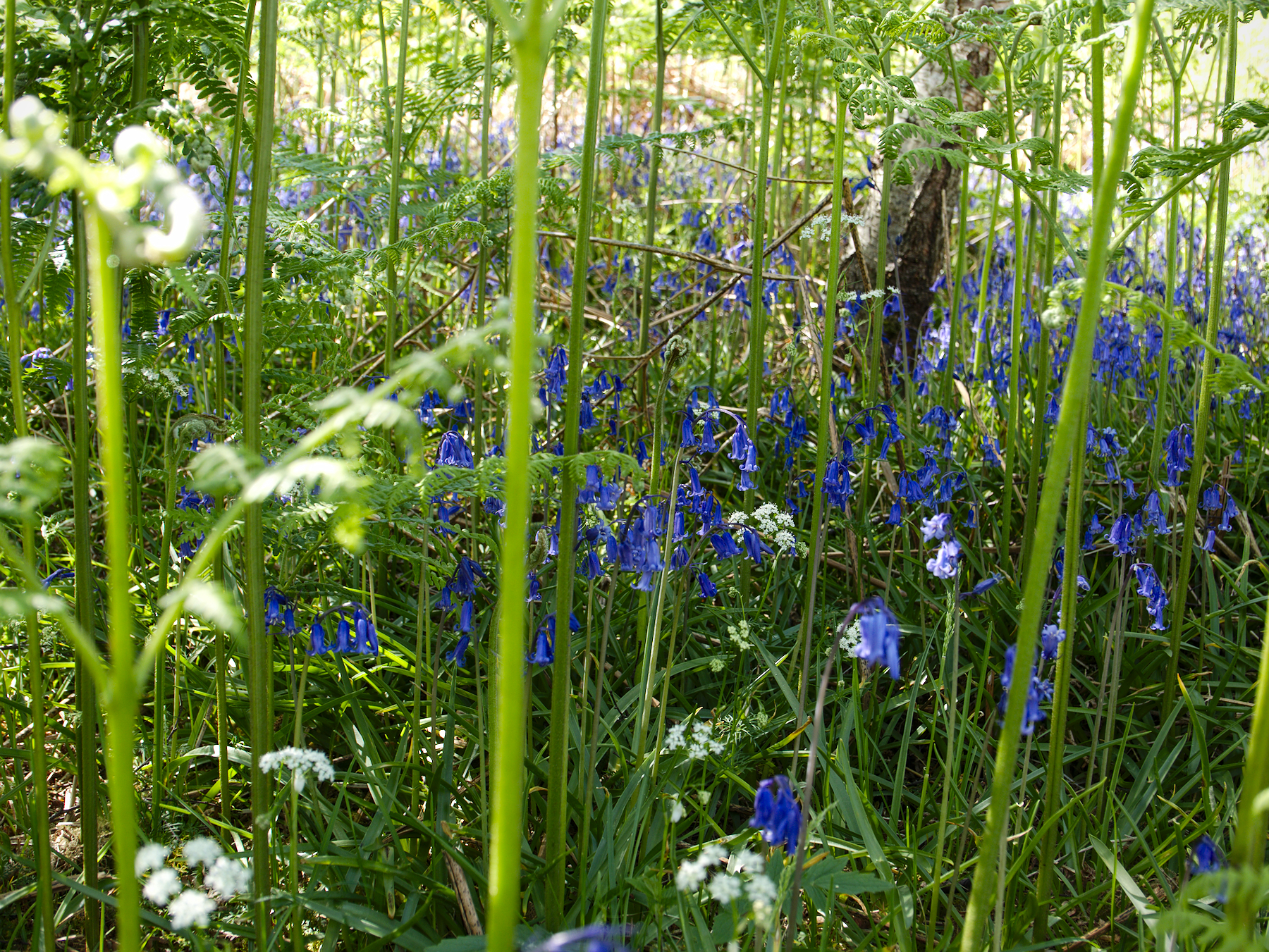
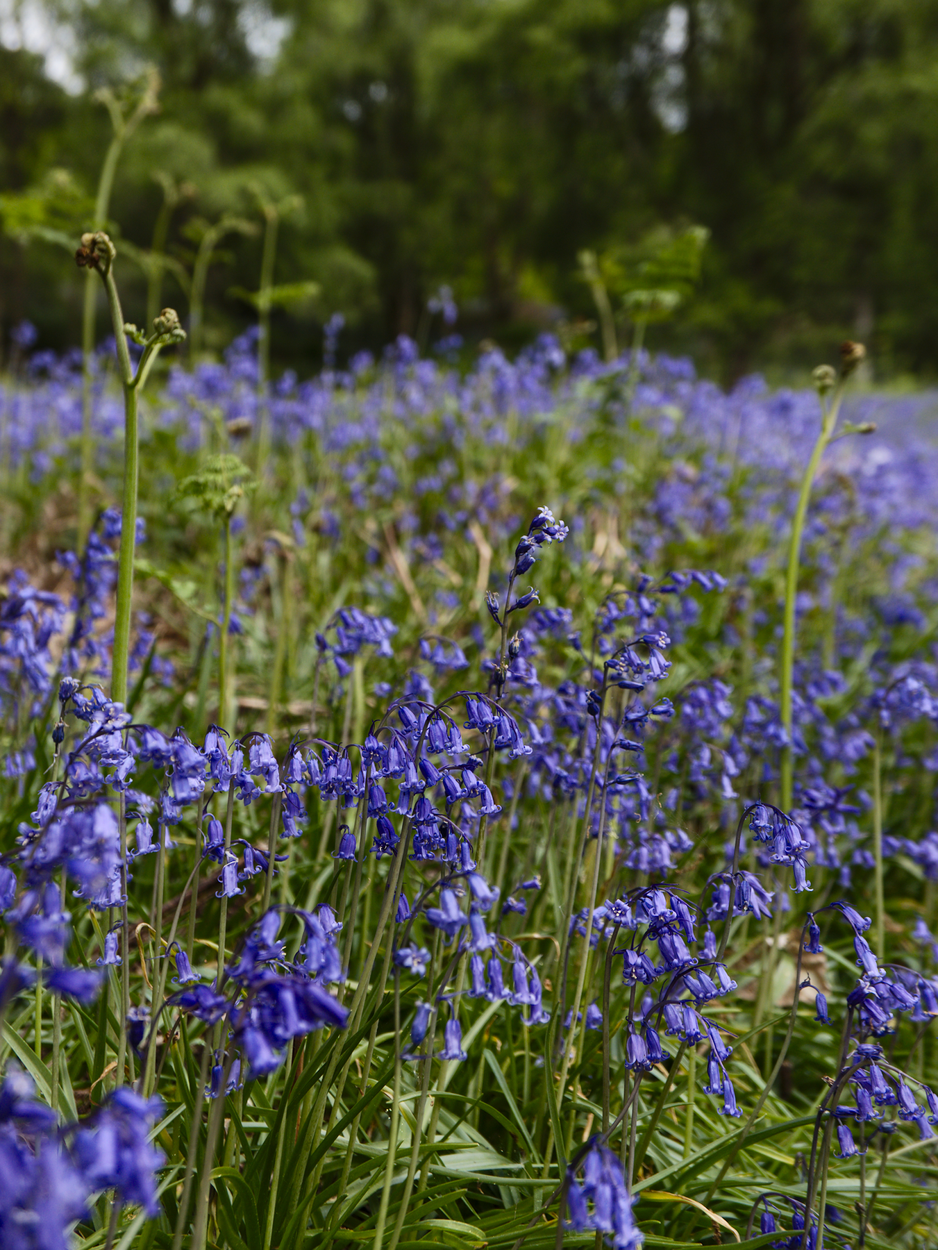
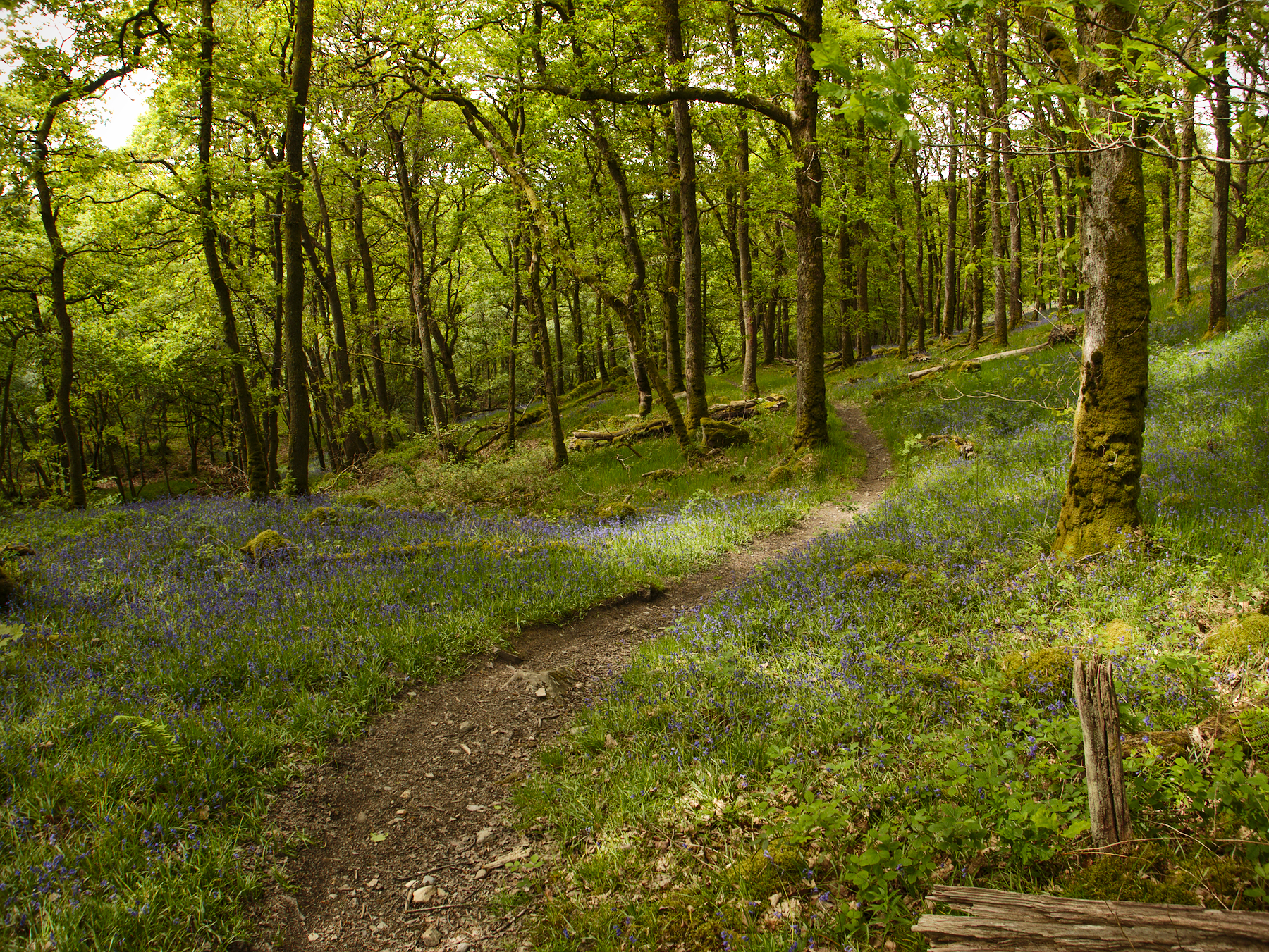
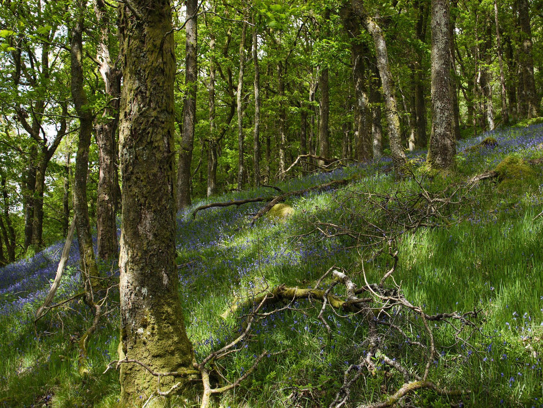
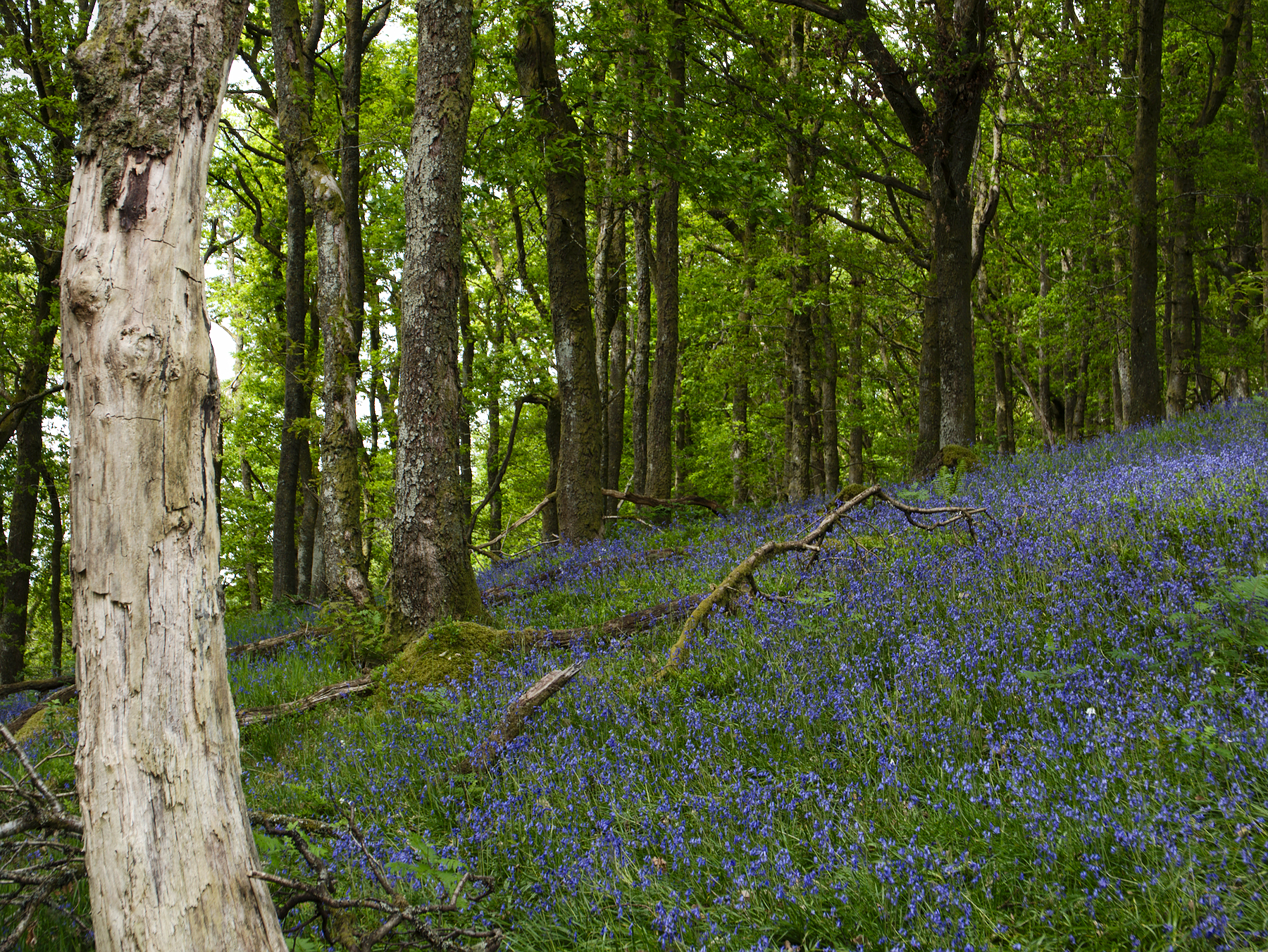
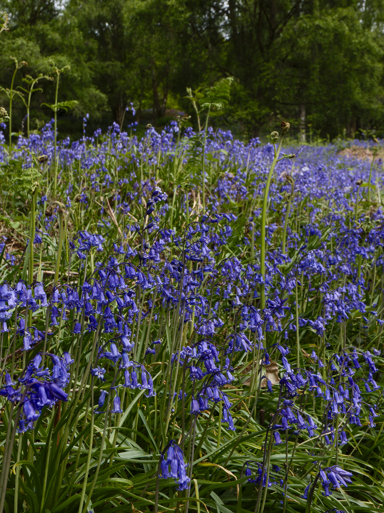
As we wound back down the mountainside, on oxbow turns, we drove into the bluebells. They filled the gaps between the looping road in one sweeping sea of blue that left us all agape. Rob pulled into a parking area for hikers and all three of us spilled out of the van, not sure where to look first.
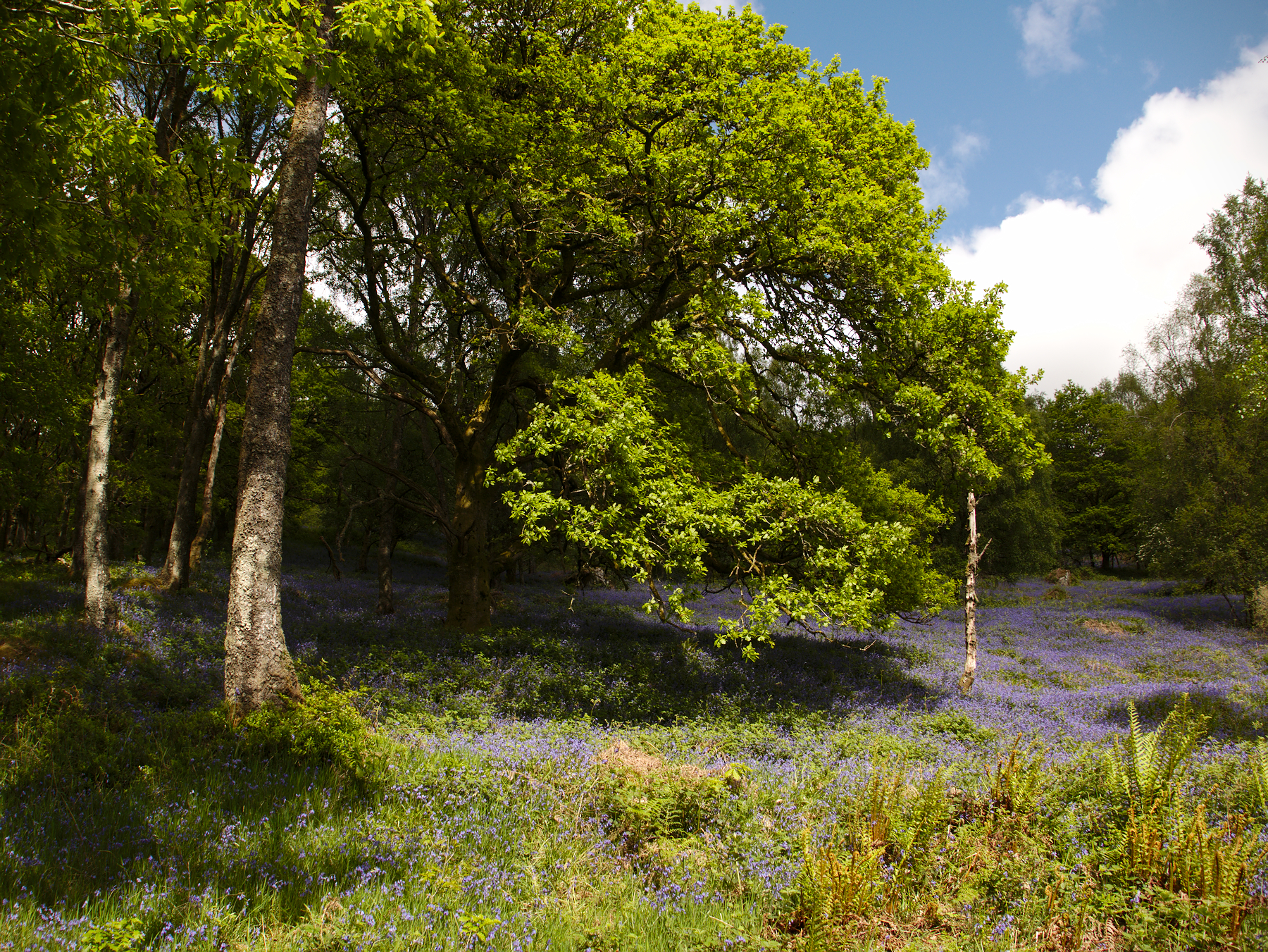
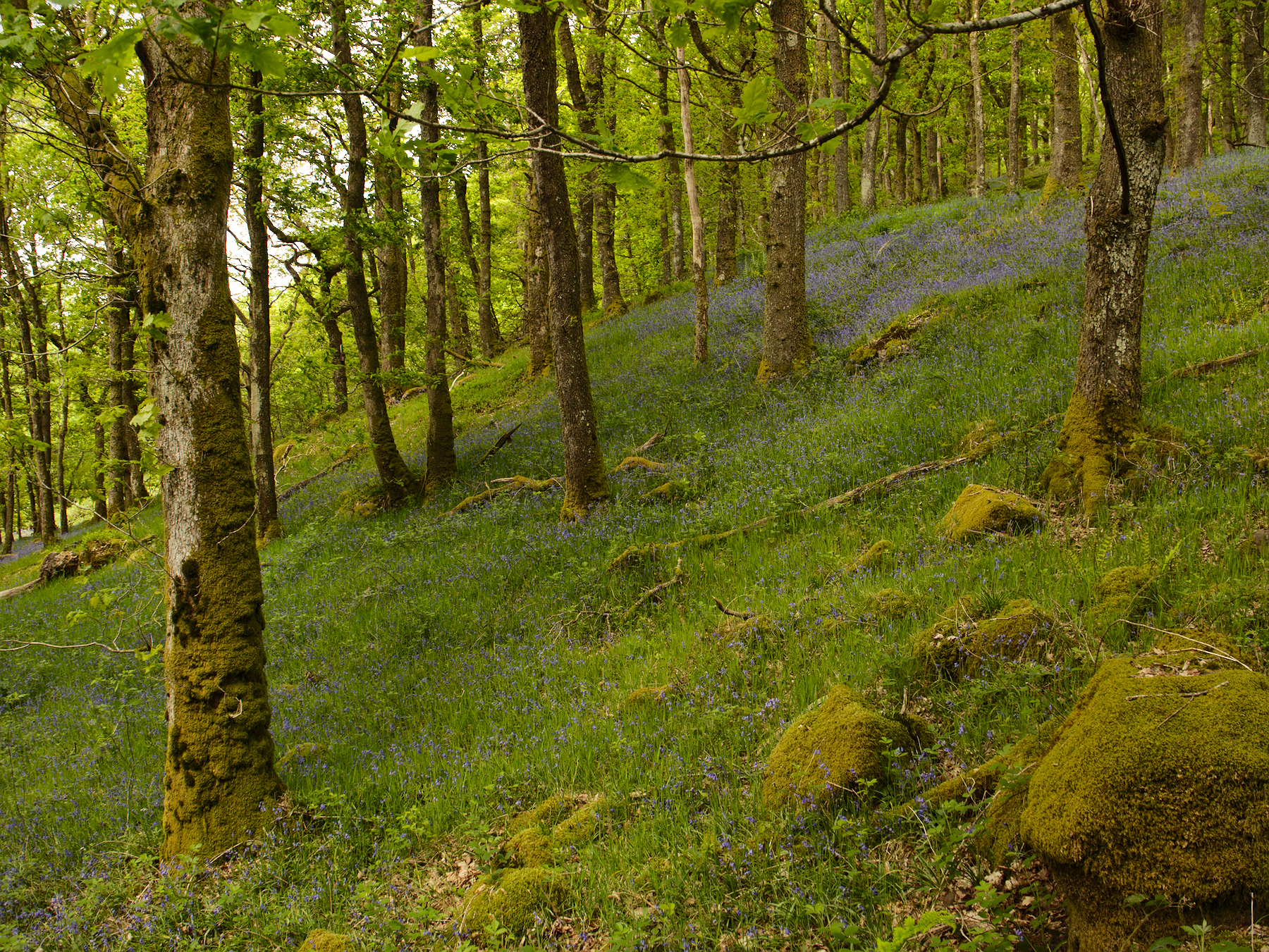
Across the street was the open field with the single bushy oak in the middle of it, and the light changed by the moment as clouds swept past. A small trail led into the woods, and the bluebells went with it, into the magical warm spaces between the trees, adding their color to the warm tones of the forest.
If we hadn’t been working on a schedule, I’d have followed that trail. I certainly felt the urge to – wherever it led, I’m entirely certain it would have been worth it. I said as much when we got back to the car, and Rob agreed, but added, “It’d take you right to the sidhe, into the fairy world.”
He was probably right.
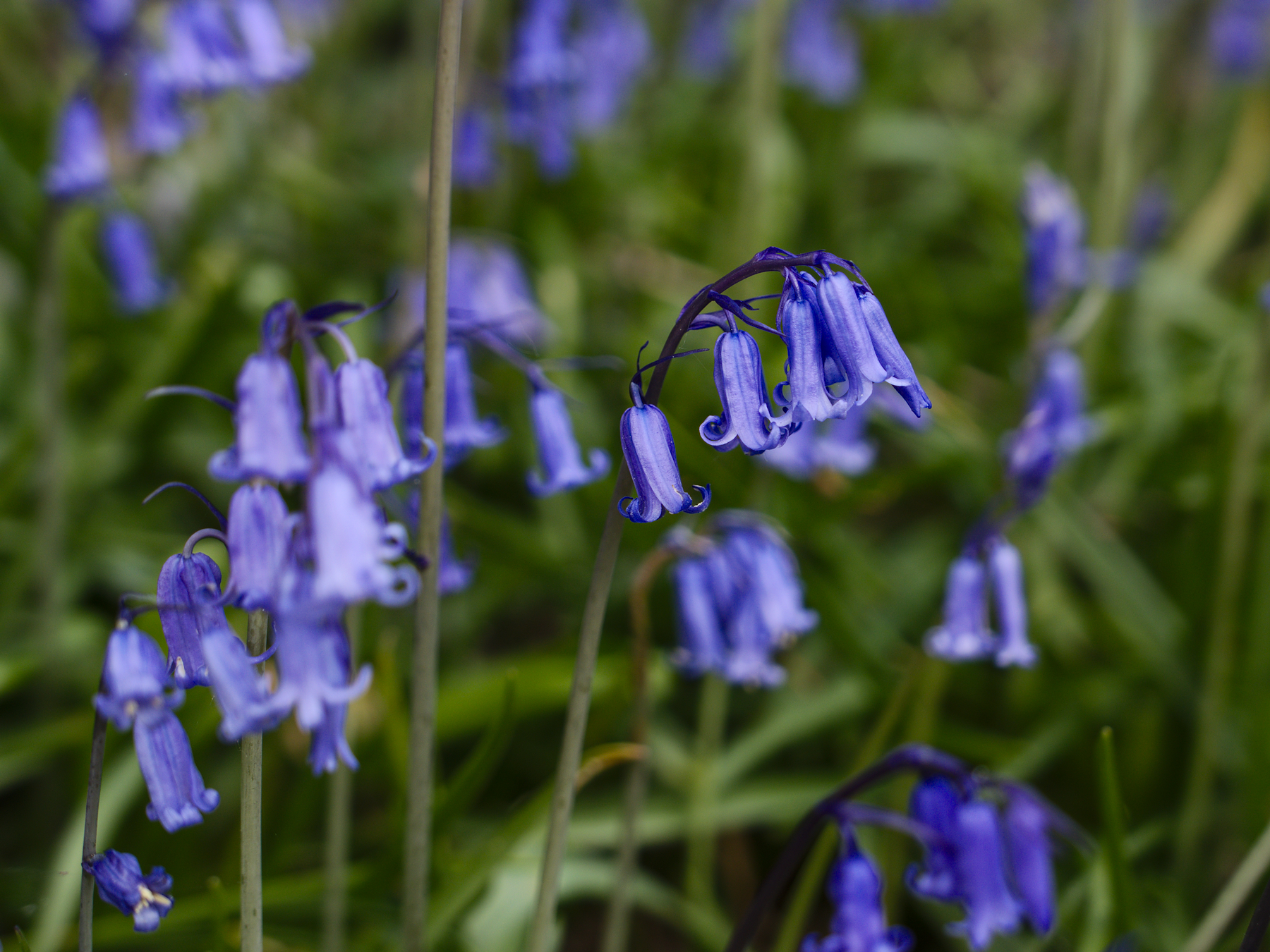
As we left, he coined the phrase: it was an amazement of bluebells.
Doune Castle
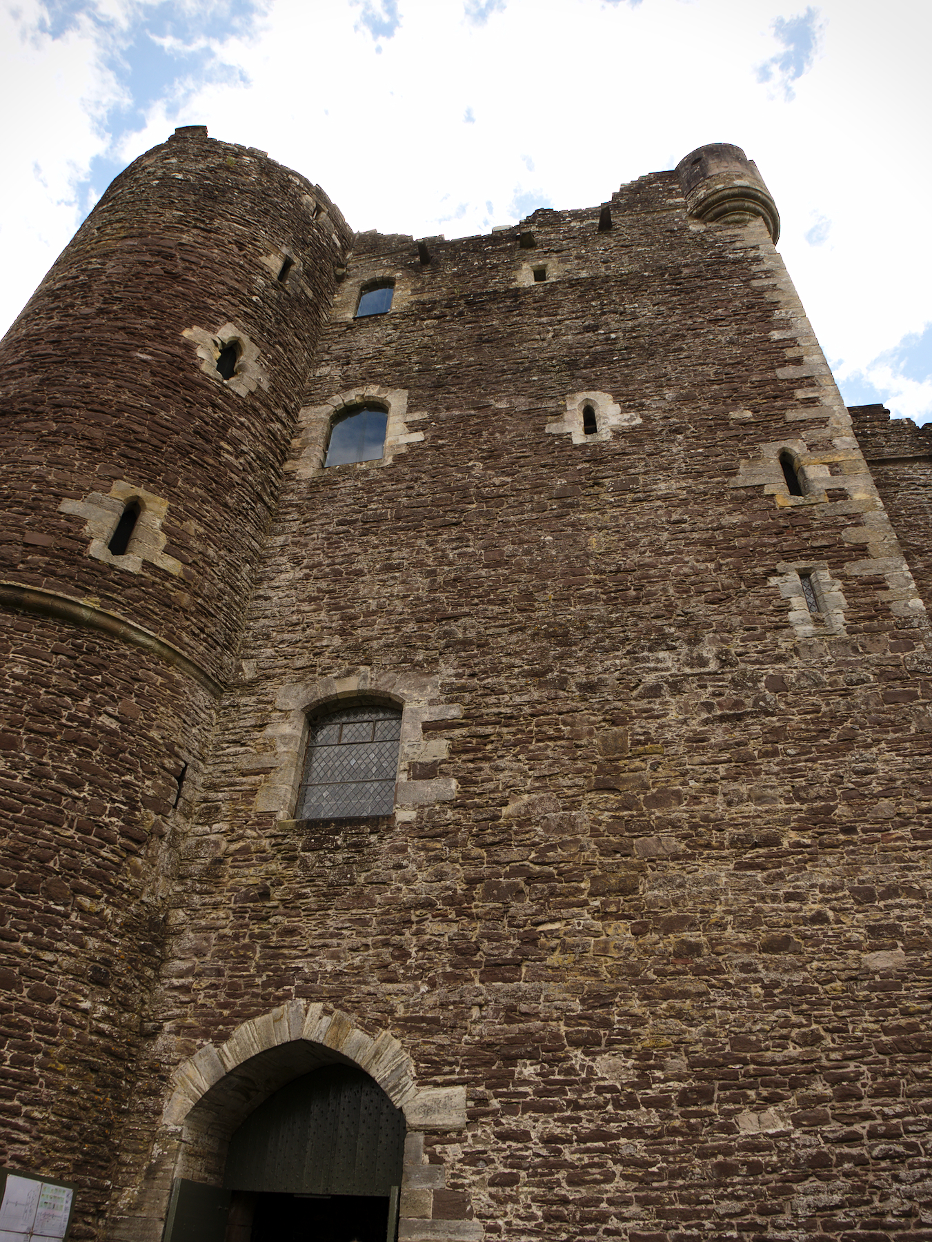
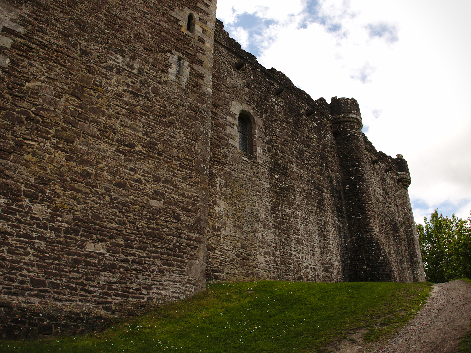
We saw six castles during our travels; some just from afar, and a few of them in ruins. We toured two of them, Eileen Donan castle on the edge of Skye, and Doune Castle when we left the Trossachs.
Doune is the more famous, although not for the reasons you might expect. In history, Doune was the “hunting lodge” for the Duke of Albany. It is relatively small as castles go, and the Duke was never able to complete all the work he had planned for it.
It’s real fame comes from it’s appearances in film. Doune serves as Winterfell in the first season of Game of Thrones, makes appearances in Outlander, and is perhaps even more famous as the castle from…well, at least half the castle scenes in Monty Python and the Holy Grail.

It was the Monty Python aspect that made it the most fun, as the audio tour was narrated by two of the chaps from the film, replete with their usual sense of humor and funny sound effects.
But it was also a really well done tour, with a lot of insight into what life was like in the castle.
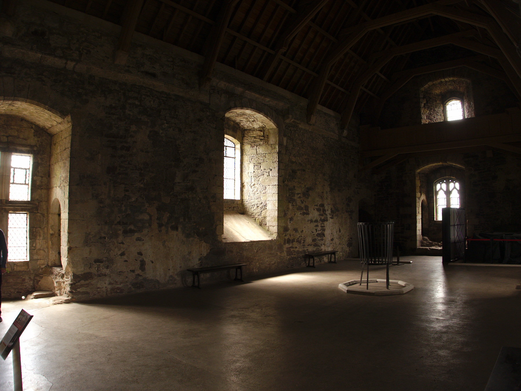
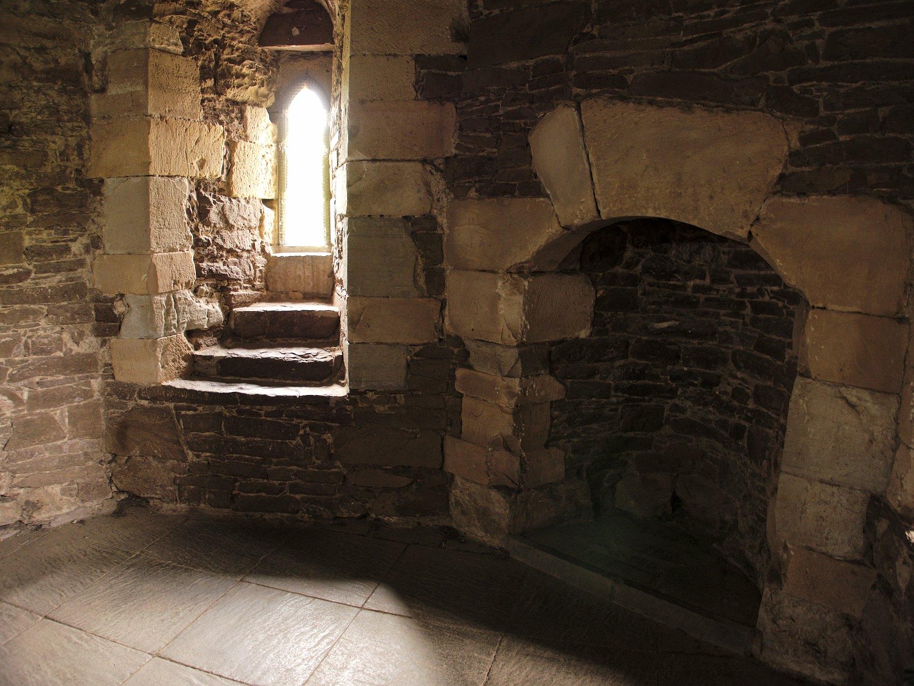
We saw the kitchen, with a fireplace that spanned the entire end of the room. Guest chambers were above it, kept warm in the winter by the kitchen’s heat – and, we can assume, sweltering in the summertime by the same.
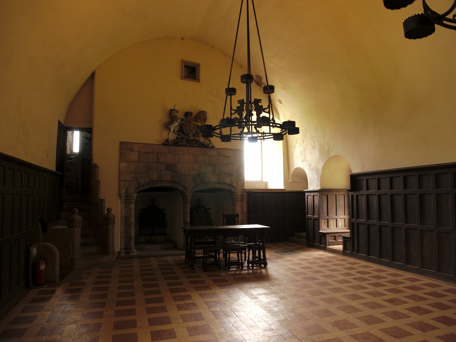
The Great Hall would have been the dining area, and where most of the less-important folks would have slept at night. It had its own privy in an alcove near the head table, just for the lordly folks. Just beyond it was the Lord’s Hall, where the Duke would have conducted business. Note the TWO fireplaces behind his high table, most likely just ostentation meant to impress guests.
The Duke’s chamber was above the Lord’s Hall, and while quite small did have a fireplace. The Dutchess’ chamber did not, although she did have her own hall for entertaining, prayer, etc. If you look at the photo of her hall, about 2/3 up the wall you’ll see a row of holes; there used to be a wooden floor there, giving it a second level.
Those of you who follow Mandy on social media have probably already seen this, but if not, then here’s a lighthearted moment from outside the castle, where I play the role of King Arthur and Mandy plays Patsy, his squire:
Monty Python and the Holy Grail was a low-budget film, which is why Doune Castle was used to represent so many different locations throughout the movie. They also couldn’t afford horses, so Arthur and his knights all “galloped” around on foot, with their squires following behind clapping coconut shells together to imitate hoof beats.
And as we saw in Plockton, there are coconuts in Scotland, thereby solving that particular conundrum!
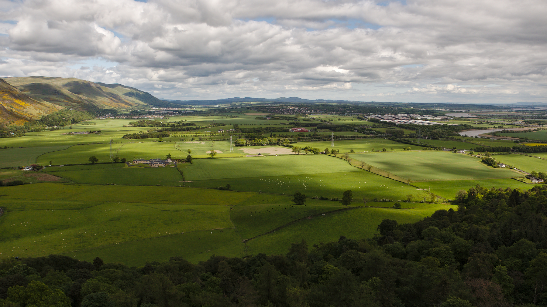
Stirling
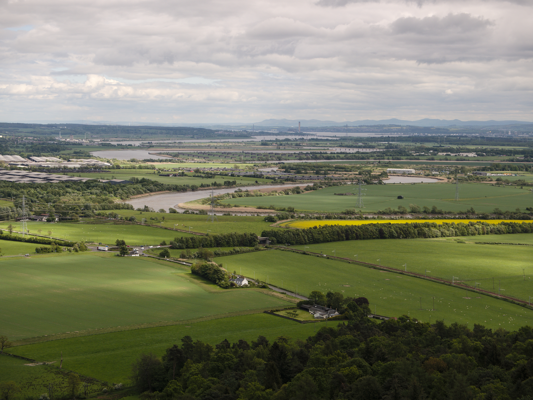
Our visit was relatively quick, as the final day of our tour was wrapping up. We had left the Trossachs, the Highlands and villages behind, and were moving back into a much more developed area of Scotland. Our stop at Sterling was historical, and belonged to an older chapter of history that predates the Jacobites by over 200 years, back to the First Scottish War of Independence.
The Battle of Stirling Bridge took place there, in 1297. Ring any bells? I’ll give you a hint: it’s the battle where William Wallace helped lead the Scottish forces in a crushing defeat of the English. The Scots having destroyed all the bridges across the Forth save one, the English had no choice but to traverse it. Their army was still crossing when the battle began, and the Scots concentrated on this choke point and stalled the English advance before finally routing them.
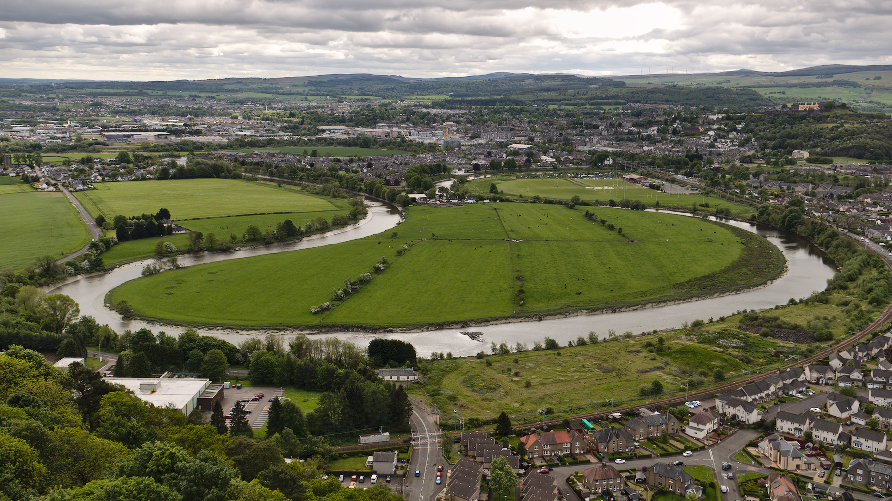
It was a huge victory for the Scots, and William Wallace became famous as a result. A towering monument to him stands on a hill across the Forth from Stirling Castle, and of course most people know the movie Braveheart. But as is so often the case, Wallace has been romanticized and idolized well beyond his actual accomplishments. He wasn’t actually that big of a deal, in terms of his contributions to the War – he just had better PR than his peers.
We climbed the 246 circular steps inside the Wallace monument (for the record, whoever designs these tiny, circular stairways in monuments should spend the rest of eternity trying to get back down again against a wave of German tourists) and admired the views from the top. The exhibits along the way included what is purportedly, but most likely not, Wallace’s sword, as well as a replica of Robert the Bruce’s sword.
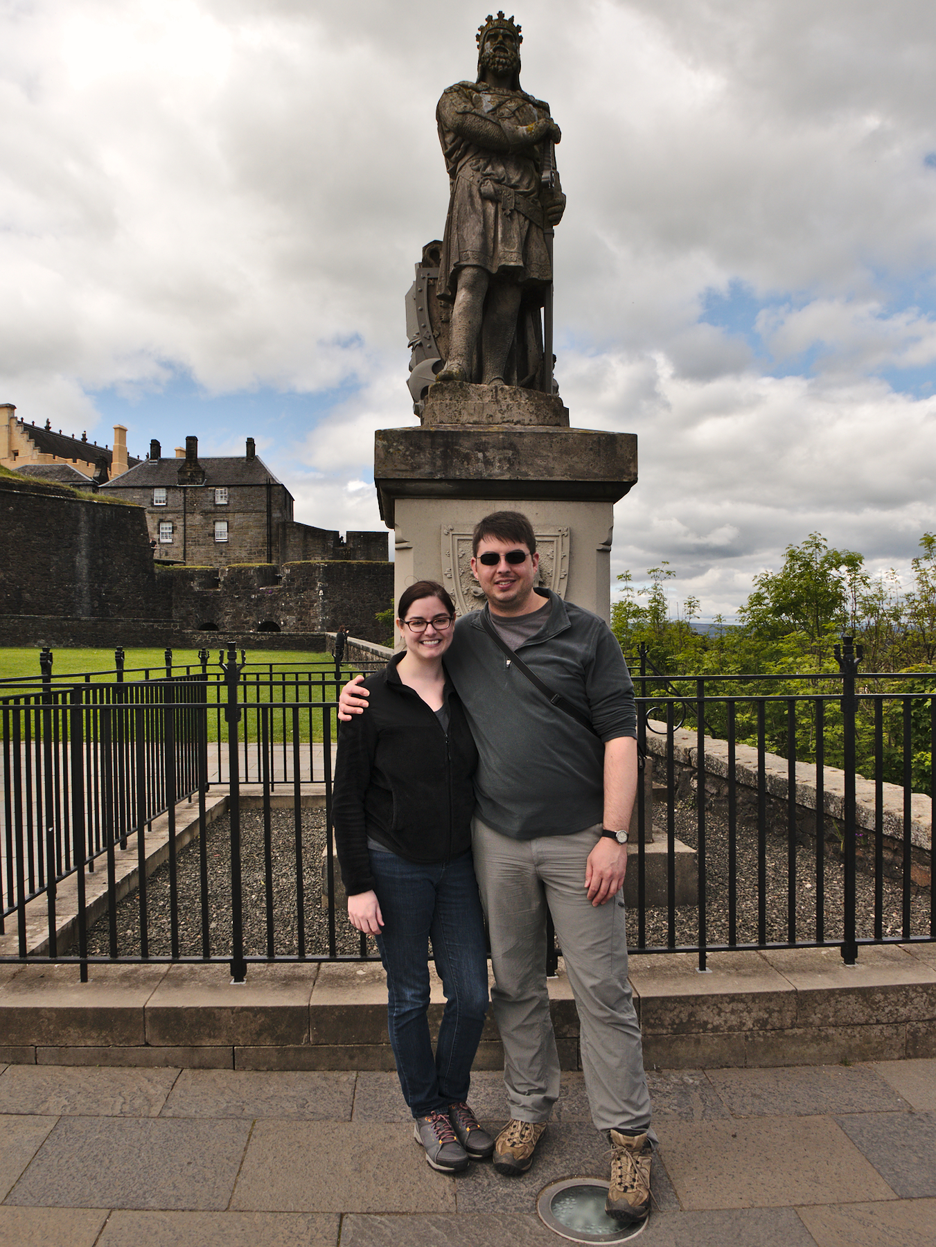
Robert the Bruce came along after Wallace and was one of the true bad-asses of medieval Scotland. His statue stands outside Stirling Castle. Robert the Bruce is a personal hero of Rob the guide, who regaled us with tales of his deeds for the rest of our drive.
The Kelpies
Falkirk was an industrial center, not far from Stirling, but over the decades its major industries declined, leaving it blighted. Scotlands two major canals, one that runs east-west and the other north-south, meet in Falkirk, and despite having fallen into disuse were seen as an asset that could be leveraged.
Falkirk’s solution was novel and enlightened: they would fund a public art piece, something impressive that would bring people to the area. And as people came, there would be opportunities for businesses, commerce, and lodging to develop around that site, which would revitalize the area.
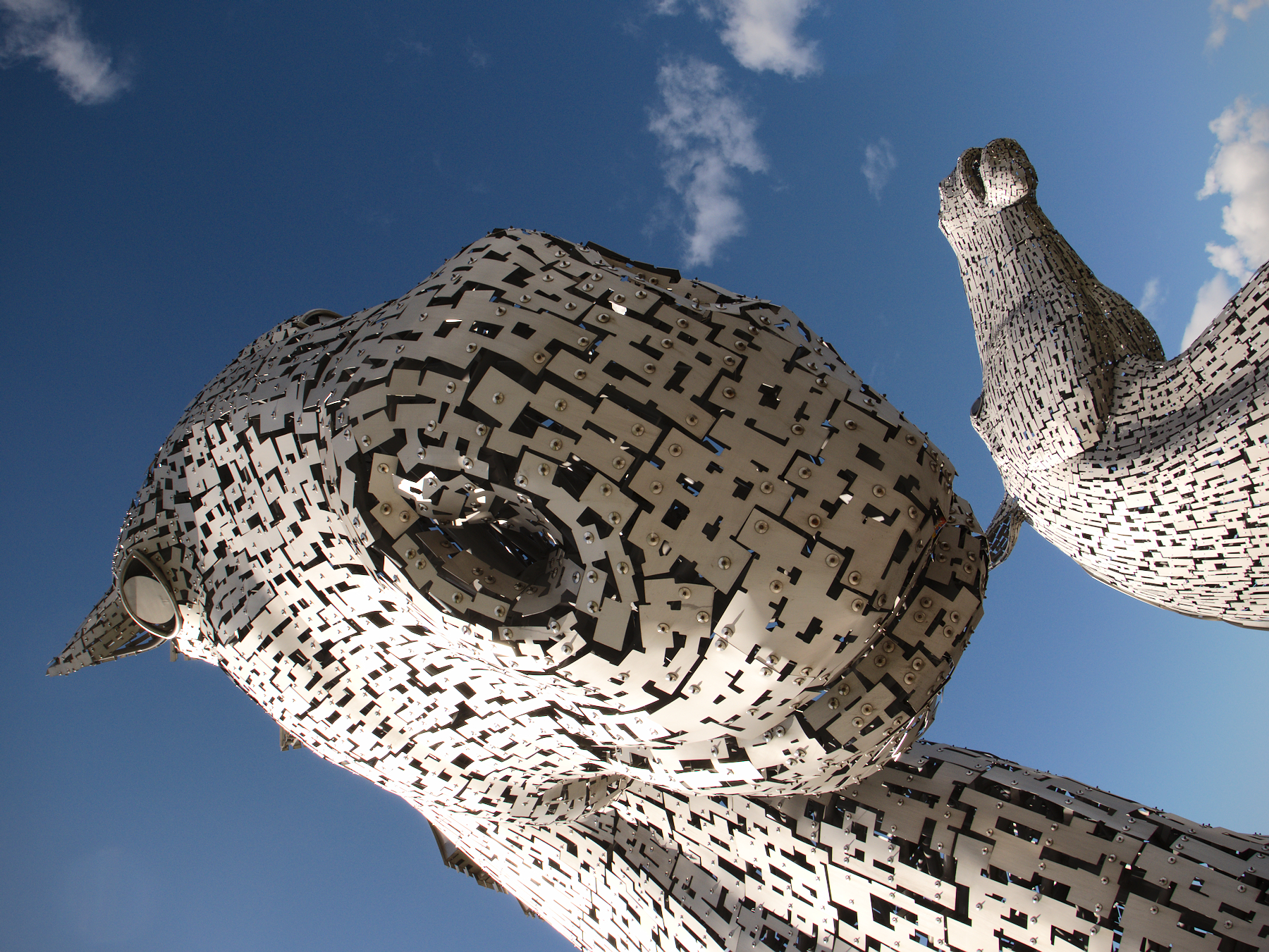
So The Kelpies came to be, a pair of 96 foot tall stainless steel Clydesdale horse heads that rear up from a basin at the convergence of the canals.
In Scottish lore, kelpies are a sort of water spirit that often take the shape of a horse. They lure people close to them, or better yet onto their backs, then charge back into the water to drown them. It’s a dark lore – most lore is.
The Kelpies themselves are awe inspiring. They tower above you, reflecting the sun, their nostrils flared so that you can almost imagine they are breathing.
And as an idea, it seems like it may be working. The parkland around them was full of people who had come to admire them, who were out walking and seemed happy. Old barges were tied off in the canals, converted into houseboats and rented out to tourists who wanted a different kind of experience.
There was already talk of expanding the houseboats throughout the whole canal system, borrowing a popular theme for other European nations and promoting “canal tourism” as a new way to travel and see Scotland.
An art installation used to revitalize a city. It seemed like a good idea to us.
Edinburgh Finale
Rob dropped us off at our swanky hotel and we said farewell. And that was the end of the adventure. We spent the next day winding down, walking the streets of Newtown’s shopping district. We popped into a few shops, including a department store just to see if it was any different. Aside from the world’s most confusing floor plan and some noisy escalators, it was pretty much the same.
We had lunch at a Spanish restaurant, sat in the hotel’s glassed-in central courtyard for some drinks, and splurged on room service for dinner. The next morning we’d be up early and headed back to the airport.
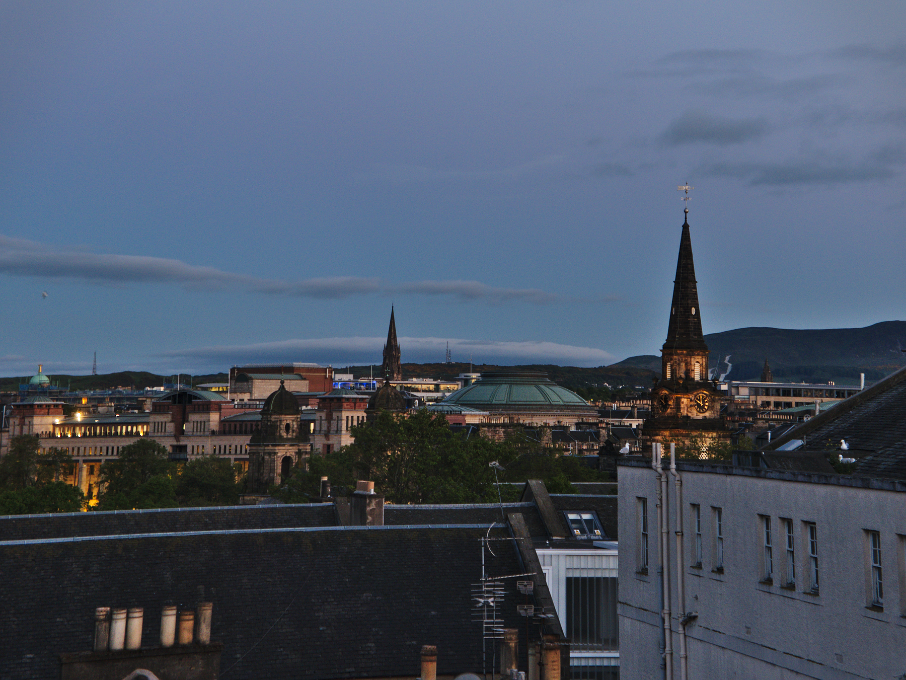
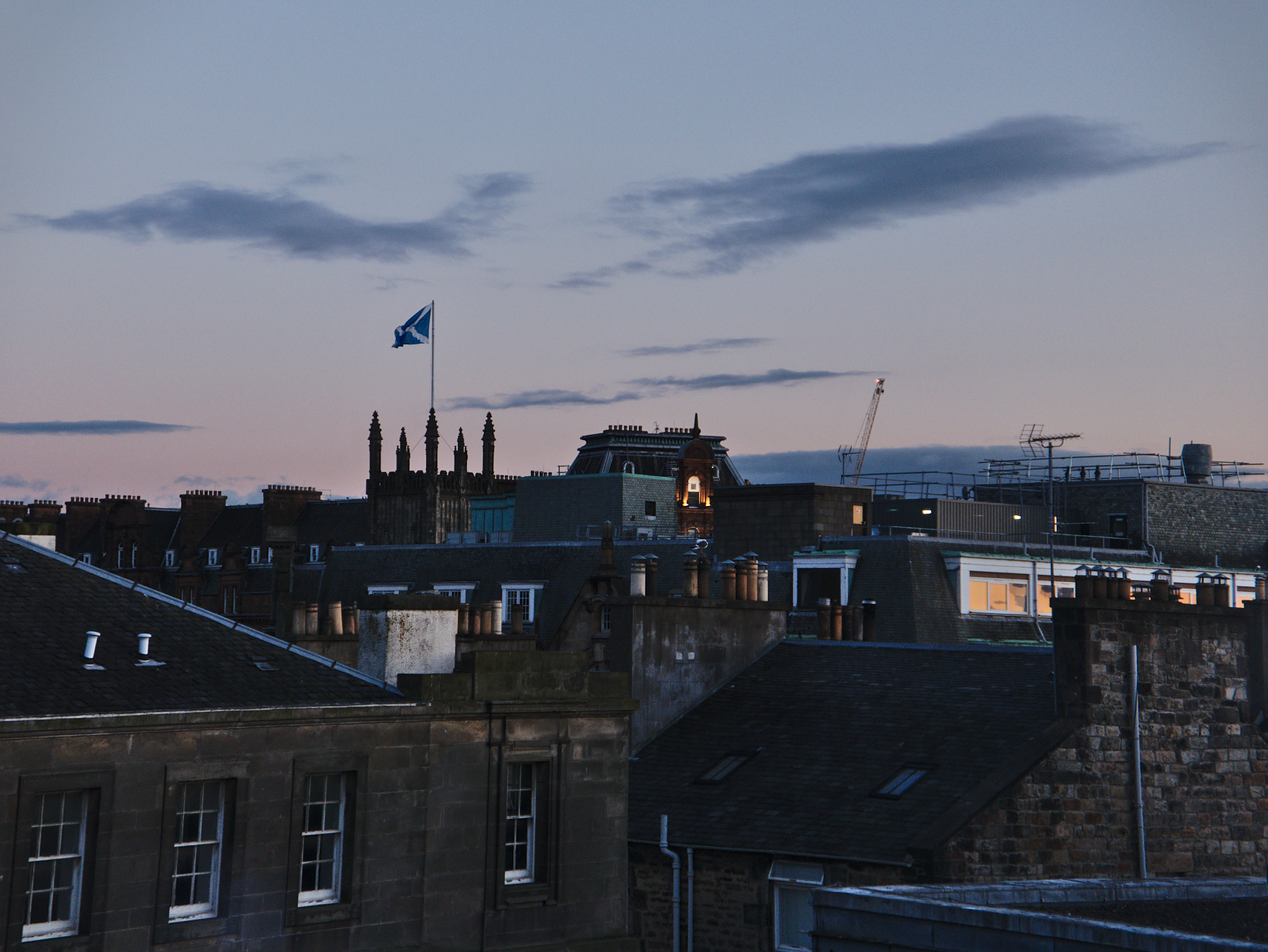
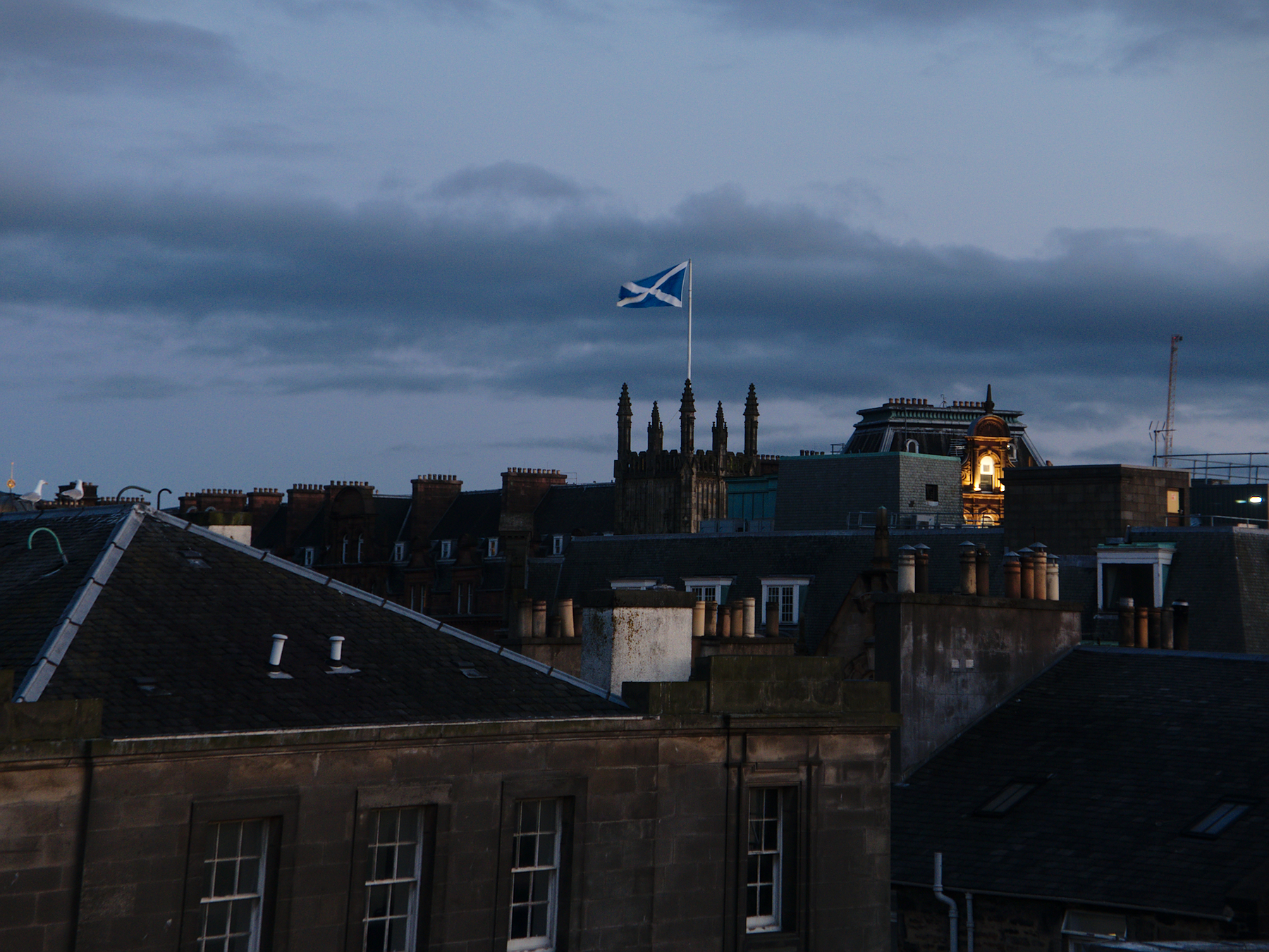
We did get the best room in the house, however, on the top floor, with a view out to Edinburgh Castle and the dome of the concert hall. It was a hell of a view, especially as the light faded around 9 and 10 at night, and I grabbed a few last pictures.
Epilogue - Brent & Mandy
Brent’s photos were all taken using a Lumix LX100 II.